Click here for: Washburn Fire in Yosemite National Park Updates for Wednesday, July 20, 2022
Note: Map is 1,500 Pixels Wide.
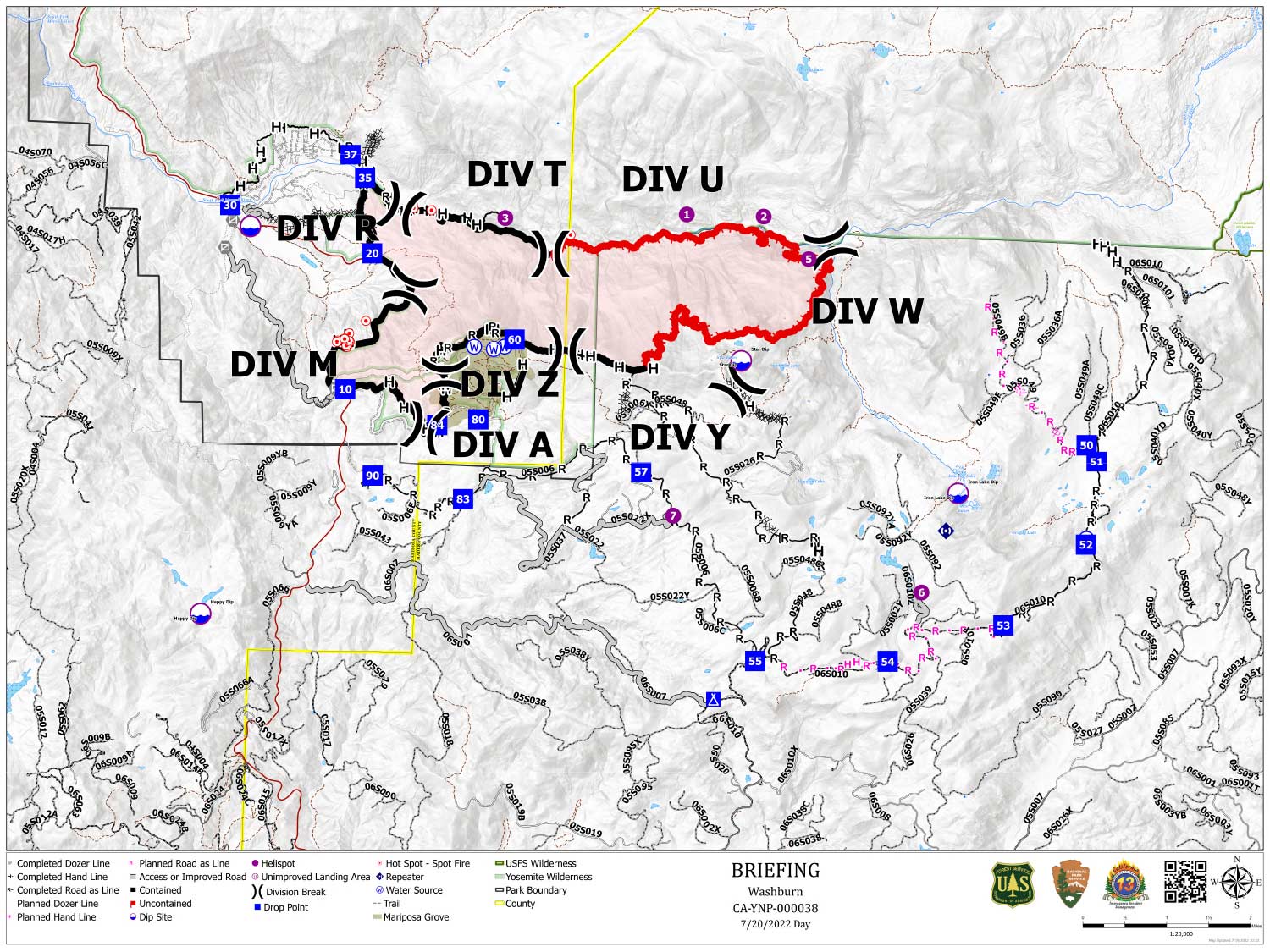
Shows Planned Hand Line, Planned Road as Line, Divisions, Dozer Lines and Uncontrolled Fire Edge.
Below Map:
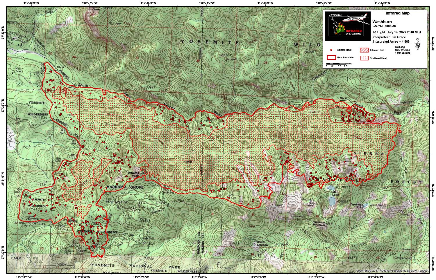
Infrared Map for Wednesday, July 20, 2022
Note: Map is 1,500 Pixels Wide.
Acreage: 4,868 Acres (Growth since last flight: 8 Acres)
I Started interpretation with the new NIFS Perimeter.
Start Acres 4,860
End Acres 4,868
Interior heat persists with a large pocket of scattered heat. It is getting smaller each night it is flown.
Larger areas where isolated heat is being mapped.
Still lots of heat interior.