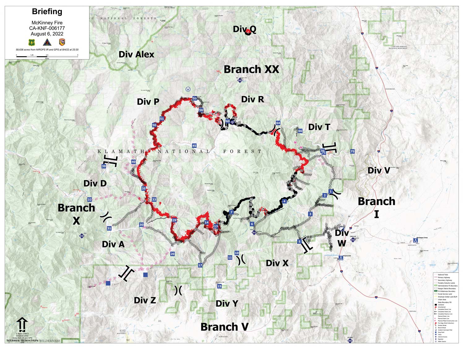
Note: Click here for large map (10MB file size) of today's Operations Overview Map for McKinney Fire
Can zoom in and show much more detail!
Click here for: Siskiyou County McKinney Fire Updates for Saturday, August 6, 2022
Note: Map is 1,500 Pixels Wide.
Shows Uncontrolled Fire Edge, Controlled Line, Dozer Lines, etc.
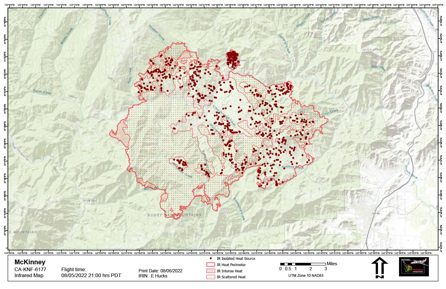
Note: Official Mapping: 60,044 acres an increase of 410 acres since last flight.
Flight Notes:
Smokey Fire is another fire: The Smokey perimeter prior to acreage calculations and interpretation. Smokey is under its own IRWIN ID and incident file.
Starting acreage was 59,634
Ending acreage 60,044
Growth – 410 acres
Significant interior cooling was evident with the fire interior composed mainly of scattered heat and isolated heat. Intense heat is present along the western edge and in the southwest area where firing operations are taking place.
Below Map:Infrared Map for Saturday, August 6, 2022