


Click Here for California Fires
Siskiyou County McKinney Fire Updates for Saturday, August 13, 2022|
August 13, 2022 - Florida, New Mexico, Oklahoma and Washington each had one new large fire yesterday. Nationally, 53 large fires and complexes have burned 1.4 million acres. More than 10,000 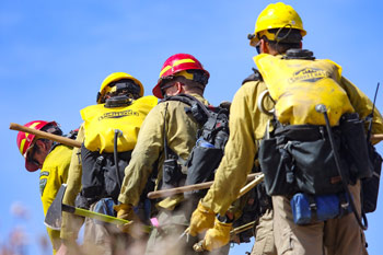 wildland firefighters and support personnel are assigned to incidents across the country.
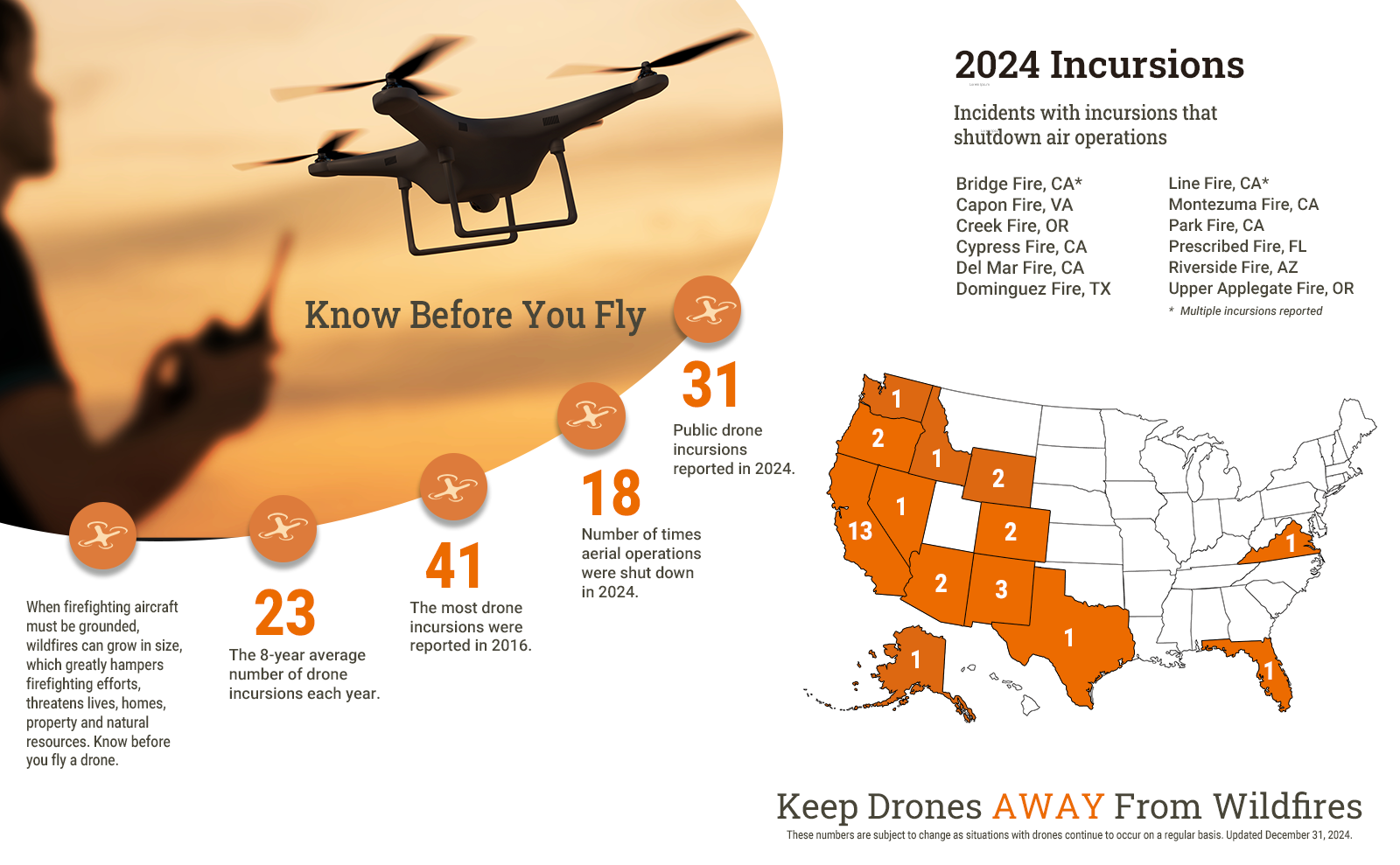
Unauthorized drones near wildfires pose serious risks to firefighter and public safety and the effectiveness of wildfire suppression operations. In 2022, 10 unauthorized drone flights near wildfires have been reported. The most recent reports were in Idaho and Texas. Aerial operations were shut down on nine fires. If an unauthorized drone is detected flying over or near a wildfire, wildland fire managers may have to ground all airtankers, helicopters and other aerial firefighting resources until they can confirm that the drone has left the area and they feel confident that it won’t be coming back.
The Predictive Services staff at the National Interagency Coordination Center released the significant wildland fire potential outlook for August, September, October and November. For additional information, visit the Predictive Services fuels and fire danger summary, fire weather and potential briefing, and the seven-day significant fire potential outlook.
The upper low off the Washington coast will likely move onshore in British Columbia, with weak troughing extending into northern California, Inland Northwest, and western northern Rockies. This will likely bring gusty Cascade Gap winds (15-30 mph) amid lowering relative humidity (10-30%), with holdovers a concern after the recent abundant lightning. Gusty winds amid low relative humidity may also develop across portions of southern Oregon into northeast California, northwest Nevada, and southwest Idaho near a weak cold front. Dry and breezy conditions may extend into the Idaho Panhandle and northwest Montana, with dry and breezy conditions forecast again for portions of the central Plains. Isolated to scattered mixed wet and dry thunderstorms will likely continue across eastern Idaho into western and central Montana. Scattered to widespread monsoon thunderstorms will develop over much the Southwest into southeast California and northward through the central and eastern Great Basin and central Rockies. Scattered to widespread thunderstorms are also likely across the southern half of Texas and Gulf Coast into portions of the southeast Atlantic coast.
| Number of new large fires or emergency response * New fires are identified with an asterisk |
4 | States currently reporting large fires: |
| Number of active large fires Total does not include individual fires within complexes. |
53 | |
| Acres from active fires | 1,432,044 | |
| Fires contained | 4 |
Year-to-date statistics
| 2022 (1/1/22-8/13/22) | Fires: 41,875 | Acres: 5,899,791 |
| 2021 (1/1/21-8/13/21) | Fires: 40,090 | Acres: 3,893,239 |
| 2020 (1/1/20-8/13/20) | Fires: 35,387 | Acres: 2,349,698 |
| 2019 (1/1/19-8/13/19) | Fires: 29,572 | Acres: 3,655,609 |
| 2018 (1/1/18-8/13/18) | Fires: 40,392 | Acres: 5,623,512 |
| 2017 (1/1/17-8/13/17) | Fires: 41,688 | Acres: 6,267,405 |
| 2016 (1/1/16-8/13/16) | Fires: 37,075 | Acres: 3,857,015 |
| 2015 (1/1/15-8/13/15) | Fires: 39,830 | Acres: 6,506,392 |
| 2014 (1/1/14-8/13/14) | Fires: 36,007 | Acres: 2,552,109 |
| 2013 (1/1/13-8/13/13) | Fires: 30,430 | Acres: 2,985,895 |
| 2012 (1/1/12-8/13/12) | Fires: 40,694 | Acres: 5,880,144 |
10-year average Year-to-Date
| 2012-2021 | Fires: 36,893 | Acres: 4,301,173 |
Source: NIFC
