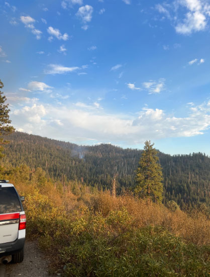
September 7, 2022 - Yosemite National Park officials report with the ongoing heat wave and a brief thunderstorm, we have had increase in fire activity - here's the most recent information. Alder Fire on September 6. Photo Credit: NPS
There are now multiple active wildfires in Yosemite National Park. A Type 2 Incident Management Team, CA Interagency Incident Management Team 10, has arrived in Yosemite to assist with a potential increase in initial attack, logistical needs, and operations of these fires. Firefighter and public safety continue to be one of our main priorities.
Smoke outlook available here
The Yosemite Public Information Map can be accessed here
RANCH FIRE
Location: Across the canyon west of Rodgers fire
Discover date: September 6, 2022
Size: 1/10 acre
Cause: Lightning
Reported by aircraft and described as a single tree burning
Plan to transport firefighters today to respond
ALDER FIRE
Location: North of Alder Creek
Discover date: September 6, 2022
Size: 1/10 acre, 50% contained
Cause: Lightning
ASPEN FIRE
Location: Northeast of Aspen Valley
Elevation: 6,200
Discover date: September 4, 2022
Size: 26 acres, 30% contained
Cause: under investigation
Fire History: Burning in the 2013 Rim fire footprint
Burning in snags and whitethorn
No closures, no evacuations
https://inciweb.nwcg.gov/incident/8385/RED FIRE
Location: Between Red Creek and Illilouette Creek
Elevation: 7,800
Discover date: August 4, 2022
Size: 6,056 acres
Cause: Lightning
Fire History: Burning in the 2001 Hoover fire footprint
Burning in red fir, lodge pole litter. Most activity on the southwest
Trail closures on segments heading out the Illilouette drainage from Glacier Point area to Merced Pass Lake is temporarily closed due to fire activity
https://inciweb.nwcg.gov/incident/8332/
RODGERS FIRE
Location: Northwest of Rodgers Canyon and southwest of Pleasant Valley
Elevation: 8,100
Discover date: August 8, 2022
Size: 2,541 acres
Cause: Lightning
No recent fire history
Burning in mixed conifer and red fir litter, and dead and down logs. Activity is on the north, southeast, and southwest corners
Source: NPS


