


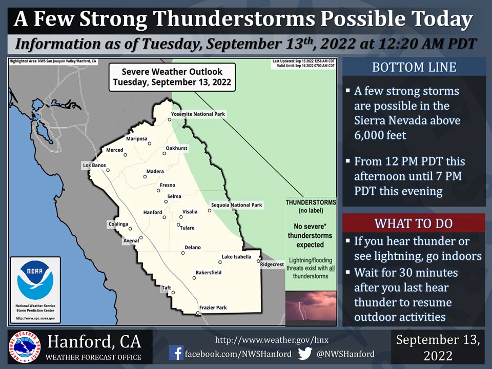
Locations for possible thunderstorms includes Yosemite National Park above 6,000 feet.
Dangerous cloud to ground lightning strikes and wind gusts near 45 mph are a couple of hazards associated with strong thunderstorms.
In addition, any thunderstorm can produce intense rainfall rates, leading to localized flooding.
Area Forecast Discussion
National Weather Service Hanford CA
143 AM PDT Tue Sep 13 2022
.SYNOPSIS...
Cooler temperatures will be the main story for this week. Showers
and thunderstorms possible in the Sierra Nevada.&&
.DISCUSSION...
The cooler temperatures the past few days may seem
like a brief reprieve after the long stretch of excessive triple
digit heat. However, the cooler temperatures will only get cooler
today and will remain cooler than average through the weekend. The
cooler temperatures are due to a persistent linear onshore flow
as well as multiple troughs including one on the weekend which is
bringing in colder temperatures from the Pacific instead of the
hot dry air from the desert southwest. Both the GEFS and European
model ensembles are in solid agreement about the flow pattern.
Both ensembles are showing a major trough moving in Saturday into
Sunday.
The Climate Prediction Center currently has the San Joaquin Valley,
the Kern County mountains and desert, and the Sierra Nevada as below
average in their 6 to 10 day outlook. However, it is not all good
news as the CPC also has the same regions as slight above average
in the 8 to 14 day outlook so temperatures may warm up after this
upcoming weekend. However, the latest probabilistic models have
near 0 chances of triple digits for the San Joaquin Valley until
the middle of next week.
Thunderstorms over the Sierra Nevada are expected every afternoon
from Tuesday due to what is left of the moisture from Hurricane
Kay. A thing to look for is the possibility of precipitation in
the Valley locations due to the big trough this weekend. 10 to 20
percent of the probabilistic models are indicating precipitation
accumulation of at least one hundredth of an inch Sunday and
Monday. Also, the GEFS and European model ensembles are showing
some light accumulation up to couple hundredths in the Valley
during the same timeframe.
&&
.AVIATION...
VFR conditions will prevail in Central California
through at least the next 24 hours. However, MVFR and even IFR
conditions could be possible due to the showers and thunderstorms in
the afternoon over the Sierra Nevada.
&&
.AIR QUALITY ISSUES...
ISSUED: 09/12/2022 15:00
EXPIRES: 09/13/2022 23:59
None.
Source: NWS
