


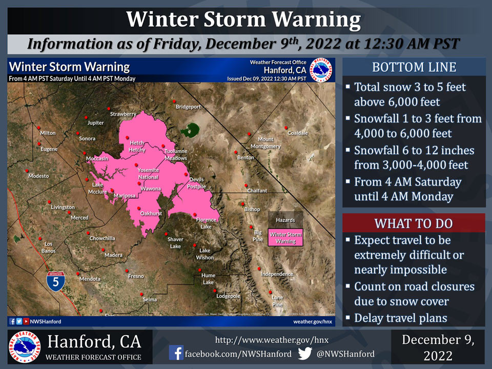
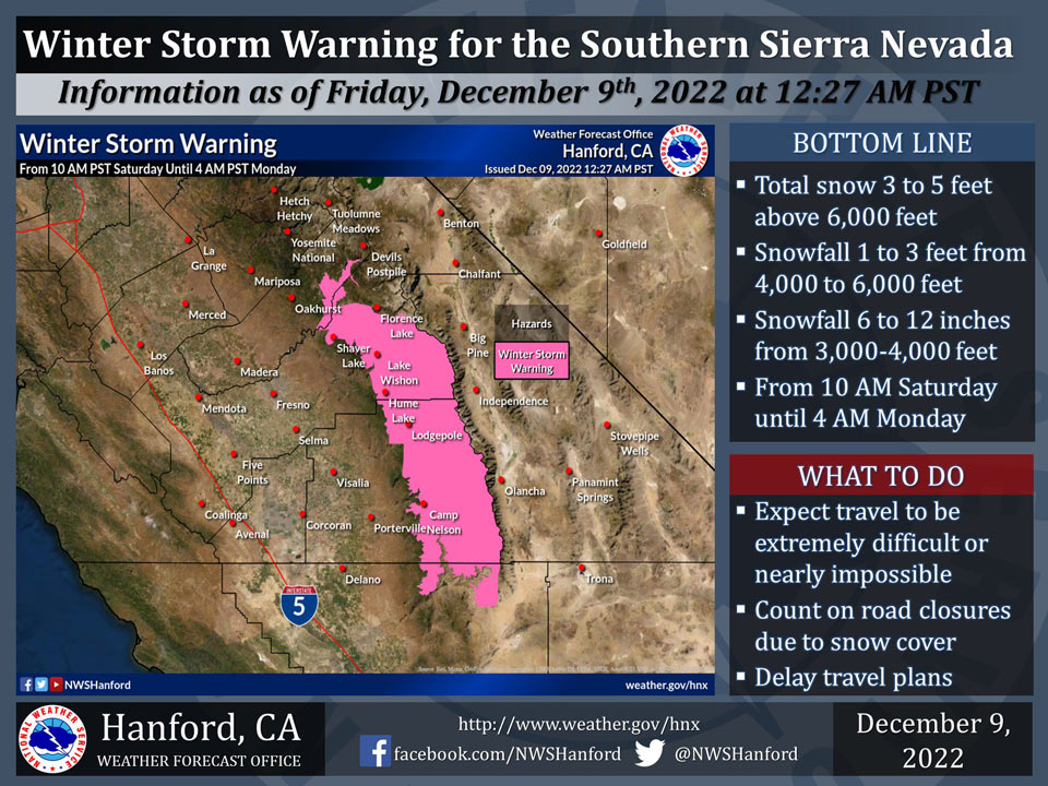
December 9, 2022 - The National Weather Service Hanford Office reports Winter Storm Warnings are in effect for the Sierra Nevada this weekend.
Most of this snow will fall Saturday night and Sunday. Snow levels around 4,000 feet Saturday will rise to about 6,000 feet Saturday night. Snow levels will drop to around 3,000 feet by Sunday evening.
Winter Storm Warning
URGENT - WINTER WEATHER MESSAGE
National Weather Service Hanford CA
441 AM PST Fri Dec 9 2022


Mariposa-Madera Lower Sierra-Yosemite NP outside of the valley-
Yosemite Valley-Upper San Joaquin River-
Including the cities of Bass Lake, Coarsegold, Fish Camp,
Oakhurst, North Fork, Tuolumne Meadows, Wawona, Yosemite Valley,
Devils Postpile, Florence Lake, and Lake Thomas Edison
441 AM PST Fri Dec 9 2022

...WINTER STORM WARNING REMAINS IN EFFECT FROM 4 AM SATURDAY TO
4 AM PST MONDAY...

* WHAT...Heavy snow with total snow accumulations of 3 to 4 feet
  expected with isolated heavier amounts to 5 feet. Winds could
  gust as high as 50 mph.

* WHERE...Mariposa-Madera Lower Sierra specifically above 3,500
  feet, Yosemite NP, including Yosemite Valley, and Upper San
  Joaquin River. In addition, snow levels are expected to rise
  to around 6,000 feet on Saturday evening into Sunday morning
  before lowering back to around 3,500 feet by Sunday evening.

* WHEN...From 4 AM Saturday to 4 AM PST Monday.

* IMPACTS...Travel could be very difficult to impossible. Gusty
  winds could bring down tree branches.

PRECAUTIONARY/PREPAREDNESS ACTIONS...

If you must travel, keep an extra flashlight, food, and water in
your vehicle in case of an emergency.

The latest road conditions for the state you are calling from can
be obtained by calling 5 1 1.
Source: NWS
