


Updated Tuesday Morning: Winter Storm Warning Begins Wednesday Morning for the Sierra Nevada from Yosemite National Park (Outside of the Valley) to Sequoia National Park
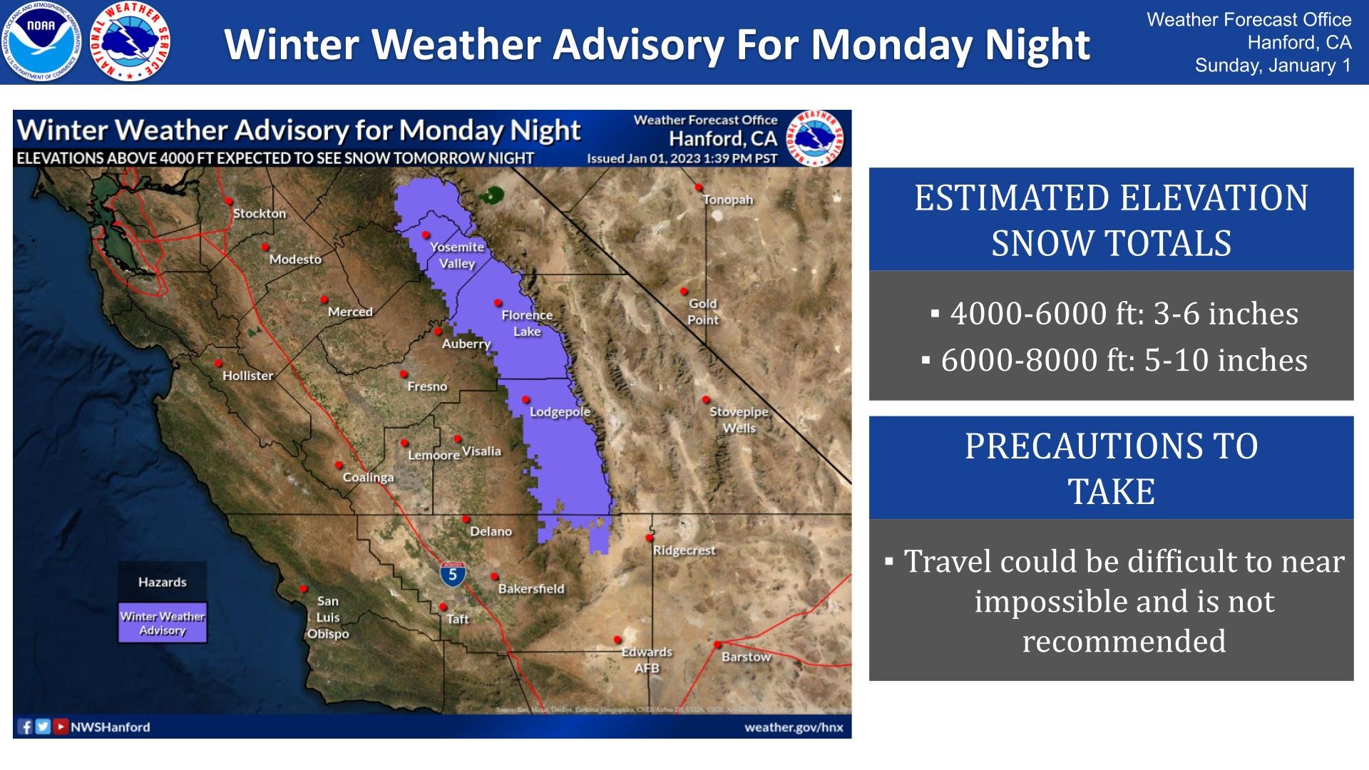
January 1, 2023 - The National Weather Service Hanford Office reports a Winter Weather Advisory is out for elevations above 4000 feet for Monday night into early Tuesday morning.
Elevations 4000+ feet may see 3-6 inches, and from 6000+ feet may see 5-10 inches of snow. Travel will be near impossible.
Winter Weather Advisory
URGENT - WINTER WEATHER MESSAGE
National Weather Service Hanford CA
1143 AM PST Sun Jan 1 2023


Yosemite NP outside of the valley-Yosemite Valley-
San Joaquin River Canyon-Upper San Joaquin River-
Kaiser to Rodgers Ridge-Kings Canyon NP-Grant Grove Area-
Sequoia NP-South End of the Upper Sierra-
Including the cities of Tuolumne Meadows, Wawona,
Yosemite Valley, Devils Postpile, Florence Lake,
Lake Thomas Edison, Lake Wishon, Huntington Lake, Shaver Lake,
Cedar Grove, Grant Grove, Hume Lake, Giant Forest, Lodgepole,
and Johnsondale
1143 AM PST Sun Jan 1 2023

...WINTER WEATHER ADVISORY IN EFFECT FROM 4 PM MONDAY TO 4 AM PST
TUESDAY...

* WHAT...Snow expected. Total snow accumulations of 3 to 6 inches
  between 4000 and 6000 feet and 5 to 10 inches above 6000 feet.

* WHERE...Sierra Nevada above 4000 feet.

* WHEN...From 4 PM Monday to 4 AM PST Tuesday.

* IMPACTS...Travel could be very difficult to impossible. The
  hazardous conditions could impact the evening commute.


PRECAUTIONARY/PREPAREDNESS ACTIONS...

Slow down and use caution while traveling.

The latest road conditions for the state you are calling from can
be obtained by calling 5 1 1.
Source: NWS
