


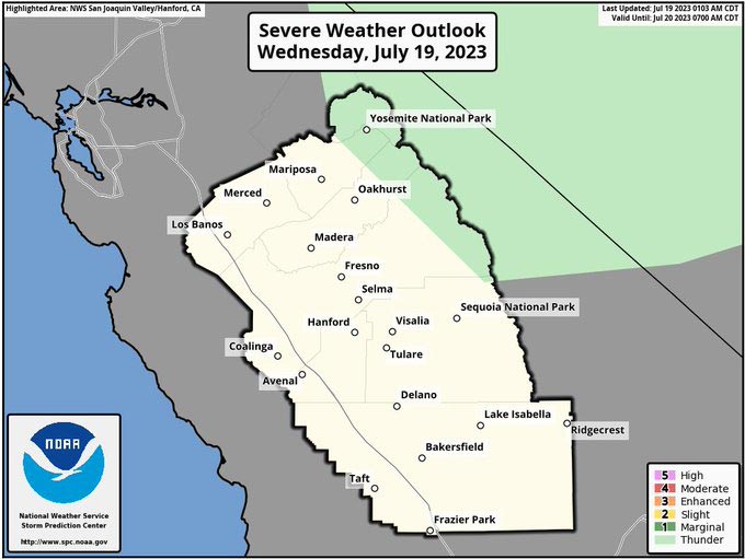
Includes Eastern Mariposa, Madera and Fresno Counties
July 19, 2023 - National Weather Service Hanford Office officials report general thunderstorm activity expected this Wednesday, July 19th across the Sierra Nevada.
Thunderstorm activity has a good chance of forming today from an area from Yosemite to just north of Mt. Whitney.
Remain alert to the dangers of thunderstorms today.
Area Forecast Discussion
National Weather Service Hanford CA
101 AM PDT Wed Jul 19 2023
.SYNOPSIS...Triple digit heat is expected to continue in most of
the San Joaquin Valley and Kern County Desert areas through the
weekend. An Excessive Heat Watch is in effect for much of the area
beginning Friday and heading into the weekend. Other than a
chance of thunderstorms over the Sierra Nevada this afternoon and
evening, dry conditions will prevail through the weekend.
&&
.DISCUSSION...
It was another hot day across much of Central California
yesterday. Except there were some showers and isolated
thunderstorms in the Sierra Nevada, as well as northern portions
of our San Joaquin Valley, or mainly towards Merced County. This
was due to an upper-level disturbance that passed from the
Eastern Pacific and is continuing to gradually move inland
tonight. High temperatures were not as hot in areas where cloud
cover increased due to the showers and thunderstorms developed,
including in the aforementioned portions of the San Joaquin
Valley. A few showers and isolated thunderstorms continue to
develop overnight tonight in the Sierra Nevada, including towards
Yosemite and areas just east of Mariposa.
Based on probabilistic data, forecast high temperatures are a
little lower today. The chances for a reading of 105 degrees and
above in the San Joaquin Valley are generally quite low, or up to
30 percent. However, temperatures in the Kern County desert will
remain quite hot, such as in the Indian Wells Valley, as a reading
of at least 105 degrees in this area is almost certain. About a
20 percent chance for thunderstorms remains in the Sierra Nevada
through this afternoon, mainly along the crest. Little change in
temperatures is expected for Thursday, so much of our forecast
area will get a brief break from the very hot temperatures that we
observed the past few days. We are not expecting another chance
for showers and thunderstorms after today. Low temperatures
should be relatively mild the next couple of mornings, compared
to recent days.
Temperatures will be on the rise by Friday. The probability of a
high of 105 degrees in the Central Valley will be much higher, or
as much as 75 percent by Friday and will remain steady until
Sunday. Highs of above 110 degrees are likely, or as much as 80
percent, in the desert portion of eastern Kern County during at
least Friday and Saturday. Thus, we will keep the Excessive Heat
Watch going for these areas, as well as the mountains below around
5,000 feet for Friday into the weekend. Latest blended guidance
shows highs as hot as 115 degrees have a low chance (less than 5
percent) of occurrence in the Indian Wells Valley.
For the first part of next week, expect minor changes in
temperatures, though extremely hot temperatures are unlikely. It
is more certain we will remain a few degrees above seasonal
averages, which means triple digits continue for much of the lower
elevations. A high of 105 degrees during Monday until next
Wednesday in the Central Valley has a low to moderate
probability (20 to 40 percent) of happening. Dry weather continues
for next week, based on latest ensemble and deterministic guidance.
&&
.AVIATION...Widespread MVFR due to haze and smoke in the San
Joaquin Valley along with areas of mountain obscuring IFR in the
Sierra Nevada through 00Z Thursday. Otherwise, VFR conditions will
prevail throughout the Central CA interior for at least the next
24 hours.
&&
.AIR QUALITY ISSUES...
None.
&&
.CERTAINTY...
The level of certainty for days 1 and 2 is high.
The level of certainty for days 3 through 7 is medium.
Certainty levels include low...medium...and high. Please visit
www.weather.gov/hnx/certainty.html for additional information
and/or to provide feedback.
&&
.HNX WATCHES/WARNINGS/ADVISORIES...
Excessive Heat Watch from Friday morning through Sunday evening
for CAZ300>322-324-332>339.
Source: NWS
