


Includes Fresno, Madera, Merced and Mariposa Counties including Yosemite National Park
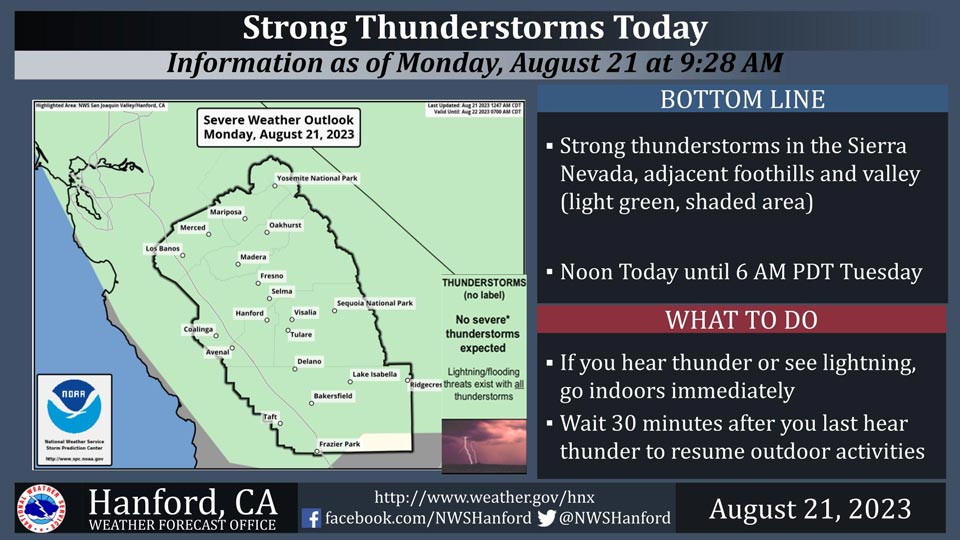
August 21, 2023 - National Weather Service Hanford Office officials report Thunderstorms this afternoon and evening will contain gusty winds, heavy rain and frequent lightning.
Area Forecast Discussion
National Weather Service Hanford CA
1221 AM PDT Mon Aug 21 2023
.SYNOPSIS...
Remnants of Tropical Storm Hilary will continue to bring
widespread rainfall to the area through this morning and into
tonight. Thunderstorms are also possible this afternoon. The
system is expected to exit our area Tuesday morning and dry
conditions will begin to prevail Wednesday with some showers
along the Sierra Nevada crest possible on Thursday and Friday.
Flooding will continue to impact the area as the water from
yesterday's excessive rainfall recedes.
&&
.DISCUSSION...
As Tropical Storm Hilary continues it's track up through Southern
California and into Southern Nevada, it will continue to bring
rainfall to our CWA. The majority of this rain will fall in the
San Joaquin Valley as TS Hilary moves north. Thunderstorms are
also possible as thermal instability causes the moisture to
uplift in the afternoon.
Here's the 4.1 NBM probabilities for an additional 0.25 inches of
rain in select locations in the San Joaquin Valley for the next
24 hours.
Reedley: 56%
Fresno: 51%
Porterville: 51%
Visalia: 46%
Madera: 41%
Bakersfield: 36%
Delano: 36%
Hanford: 36%
Lemoore: 36%
Merced: 36%
An excessive amount of rain fell yesterday, mostly in the Kern
County desert and mountains, as well as the southernmost Sierra
Nevada. 3 to 5 inches fell in the desert and mountains, and 2 to 4
inches fell in the southern Sierra Nevada. There was also an
excess of 1 to 2 inches on the valley foothills and the
southernmost portion of the valley, including Bakersfield.
Flooding will continue to impact these areas for several days as
the flood waters recede and will continue to be hazardous.
Temperatures are expected to return to normal for this time of
year by Wednesday and are expected to remain consistent through
the weekend, with highs in the low to mid 90's. Long term ensemble
models show the upper lever ridge currently over the Midwest will
begin to back track west, leading to the possibility of slightly
warmer than normal temperatures by next Tuesday, when the center
of the ridge is located over California.
&&
.AVIATION...
Widespread MVFR and areas of mountain obscuring IFR conditions in
and near showers and thunderstorms across Kern County mountains
and Sierra Nevada. Showers and thunderstorms will also impact the
remainder of the Central CA interior with areas of MVFR.
&&
.AIR QUALITY ISSUES...
ISSUED: 08/20/2023 13:29
EXPIRES: 08/21/2023 23:59
None.
&&
.CERTAINTY...
The level of certainty for days 1 and 2 is medium.
The level of certainty for days 3 through 7 is medium.
Certainty levels include low...medium...and high. Please visit
www.weather.gov/hnx/certainty.html for additional information
and/or to provide feedback.
&&
.HNX WATCHES/WARNINGS/ADVISORIES...
Flood Watch through Monday evening for CAZ314-316-322-328>339.
High Wind Warning until 5 AM PDT Monday for CAZ337>339.
Source: NWS
