


October 29, 2023 - National Weather Service Storm Prediction Center Officials report surface high pressure and colder air will continue to spill across the central U.S. as a broad mid-level trough ejects into the Plains states today.
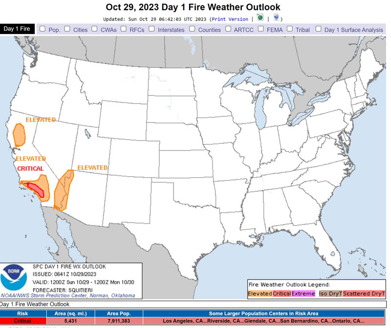
The surface anticyclone will also intensify along the West Coast, supporting the tightening of a pressure gradient across California. Here, strong northerly surface winds will become prevalent in the Valley regions, with dry offshore flow expected across the southern California coastline.
Elevated highlights have been added across portions of the Sacramento Valley and Lower Colorado River Basin areas, with sustained 20+ mph northerly winds amid 15 percent RH expected during much of the afternoon.
Furthermore, channeled 25+ mph sustained offshore winds and 5-15 percent RH should overlap for most of the day in the higher terrain surrounding the Los Angeles Metropolitan area, warranting the maintenance of Critical highlights.
Elsewhere across the CONUS, surface conditions should be too moist or cool to support significant wildfire-spread potential.
Source: NWS
