


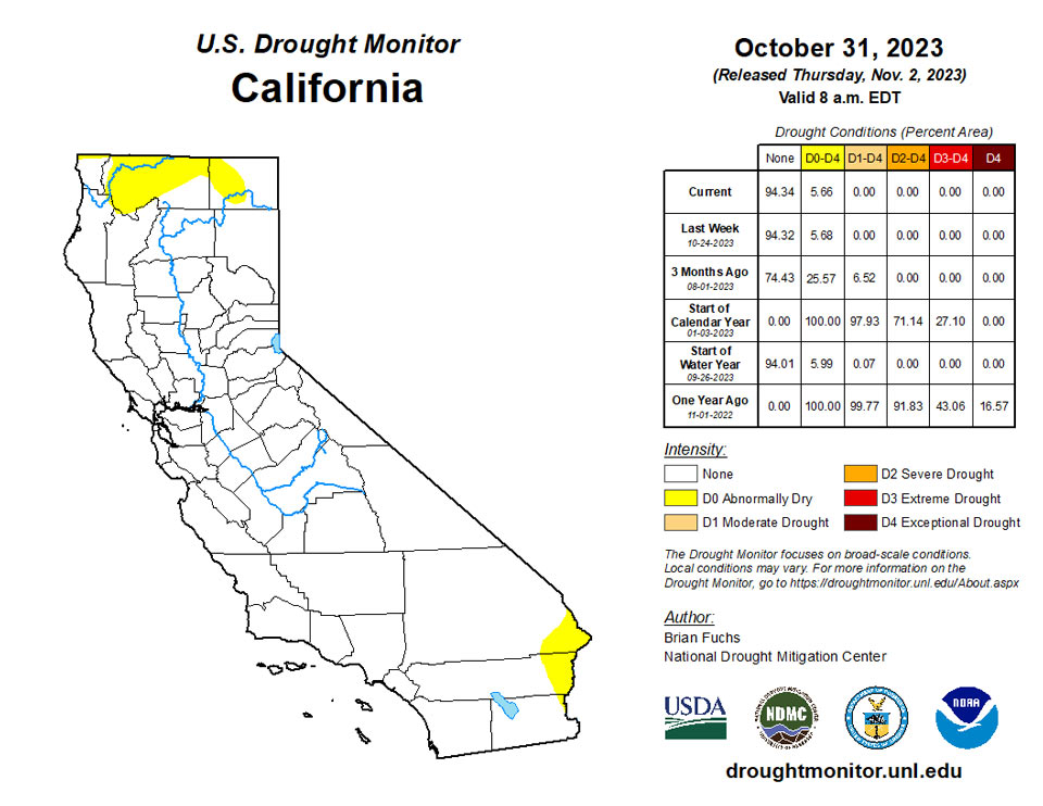
California and National Drought Summary for October 31, 2023
Summary
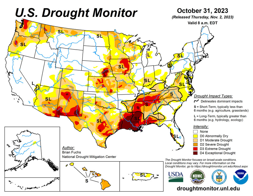
November 2, 2023 - One of the first significant storm systems of the season impacted the Plains and into the Midwest. Not only did the region see widespread precipitation, but the first real cold air also dropped in from Canada. Snow was widespread through the northern Plains and significant rain fell across portions of Kansas, Missouri, Oklahoma, Texas and Arkansas as well as in Wisconsin. The Southeast continued to be dry and warmer than normal while cold air dominated portions of Montana into Wyoming during the last week.
Northeast
Temperatures were warmer than normal over the entire region with most places 6-12 degrees above normal. Areas of Pennsylvania into southern New England recorded above-normal precipitation, with the greatest amounts over western Pennsylvania where 200% of normal precipitation was received. Drought conditions were mostly status quo, with some improvements made to the abnormally dry conditions in western Pennsylvania and some expansion of abnormally dry conditions over western New Jersey and southeastern Pennsylvania. Degradation was also made to the drought intensity levels over much of eastern and southern Virginia this week, with severe drought expanding over northern Virginia and moderate drought expanding into southern Virginia.
Southeast
The week was dry over the region with only some light rain over portions of northern Alabama. Western Tennessee did receive some significant rains associated with the storm system that impacted the Midwest, with some areas of western Tennessee recording 200% of normal rain for the week. Temperatures were warmer than normal over the entire region with most areas 4 to 8 degrees above normal for the week. Only south Florida was near normal during this time. Several recording stations from Mississippi, Alabama and Tennessee recorded less than 0.50 inches of rain for the month of October with dryness that was comparable to records set in 2016 and 1963. Fire alerts were reinstated for all 67 counties in Alabama with no burn permits being issued for any county in northern portions of the state. The Mississippi River at Memphis remains near historic low-water thresholds, impacting barge traffic. Nashville ended up with just 0.73 inches of rain for October, with 0.43 taking place on October 30. Widespread drought expansion and degradation was introduced this week for the region. Extreme drought was expanded significantly over northern Mississippi and Alabama and into much of southern Tennessee. A new area of exceptional drought was brought into northern Mississippi. Extreme drought also expanded in southern Alabama into the panhandle of Florida and southwest Georgia.
South
Temperatures were mixed for the week as areas impacted by the strong storm system through the region were 1-3 degrees below normal while those further to the west were 9-12 degrees above normal for the week. Significant rain fell over most of Oklahoma and Texas and into northern Arkansas this week, allowing for improved drought conditions. Lake Waco, in north central Texas, gained 112,000 acre-feet over the past week, taking it from its historic low of 54.5% of conservation storage to 114% of conservation storage. Most of these areas had a full category of improvement to their drought status, with some areas of Texas seeing multiple category improvements to the drought intensity. A full category of improvement was made over much of Arkansas this week with a reduction of moderate and severe drought conditions.
Midwest
Temperatures were well above normal over most of the region this week with eastern portions of the region 9 to 12 degrees above normal. Western areas were near normal but parts of northern Minnesota were 3 to 6 degrees below normal after cold Canadian air impacted the area. Much of the region received precipitation during the week with only portions of eastern Kentucky and southwest Iowa missing out. Areas of Wisconsin recorded the most rain with some areas at 800% of normal. Significant amounts of rain were also recorded in western Missouri. With the significant precipitation of the last week and the generally wetter pattern lately, improvements were made over much of the region. Significant rains over western Kentucky allowed for drought removal, and moderate drought and abnormally dry conditions were improved over Ohio, Indiana, Illinois and Michigan. Most of southeast and central Missouri had drought conditions improved this week and northwest Iowa also had moderate drought improvements. Moderate drought was expanded over southwest Iowa, and eastern Iowa saw minimal changes as the long-term drought signal is still significant in this region. Portions of central Wisconsin recorded up to 800% of normal precipitation for the week, removing extreme drought from the state and reducing severe drought too.
High Plains
Significant precipitation was recorded in North Dakota, northeast Nebraska, and central and southeast Kansas. Some of the precipitation in these regions came as snow and it is anticipated that much of the ensuing melt-off will get moisture into the soils. Temperatures were cooler than normal over most of the region with the greatest departures over the western Dakotas where temperatures were 10-15 degrees below normal. A full category improvement to the drought intensities was made over northern North Dakota, central and western Nebraska, and southeast Kansas. Some expansion of abnormally dry conditions took place over eastern Colorado and western Kansas as well as southern Wyoming.
West
Much of Montana and central to western Colorado saw the most significant precipitation for the week, with good amounts of snow in the higher elevations. Great Falls, Montana, recorded over 8 inches of snow for the week and Havre had 5.7 inches. Crested Butte, Colorado, recorded 13 inches of snow for the week while Steamboat Springs had 4.9 inches. Temperatures were below normal for almost all of the region with most areas 5-10 degrees below normal. Areas of Arizona and New Mexico were near normal to up to 5 degrees above normal while Montana and Wyoming received the coldest air and temperatures for the week were 20-25 degrees below normal. The precipitation in Montana allowed for improvement to the drought conditions, mainly in the northern portions of the state. Some improvements were made in western Colorado while there was some slight expansion to the abnormally dry conditions in Utah. Improvements were also made this week in central Washington as the most recent wetter pattern started showing up in the drought indices and indicators, allowing for improvements on the map.
Caribbean
Puerto Rico had improvements made to the moderate drought and abnormally dry conditions due to the recent change to a wetter pattern.
Tropical showers delivered additional drought relief to the U.S. Virgin Islands during the monitoring period ending October 31. One-category improvements were introduced for all three major islands, with D3 (extreme drought) becoming D2 (severe drought) on St. Thomas and St. Croix. Neither dryness nor drought exists on St. John, following last week’s D0 (abnormally dry) designation. In addition, the classification of drought for St. Thomas and St. Croix was changed from “SL” to “L,” reflecting short-term wetness and lingering, long-term drought impacts. During the last 7 days of October, the 2.11-inch rainfall total at King Airport on St. Thomas boosted the monthly sum to 8.69 inches (165% of normal). On St. John, the long-term observation site at Windswept Beach received 6.28 inches for the week and 17.23 inches (284% of the long-term mean) during October. It was the second-wettest October on record at Windswept Beach, behind only 17.98 inches in 2010. At more than a dozen volunteer (CoCoRaHS) observation sites scattered across the three major islands, weekly rainfall ranged from 2.33 to 7.59 inches, while October rainfall ranged from 6.19 to 18.65 inches. USGS wells also reflected improvement, with decreasing depths to water. For example, depth to water to the Grade School 3 Well on St. Thomas decreased to less than 3.8 feet by October 31, a stark improvement from more than 16.6 feet on August 6.
Pacific
No changes were made in Alaska this week.
More degradation took place in Hawaii on the Big Island, Maui and Molokai but some improvements were also made on Kauai and the northwest side of the Big Island.
Showery weather across the U.S.-Affiliated Pacific Islands (USAPI) kept the region free of drought. Short-term dryness (D0-S) persisted in the Republic of the Marshall Islands (RMI) at Kwajalein and Wotje, although those locations have recently noted frequent showers. During the drought-monitoring period ending October 31, rainfall totaled 1.42 inches at Kwajalein and 2.99 inches at Wotje; preliminary monthly totals in those locations were 11.46 and 8.24 inches, respectively. Elsewhere in the RMI, Majuro reported reservoir storage of more than 33 million gallons, about 92% of capacity, in the most recent update on October 23. Ample rain has fallen in recent weeks in most locations across American Samoa, the Republic of Palau, the Mariana Islands, and the Federated States of Micronesia (FSM). In the FSM, October 25-31 rainfall totaled 3 to 6 inches or more in locations such as Fananu, Chuuk Lagoon, Lukunor, Nukuoro, and Pingelap. In American Samoa, Pago Pago International Airport received 2.98 inches of rain from October 25-30. Meanwhile in the Marianas, Guam International Airport noted an October rainfall total of 17.40 inches (137% of normal).
Looking Ahead
Over the next 5-7 days, much of the southern half of the U.S. is expected to be dry with little to no precipitation anticipated in areas south of a line from central California to Nebraska and into the Mid-Atlantic. The Pacific Northwest as well as the northern Plains and Midwest are expected to have the most active weather and precipitation. Temperatures are expected to be warmer than normal over the Southwest, southern Plains and Southeast with departures of 8-10 degrees above normal in west Texas and into New Mexico. Cooler-than-normal temperatures are anticipated over northern California, the northern Plains and upper Midwest with departures of 5-8 degrees below normal.
The 6–10 day outlooks show a good chance of a warmer-than-normal pattern over the southern U.S. and the Pacific Northwest. The best chance for below-normal temperatures is over the Great Lakes and New England regions. There is a high likelihood that temperatures over Alaska and Hawaii will also be above normal. The greatest chances of above-normal precipitation will be over northern California and southern Oregon while coastal areas from North Carolina to Maine will also have above-normal chances of recording above-normal precipitation. The best chance of below-normal precipitation is over the southern Plains and into Arizona and New Mexico.
Author(s):
Brian Fuchs, National Drought Mitigation Center
Brad Rippey, U.S. Department of Agriculture
Dryness Categories
D0 Abnormally Dry—used for areas showing dryness but not yet in drought, or for areas recovering from drought.
Drought Intensity Categories
D1 Moderate Drought
D2 Severe Drought
D3 Extreme Drought
D4 Exceptional Drought
Drought or Dryness Types
S Short-term, typically less than 6 months (agriculture, grasslands)
L Long-term, typically more than 6 months (hydrology, ecology)
SL Area contains both short- and long-term impacts
Source: National Drought Mitigation Center
