


| Current as of | Sun, 07/07/2024 - 23:13 |
|---|---|
| Incident Time Zone | America/Los_Angeles |
| Incident Type | Wildfire |
| Cause | Under Investigation. |
| Date of Origin | Wed, 06/26/2024 - 22:29 |
| Location | East of Pine Flat Reservoir, 46 miles East of Sanger |
| Incident Commander | California Incident Management Team 11 assumed command of the Basin Fire on June 28th. |
| Incident Description | The Basin Wildfire is burning in grass, chapparal and oak timber. It is also burning in steep terrain. |
| Coordinates | 36° 51' 52'' Latitude -119° 6' 9
'' Longitude |
| Total Personnel: | 872 |
|---|---|
| Size | 14,020 Acres |
| Percent of Perimeter Contained | 60% |
| Fuels Involved |
Tall Grass, Brush, and Hardwood (Oak) Litter. The fire perimeter falls with in the regional Fuels and Fire Advisory for California Grass and Herbaceous-Dominated Ecosystems. Heavy grass fuel loading is predominate in the surrounding area with a FDFM at 3%. Live fuel moisture is near average with 1,000 hour fuels at average. ERC's are average for this time of year as well |
| Significant Events |
Active fire activity was observed today. Smoldering and creeping, some interior islands continuing to burn out aggressively. Firefighters continued to mop up hot spots, suppression repair is ongoing. |
| Planned Actions |
This fire is a full suppression fire. The current strategy of using tactical ridges and indirect line reduces |
|---|---|
| Projected Incident Activity |
12 hours: Diurnal winds will push the fire to the west along the Kings River. These winds will also influence fire movement in Dinky Creek north Balch Camp. |
| Weather Concerns |
Long-duration, high impact and record setting heat wave is ongoing over the west and will continue to bring temperatures at least 15 degrees above average into the middle of next week. The Excessive Heat Warning has been extended once again into Saturday 7/13. This extended period of hot and dry conditions are elevating cumulative heat stress and fire danger concerns. No change in weather conditions are expected over the fire over the next few days. |
|---|
PEOPLE AND EQUIPMENT: 1,028 personnel, 24 crews, 38 engines, 10 helicopters, and 14 dozers
CURRENT SITUATION: The Basin Fire is at 14,020 acres. Containment is now 60%. Temperatures will reach 112 degrees today. This 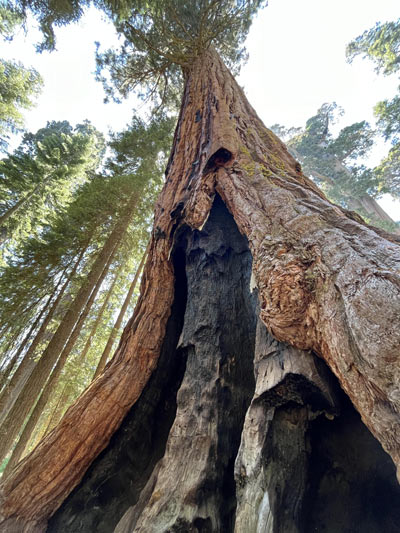 heat wave impacts the fire by drying out the vegetation and producing heat stress challenges for fire personnel. After today, temperatures will decrease gradually by about 2 degrees a day.
With fire activity reduced, equipment and personnel are shifting to suppression repair, remaining ready to respond to any new fire activity or being released for work elsewhere. The equipment and personnel resources continue to be shifted as conditions dictate to active wildfires both statewide and nationally.
Northern perimeter: Crews succeeded in constructing a helicopter landing area west of the Dinkey Creek drainage despite steep, rugged terrain. This major accomplishment enabled firefighters to tie-in the fire line in an area that was previously inaccessible north of Sycamore Springs Road to the northern apex of the fire. Crews will continue to work this area today.
Suppression Repair: Dozers have switched from building contingency line to working on suppression repair. Crews will begin returning areas of the fire line to as natural a state as practicable to minimize future erosion and enhance wildlife habitat as the fire area recovers.
An EXCESSIVE HEAT WARNING through next week continues to affect the fire with high temperatures, drying vegetation, and little relief at night. Temperatures are forecast to reach as high as 108 today and relative humidity remains low. Winds are forecast to remain low, from the west at 8-12 mph and gusts to 15. The National Weather Service has reported that “A heat wave this intense, this long, has not been experienced in this region in 20 years.” Cooling stations have been set up at the fire command post and on the fire line to help reduce the cumulative effects of heat stress on firefighters.
The Basin Fire started on June 26th and the cause is currently under investigation. Currently, the fire is burning at 2000-4500 elevation, northeast of Pine Flat Lake, west of the Spanish Mountain, south of Black Rock Rd (11S012) and north of the South Fork of the Kings River.
***CHANGE IN EVACUATION ZONES***: The mandatory evacuation order remains in place only for Fresno County zones K30 and K40. Evacuation warnings remain in effect for zones K29, K31, K41, and K166. Check the Fresno County Evacuation map:
https://www.arcgis.com/apps/webappviewer/index.html?id=e7d6006a016a444db8b210ac4d2eb5cf
The Sierra National Forest has updated three Forest Orders that supersede previous orders issued in late June 2024. These revised orders are intended to ensure public safety and allow for the continued enjoyment of public lands while effectively managing ongoing fire activities. Visit https://www.fs.usda.gov/alerts/sierra/alerts-notices for full details of the updated fire restrictions and Forest Orders.
Closures: Road closure signs have been placed on the perimeter of the fire. The public should review which roads are closed before traveling into the area because no one will be allowed to enter zones under evacuation warnings. To access websites showing both evacuation orders, road closures and many other emergency resources, visit: http://www.fresnocountyemergency.com
Smoke - Visit AirNow to find out the Air Quality Index in your area. As smoke gets worse, the amount of particles in the air changes - and so do the steps you should take to protect yourself. AirNow recommends precautions you can take to protect your health when air pollution gets bad
Previous Information
Sierra National Forest Basin Fire Update for Thursday, July 4, 2024: 46% Containment at 13,979 Acres – Includes Public Information Map
