


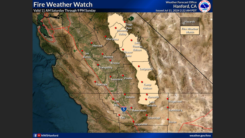
Includes Eastern Mariposa, Madera, and Fresno Counties and Yosemite
July 11, 2024 - National Weather Service Hanford Office officials report a Fire Weather Watch has been issued for the Sierra Nevada this weekend due to an increased probability for dry thunderstorms of 10-30% for the afternoons of Saturday and Sunday.
This is combined with low relative humidities and the low probability for wetting rain (10-25%), creating an elevated fire risk.
Fire Weather Watch
URGENT - FIRE WEATHER MESSAGE
National Weather Service Hanford CA
146 AM PDT Thu Jul 11 2024


Central Sierra-North Kings River-Sequoia Kings-Lake Isabella-
146 AM PDT Thu Jul 11 2024

...FIRE WEATHER WATCH REMAINS IN EFFECT FROM SATURDAY MORNING
THROUGH SUNDAY EVENING FOR LOW RELATIVE HUMIDITY AND THUNDERSTORM
CHANCES... INCLUDING A CHANCE FOR DRY LIGHTNING IN THE SIERRA
NEVADA FOR FIRE WEATHER ZONES 592, 593, 594, AND 595...

* AFFECTED AREA...Fire weather zone 592.Fire weather zone
  593.Fire weather zone 594.Fire weather zone 595.

* WIND...Terrain-driven winds 6-12 mph. Stronger, erratic wind
  gusts possible in thunderstorm outflow.

* HUMIDITY...Minimum daytime humidity levels as 15-25%

* THUNDERSTORMS...25% chance of thunderstorms - including dry
  lightning - late Saturday morning through Saturday afternoon.
  Less than a 10% chance of wetting rain with these storms.
  Thunderstorm potential resumes Sunday afternoon, ending
  Sunday evening.

* IMPACTS...any fires that develop will likely spread rapidly
  dueto dry fuels. Outdoor burning is not recommended.

PRECAUTIONARY/PREPAREDNESS ACTIONS...

A Fire Weather Watch means that critical fire weather conditions
are forecast to occur. Listen for later forecasts and possible
Red Flag Warnings.
Source: NWS
