


Click Here for California Fires
August 6, 2024 - Currently, 89 large active wildfires are being managed with full suppression strategies nationwide. Wildfires have burned 2,266,309 acres 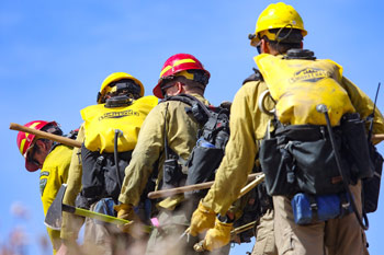 nationwide. More than 29,600 wildland firefighters and support personnel are assigned to wildfires, including 23 complex and 3 Type 1 incident management teams, 635 crews, 1,772 engines, 174 helicopters, and six Modular Airborne Fire Fighting Systems, or MAFFS.
Evacuation orders are in effect on 21 wildfires. If you live in an area that has been evacuated, please follow the instructions from local authorities. They will provide the latest recommendations based on the threat to your community and appropriate safety measures. If you are concerned about the potential for evacuation or other disaster impacts, https://www.ready.gov/ can help you get plans in place.
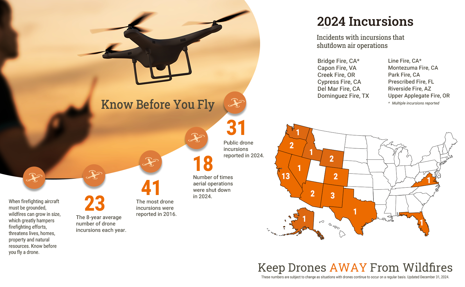
So far in 2024, 14 UAS incursions have been reported near wildfires in 10 states. Seven of these incursions have caused firefighting aircraft to be grounded while the unauthorized drone operator was located. Unauthorized drones have no communication with wildland firefighters and pilots working on the ground and in the air. Regardless of your motivation, flying a drone near a wildfire is putting someone else's life in danger. Always Know Before You Fly and keep drones away from wildfires.
On August 1, predictive services staff at the National Interagency Coordination Center released the National Significant Wildland Fire Potential Outlook for August through November. For additional information about the current outlook visit the Outlook page on the NICC site.
A new fuels and fire behavior advisory has been issued for Colorado's Front Range and Eastern Wyoming. There are already advisories in place for Southwest Oregon, the region east of the Cascades in Oregon and Washington, Nevada, Southern Idaho, Utah, and California. Residents, travelers, or workers on their way to any of these states should be advised and familiarize themselves with the elevated risks.
The current reporting from source data for year-to-date figures appears to be underreporting fire acreage in some geographic areas and, therefore, the overall national statistics. Given the very high tempo and scale of national current fire activity, there will be delays in reconciling, especially from areas with large fires and dynamic fire activity. Adjustments may occur as the accuracy of fire locations, mapping and final fire reporting is reconciled.
Breezy and dry southwest sustained winds of 12-25 mph with gusts 25-35 mph amid relative humidity of 5-20% and above normal temperatures will develop across eastern Oregon, northern California, the northern Great Basin, southwest Montana, and western Wyoming. Areas of elevated to critical conditions are expected, with a period of dry, northwesterly winds likely after midnight across far northwest California and southwest Oregon. Dry, northerly winds are expected in the Okanogan Valley today and tonight, as well. Very dry conditions will continue in interior California, with poor overnight recovery of 20-40% for mid-slopes and ridges that will extend into eastern Oregon and much of the Great Basin. Isolated to scattered mainly wet thunderstorms are forecast near and east of the Divide in the Rockies from Montana south to Colorado and much of Arizona, while few thunderstorms are expected in New Mexico tomorrow. Isolated mixed wet and dry thunderstorms may develop on the western fringe of the moisture in portions of southeast Idaho, Utah, and western Wyoming with new ignitions likely. Heavy rain and extensive, possibly catastrophic, flooding will continue in much of eastern Georgia and the Carolinas due to Tropical Storm Debby. Dry and hot southerly flow will continue the southern Plains with winds of 10-20 mph gusting to 20-30 mph amid minimum relative humidity of 10-25%. Otherwise, scattered showers and thunderstorms are likely in the northern Plains, Great Lakes, and Northeast. Strong, downslope Chinook winds will continue in the southeast Interior of Alaska with temperatures well into the 80s.
| Number of new large fires or emergency response * New fires are identified with an asterisk |
21 | States currently reporting large fires: |
| Total number of active large fires Total does not include individual fires within complexes. |
89 | |
| Acres from active fires | 2,266,309 | |
| Fires contained | 6 |
Year-to-date statistics
| 2024 (1/1/24-8/06/24) | Fires: 29,363 | Acres: 4,718,357 |
| 2023 (1/1/23-8/06/23) | Fires: 31,840 | Acres: 1,317,057 |
| 2022 (1/1/22-8/06/22) | Fires: 39,945 | Acres: 5,846,049 |
| 2021 (1/1/21-8/06/21) | Fires: 38,883 | Acres: 3,441,915 |
| 2020 (1/1/20-8/06/20) | Fires: 33,234 | Acres: 2,278,591 |
| 2019 (1/1/19-8/06/19) | Fires: 27,889 | Acres: 3,500,137 |
| 2018 (1/1/18-8/06/18) | Fires: 38,987 | Acres: 5,279,931 |
| 2017 (1/1/17-8/06/17) | Fires: 40,007 | Acres: 5,899,245 |
| 2016 (1/1/16-8/06/16) | Fires: 35,476 | Acres: 3,500,646 |
| 2015 (1/1/15-8/06/15) | Fires: 37,389 | Acres: 6,074,389 |
| 2014 (1/1/14-8/06/14) | Fires: 34,697 | Acres: 1,798,190 |
10-year average Year-to-Date
| 2014-2023 | Fires: 35,872 | Acres: 3,893,615 |
Source: NIFC
