


California and National Drought Summary for August 2, 2016
Summary
August 5, 2016 - Shower and thunderstorm activity was scattered across much of the eastern two-thirds of the country, but in most places, moderate to heavy precipitation was not widespread enough to bring significant drought relief. Some exceptions included southwest New England and the lower Northeast, the central Appalachians and Piedmont, the lower Mississippi Valley, parts of the central Great Plains, the Black Hills and adjacent areas, southeast Arizona, and Hawaii. Heavy rains in the latter area were primarily associated with Tropical Storm Darby.New England, the Northeast, and the mid-Atlantic
Moderate to heavy rains, locally exceeding 5 inches, fell on areas from southwestern New England southward and eastward into the mid-Atlantic and through the central Appalachians. These rains removed dryness and drought from most of West Virginia and in the mid-Atlantic south of the Mason-Dixon line, but only scattered improvement was noted elsewhere. In eastern and northern New England, where only light rain fell, severe drought expanded through most of Massachusetts, and moderate drought covered the rest of southern New England. Rainfall deficits for the past 90 days range from 4 to 9 inches in much of this region. In addition, long-term rainfall shortages remain entrenched, with accumulated shortfalls over the past 2 years of 12 to 24 inches observed from central New England southward into northeastern Pennsylvania. Temperatures averaged a few degrees above normal this past week, exacerbating conditions.Great Lakes Region
A scattered pattern of moderate to heavy rain was observed last week, though only light precipitation fell on a majority of sites. This pattern was common for much of the country. In areas where moderate precipitation was isolated at best – western New York, central and northern Ohio, and adjacent Pennsylvania – D0 to D2 conditions expanded, in particular D1 grew significantly to encompass most of central Ohio.The Lower Mississippi Valley eastward through the Southeast, and eastern Florida
Moderate to heavy rainfall was observed across most of the lower Mississippi Valley. Totals ranged from 2 inches to nearly 6 inches in part of northeastern Louisiana. As a result, former D0 to D2 conditions improved one category. Farther east, isolated heavy rain fell, but most locations reported only light precipitation at best. This prompted expansion of D0 to D3 areas in numerous parts of the southeast, and in addition D0 was expanded to cover much of the immediate eastern coastline of Florida. Over the last 90 days, rainfall totaled between 4 and 10 inches less than normal from central and northern Mississippi eastward through central and eastern Georgia. The last 30 days brought less than half of normal rainfall to the eastern tier of Florida.The Middle Mississippi Valley and the Plains States
Bands of heavy rain were not widespread, but did drop 2 to 7 inches of precipitation to areas where they set up, specifically the central tier of Nebraska, part of central and northern Missouri, part of central and southern Iowa, and upper southern Texas. Beneficial moderate to locally heavy precipitation dampened much of the Black Hills and adjacent Wyoming, the northeastern quarter of Oklahoma, and scattered small areas in both Kansas and Texas. This precipitation brought improvement to the areas that received the heaviest amounts, but also to the Black Hills and adjacent Wyoming, where 30-day totals were sufficient to bring improvement to some of the extant drought areas. In addition, dryness and drought changed in relatively small areas through the rest of the region, improving where isolated heavy rain was reported, and deteriorating in places where significant rain has not been observed for two or more weeks, at least.The Rockies and West
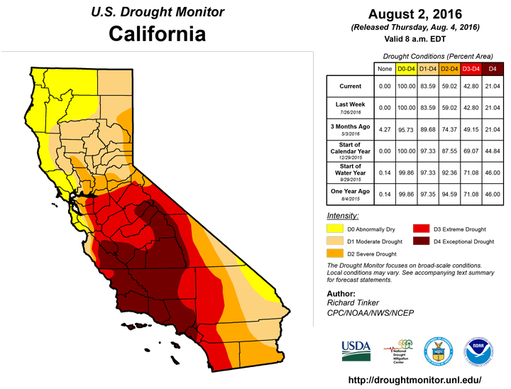
Monsoon-related shower and thunderstorm activity affected much of Arizona and New Mexico, though totals exceeding 2 areas were limited in coverage. Light to moderate precipitation also fell on parts of central and eastern Montana, but in other parts of the West, seasonably dry and slightly warmer than normal conditions prevailed. With much of the monsoon season still to come, it seemed prudent to limit changes to the Drought Monitor in the Southwest to a relatively small area. Specifically, part of the D2 area was reduced to D1. Farther north, conditions worsened in parts of central and western Wyoming, but the no changes were brought into the rest of the region.Alaska, Hawaii, and Puerto Rico
Less than an inch of precipitation was measured across the D0 region in Alaska, even as much of the state received moderate to heavy amounts. No changes were made to last week. Moderate rain fell on parts of the dry area in Puerto Rico, but seemed insufficient to bring improvement, thus status quo was maintained here too. In Hawaii, heavy rains from Tropical Storm Darby brought eliminated severe drought in northeastern parts of the Big Island, ended moderate drought and reduced the extent of abnormal dryness on Oahu, and improved moderate drought on western Molokai.Looking Ahead
During the next 5 days (August 4 – 8), heavy precipitation (1.5 to locally approaching 6 inches) is expected along the central Gulf Coast, the central and northern Florida Peninsula, and the central and southern Carolinas. Farther west, similar amounts of rain are anticipated in a swath from eastern Arizona northeastward through Iowa and northern Missouri. Moderate amounts are forecast in the eastern Great Basin and northern Arizona, through part of the north-central Plains, and in the interior Southeast. Only a few tenths of an inch at best are expected elsewhere, with little or none falling on Texas and California.During August 9 – 13, the odds favor drier than normal weather in eastern Virginia, the East Coast Megalopolis, and portions of New England. Most of the Four Corners states and the Great Basin also have enhanced chances for subnormal precipitation. In contrast, wetter than normal weather is favored from the northern Rockies eastward through the Great Lakes Region, in the lower Ohio and middle Mississippi Valleys, and across the areas of current dryness and drought in the interior Southeast.
Author(s):
Richard Tinker, NOAA/NWS/NCEP/CPC
Dryness Categories
D0 ... Abnormally Dry ... used for areas showing dryness but not yet in drought, or for areas recovering from drought.Drought Intensity Categories
D1 ... Moderate DroughtD2 ... Severe Drought
D3 ... Extreme Drought
D4 ... Exceptional Drought
Drought or Dryness Types
S ... Short-Term, typically <6 months (e.g. agricultural, grasslands)L ... Long-Term, typically >6 months (e.g. hydrology, ecology)
Source: National Drought Mitigation Center
