


May 2, 2017 - The National Weather Service Hanford office has issued a Flood Warning for the Merced River at Pohono Bridge in Yosemite National Park beginning Tuesday evening.
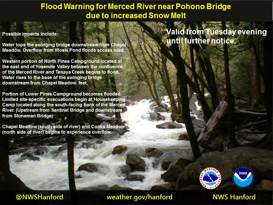
FLOOD WARNING
NATIONAL WEATHER SERVICE SAN JOAQUIN VALLEY - HANFORD CA
828 AM PDT TUE MAY 2 2017

...The National Weather Service in Hanford has issued a flood warning
for the following rivers in California...

  Merced River at Pohono Bridge

.Much above normal temperatures is causing rapid snow melt which will
produce river rises along the Merced River.

Forecasts are based on present and forecasted meteorological and
hydrologic conditions at time of issuance.

PRECAUTIONARY/PREPAREDNESS ACTIONS...

Unlisted forecast points are expected to remain below monitor stage.
All those affected by river conditions should remain alert for rapid
changes and for possible forecast revisions.

For more hydrologic information and stage definitions refer to the
following web site:http://www.wrh.noaa.gov/hnx/hydro.php

The next statement will be issued around 300 pm PDT today.

&&

CAC043-031728-
/O.NEW.KHNX.FL.W.0008.170503T0600Z-000000T0000Z/
/POHC1.1.ER.170503T0600Z.170503T1200Z.000000T0000Z.NO/
828 AM PDT TUE MAY 2 2017

The National Weather Service in  Hanford has issued a

* Flood Warning for the Merced River at Pohono Bridge.
* From this evening until further notice...or until the warning is
  cancelled.
* At 8:00 AM Tuesday the stage was 9.4 feet.
* Minor Flooding is forecast.
* Forecast to recede to near 8.5 FT late this afternoon then expected
  to rise above flood stage of 10.0 FT tonight then forecast to rise
  to near 10.5 FT early Wednesday then forecast to fluctuate near
  10.0 FT thru Wednesday morning.
* Flood Stage 10.0 ft
* IMPACT...Near 10.5 feet, Water tops the swinging bridge downstream
  from Chapel Meadow. Overflow from Woski Pond floods access road.
* IMPACT...Near 10.0 feet, Western portion of North Pines Campground
  located at the east end of Yosemite Valley between the confluence
  of the Merced River and Tenaya Creek begins to flood. Water rises
  to the base of the swinging bridge downstream from Chapel Meadow.
* IMPACT...Near 9.5 feet, Portion of Lower Pines Campground becomes
  flooded. Limited site-specific evacuations begin at Housekeeping
  Camp located along the south-facing bank of the Merced River.
  (Upstream from Sentinel Bridge and downstream from Stoneman Bridge)
* IMPACT...Near 9.0 feet, Chapel Meadow (south side of river) and
  Cooks Meadow (north side of river) begins to experience overflow.
* IMPACT...Near 6.5 feet, River is closed to rafters and flotation.
