


California and National Drought Summary for May 30, 2017
Summary
June 1, 2017 - The USDM week (May 23‐30) was characterized by above normal precipitation across much of the Southeast and Mid‐Atlantic. Soaking rains fell in the eastern half of the country during the first half of the week, providing drought relief in the hardest hit areas of Georgia and northern Florida. By the time the system had moved out on May 27, much of the region had received more than double the rainfall (2 inches or more) of what is typically expected for the week. Drought and dryness continued in the High Plains, parts of the South and much of the Southwest. Temperatures across much of the country were at or below normal for the period. However, the Northwest was 5‐10 degrees above normal.Northeast
Above‐normal precipitation fell in much of the region during the week. This resulted in the removal of lingering pockets of abnormal dryness in West Virginia, Virginia and Maryland. Lingering dryness at the 120‐day period and beyond remains entrenched in a small area of Pennsylvania and Connecticut resulting in the D0. Average temperatures were generally near to below normal for the week across the region.Southeast
Above‐normal precipitation early in the week further ameliorated drought across much of Georgia. Many areas saw a 1‐category improvement where soils are saturated and streams are full from above average short‐term precipitation amounts. Several inches of rain fell in the northern half of the state during the period, 2‐3 inches above the average (300 percent of normal). However, drought/dryness still lingers at the 4‐month and beyond time scales.In Florida, drought conditions improved slightly in some areas of the Panhandle, but remained dire in south‐central Florida. Precipitation at 30‐, 60‐, 90‐, and 180‐days is 25‐50 percent of normal around Orlando. Florida’s pasture and range conditions are rated 50 percent poor to very poor for the week ending on May 28, while 72 percent of their topsoil and 67 percent of their subsoil moisture is rated poor to very poor.
Above‐normal precipitation (1‐5 inches) fell in Alabama this USDM week resulting in drought improvement in all areas of the state.
In North Carolina, precipitation is near to above normal at time scales up through 6‐months. Soil moistures are generally near average for this time of year with the lone exception of an area near and around Fayetteville and the extreme southwest corner of the state.
South
In the Southern region during this USDM period, precipitation ranged from a tenth of an inch in Oklahoma and the Texas Panhandle to more than 4 inches in eastern Texas stretching into Louisiana. Heavy rains (2‐4 inches) also fell in eastern Arkansas and northern Mississippi. Also in that same locale temperatures were as much as 8 degrees below normal. Dryness prevailed in north and west Texas prompting a large D0 expansion based on low 30‐60 day totals.Midwest
The majority of the Midwest continued its drought free status even while drier‐than‐normal precipitation dominated much of the region during the USDM period. Minnesota, Wisconsin, Iowa and Illinois had 50 percent of normal precipitation totals for the week along with temperatures that were 2‐ 6 degrees below normal. Meanwhile, above‐normal precipitation fell in most of the Ohio Valley and Kentucky.High Plains
Objective short‐term blends indicated conditions quickly deteriorating in the Dakotas and eastern Montana. Less than one‐half inch of precipitation has fallen (50 percent of normal) during the last 30‐ days and percentiles were in the D1‐D3 range. This prompted the expansion of both D0 and D1 in the area. Based on USDA’s crop progress report released on May 30, North Dakota’s pasture and range conditions are rated 21 percent poor to very poor while its topsoils and subsoils were rated at 36 percent and 23 percent, respectively. South Dakota’s pasture and range conditions are rated 26 percent poor to very poor and subsoils were rated at 38 percent and 39 percent, respectively. Montana’s pasture and range conditions are rated 17 percent poor to very poor while its topsoils and subsoils were rated at 34 percent and 20 percent, respectively.In Colorado, cooler‐than‐normal temperatures have slowed the snow melt resulting in below average streamflow conditions in the Yampa, White and Colorado Rivers. Streams are particularly sensitive to these patterns as the flows normally begin to peak this time of year. The remaining snowpack across the region remains above normal across the Upper Colorado River Basins and eastern Colorado for this time of year. The small pocket of abnormal dryness in central Colorado is reflective of drier‐than‐normal areas of vegetation and soils.
West*
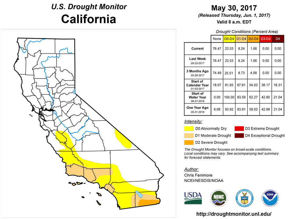
Temperatures in the West during the last 7 days have generally been 4‐8 degrees above normal. Coolerthan‐ normal temperatures were observed for the central California coast, southeast Idaho and northeast Utah. Drought changes in California remain curbed as the dry season marches on. Further north, D0 was expanded in eastern Montana. Percent of normal precipitation is 5 percent or less in the area during the last 14 and 30 days.*For details on Colorado and Wyoming, refer to the High Plains region.
Alaska, Hawaii, Puerto Rico
There were no changes to the depictions for Hawaii, Alaska, and Puerto Rico.Looking Ahead
For days 1‐3 (June 1‐4) the heaviest precipitation will be confined along the Gulf Coast, much of Oklahoma, eastern Missouri and northern Illinois. Parts of Florida are also forecasted to receive 1 inch of rain or more. Meanwhile, temperatures will begin warmer than normal in the West and cooler than normal in the Midwest. The abnormal warmth will quickly spread eastward affecting the Northern Plains on June 2 and the Midwest by June 3. By June 4, much of the CONUS will be warmer than normal with a few exceptions in the Deep South and parts of the Northeast.According to NOAA’s 6‐10 day outlook, odds are in favor of warmer than normal conditions west of the Rockies, while cooler than normal conditions dominate the east. Odds are in favor of below‐normal precipitation in the Northwest and Midwest while the probability of above‐normal precipitation is high along the eastern seaboard.
Author(s):
Chris Fenimore, NOAA/NESDIS/NCEI
Dryness Categories
D0 ... Abnormally Dry ... used for areas showing dryness but not yet in drought, or for areas recovering from drought.Drought Intensity Categories
D1 ... Moderate DroughtD2 ... Severe Drought
D3 ... Extreme Drought
D4 ... Exceptional Drought
Drought or Dryness Types
S ... Short-Term, typically <6 months (e.g. agricultural, grasslands)L ... Long-Term, typically >6 months (e.g. hydrology, ecology)
Source: National Drought Mitigation Center
