


NWS: At 5:00 a.m. Saturday Morning the Merced River in @YosemiteNPS at Pohono Bridge was 10.2 feet, which is above the 10 foot flood stage.
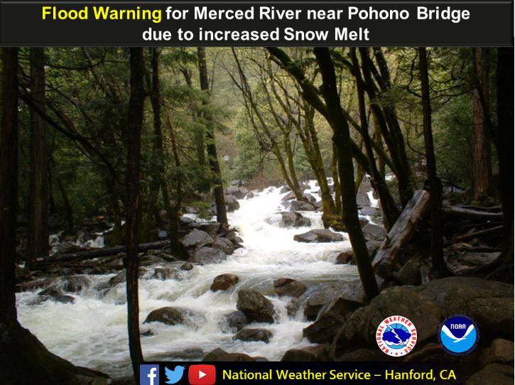
June 3, 2017 - The National Weather Service Hanford office has issued a Flood Warning for the Merced River at Pohono Bridge in Yosemite National Park beginning Saturday morning.
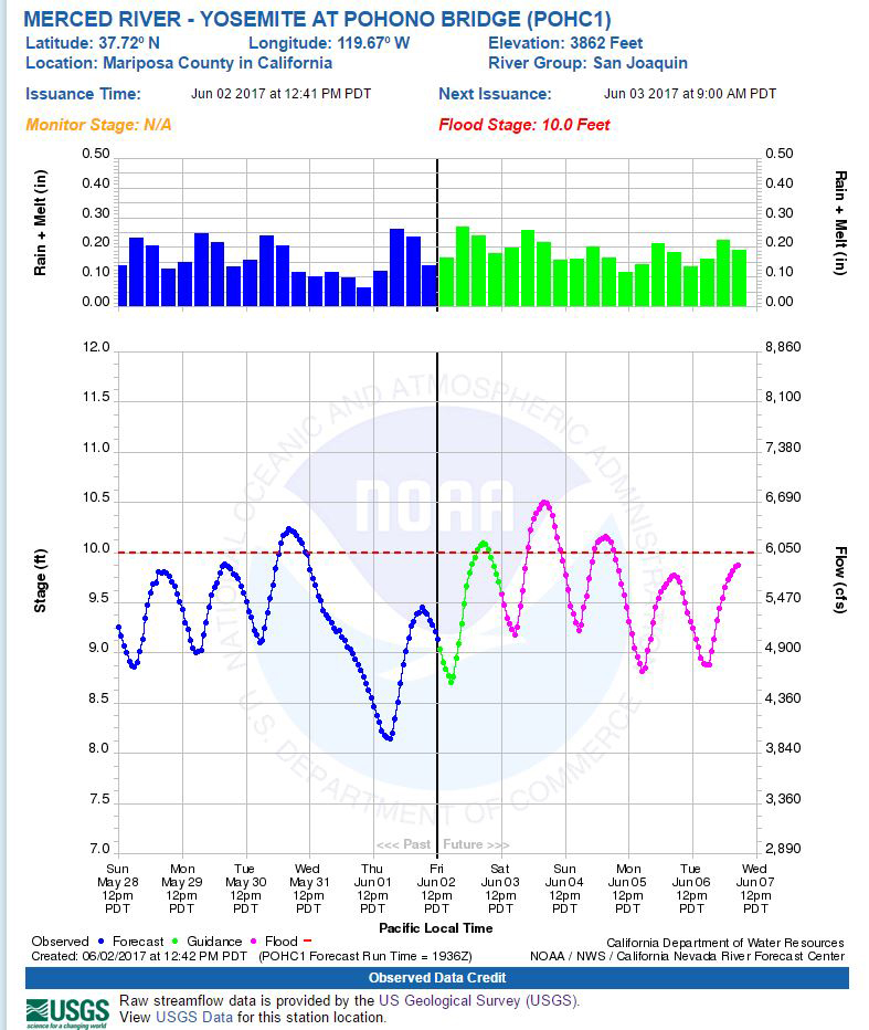
FLOOD STATEMENT
NATIONAL WEATHER SERVICE SAN JOAQUIN VALLEY - HANFORD CA
1124 PM PDT Fri Jun 2 2017

...A Flood Warning for the following rivers in California is still
in effect...

  Merced River at Pohono Bridge

Snowmelt will cause the Merced River at Pohono Bridge to rise above
flood stage the next several days. Water will also be very fast and cold
creating increased danger.

Forecasts are based on present and forecasted meteorological and
hydrologic conditions at time of issuance.

PRECAUTIONARY/PREPAREDNESS ACTIONS...

Unlisted forecast points are expected to remain below monitor stage.
All those affected by river conditions should remain alert for rapid
changes and for possible forecast revisions.

For more hydrologic information and stage definitions refer to the
following web site:http://www.wrh.noaa.gov/hnx/hydro.php


CAC043-040824-
/O.EXT.KHNX.FL.W.0013.170603T0900Z-000000T0000Z/
/POHC1.1.ER.170603T0900Z.170604T0600Z.000000T0000Z.NO/
1124 PM PDT Fri Jun 2 2017

The Flood Warning continues for
  the Merced River at Pohono Bridge.
* until further notice...or until the warning is cancelled.
* At 11:00 PM Friday the stage was 9.7 feet
* Minor Flooding is forecast
* Forecast to fluctuate near 10.0 FT thru early tomorrow then
  forecast to fall below flood stage of 10.0 FT tomorrow morning then
  forecast to recede to near 9.0 FT tomorrow afternoon then expected
  to rise above flood stage of  10.0 FT tomorrow late evening then
  forecast to rise to near  10.0 FT tomorrow late evening.
* Flood Stage 10.0 ft
* IMPACT...Near 10.0 feet, Western portion of North Pines Campground
  located at the east end of Yosemite Valley between the confluence
  of the Merced River and Tenaya Creek begins to flood. Water rises
  to the base of the swinging bridge downstream from Chapel Meadow.
* IMPACT...Near 9.5 feet, Portion of Lower Pines Campground becomes
  flooded. Limited site-specific evacuations begin at Housekeeping
  Camp located along the south-facing bank of the Merced River.
  (Upstream from Sentinel Bridge and downstream from Stoneman Bridge)
* IMPACT...Near 9.0 feet, Chapel Meadow (south side of river) and
  Cooks Meadow (north side of river) begins to experience overflow.
* IMPACT...Near 6.5 feet, River is closed to rafters and flotation.
Source: NWS
