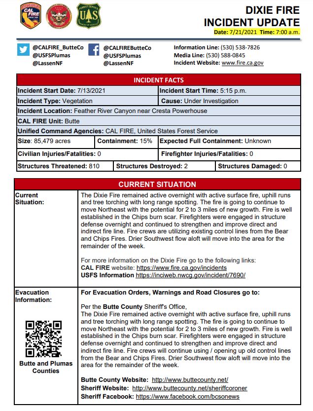
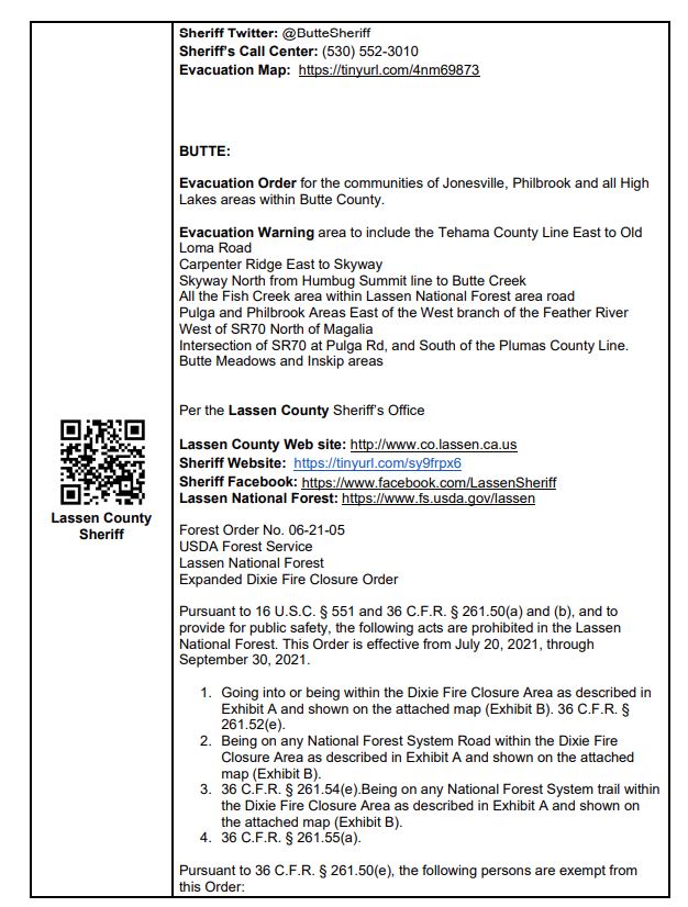
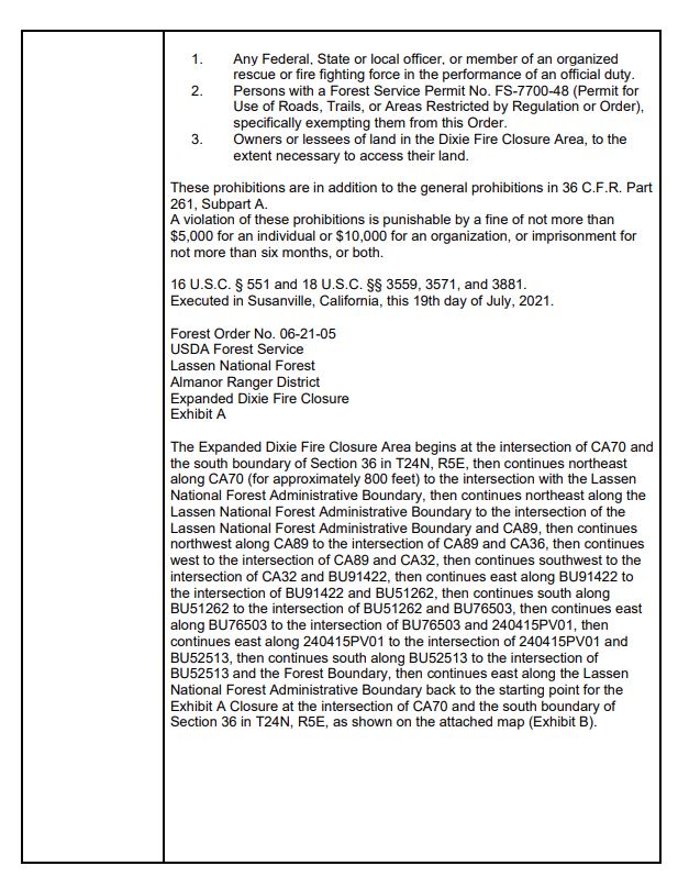
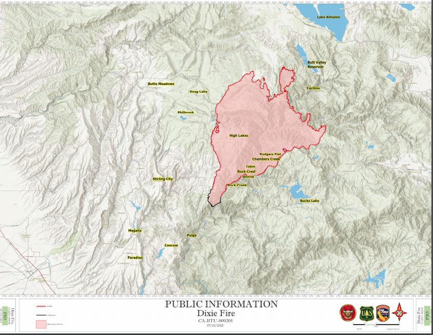
Update Per Plumas County Sheriff's Office: Evacuation Zone Map for Plumas and Butte County.
Yellow = Warning
Red = Mandatory Evacuation Are
Evening Update: CAL FIRE reports the Dixie Fire in Butte and Plumas Counties is at 91,268 Acres with 15% Containment.
'Click' here to view full size PDF images.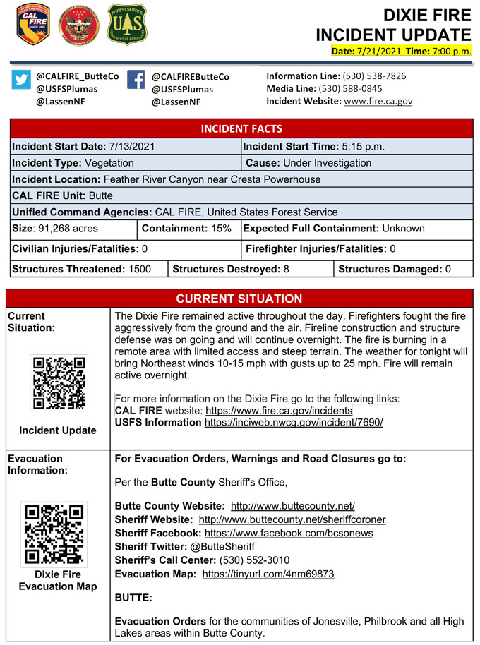
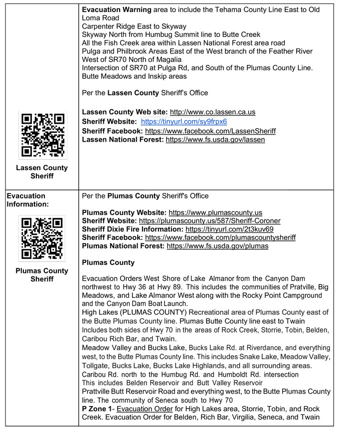
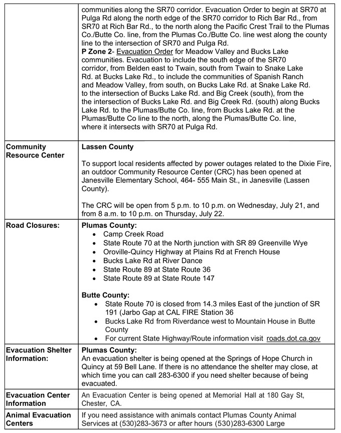
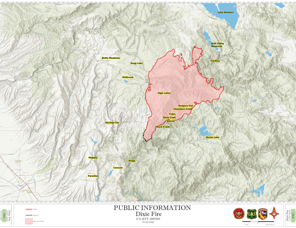
'Click' here to view full size PDF images.
Dixie Fire Evacuation and Road Closure Information Butte County
Butte County
Evacuation Order for the communities of:
Jonesville, Philbrook and all High Lakes areas within Butte County. Evacuation Warning area to include:
Tehama County Line East to Old Loma Road
Carpenter Ridge East to Skyway
Skyway North from Humbug Summit line to Butte CreeK
All the Fish Creek area within Lassen National Forest area road
Pulga and Philbrook Areas East of the West branch of the Feather RiveR
West of SR70 North of Magalia
Intersection of SR70 at Pulga Rd, and South of the Plumas County Line
Butte Meadows and Inskip areas
Butte County: SR 70 is closed from 14.3 miles East of the junction of SR 191 Jarbo Gap at CAL FIRE Station 36
Butte County animal sheltering at 2279 Del Oro and Mono Ste E, Oroville, CA
Source: InciWeb
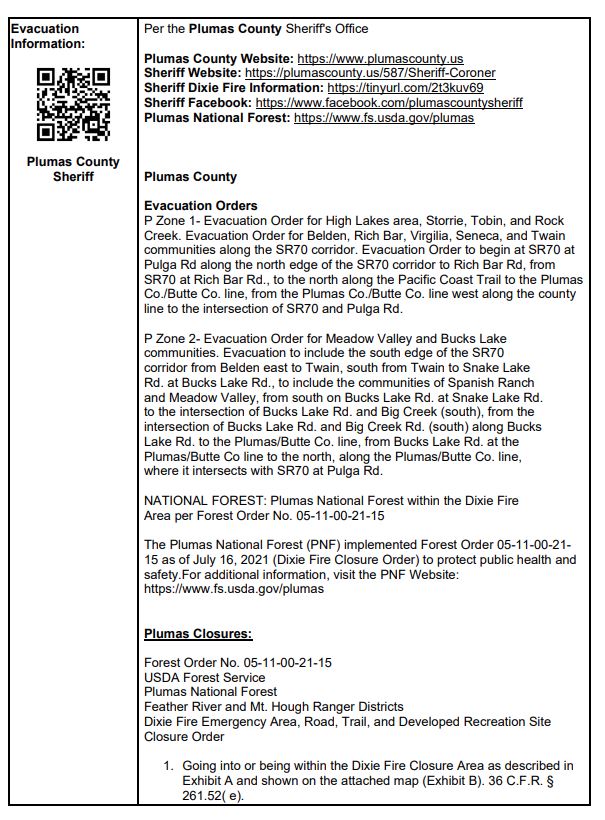
Dixie Fire Evacuation and Road Closure Information Plumas County
MANDATORY EVACUATION ORDERS have been issued for the following areas:
West Shore of Lake Almanor - From the Canyon Dam northwest to Hwy 36 at Hwy 89. This includes the community Prattville, Big Meadows, and Lake Almanor West along with the Rocky Point Campground and the Canyon Dam Boat Launch.
High Lakes (PLUMAS COUNTY) - Recreational area of Plumas County east of the Butte/Plumas County line.
Plumas/Butte County line east to Twain - Includes both sides of Hwy 70 in the areas of Rock Creek, Storrie, Tobin, Belden, Caribou Rich Bar, and Twain.
Meadow Valley and Bucks Lake - Bucks Lake Rd at Riverdance and everything west to the Butte/Plumas County line. This includes Snake Lake, Meadow Valley, Tollgate, Bucks Lake, Bucks Lake Highlands, and all surrounding areas.
Caribou Rd north to the Humbug Rd and Humboldt Rd intersection - This includes Belden Reservoir and Butt Valley Reservoir.
Prattville Butt Reservoir Road and everything west to the Butte/Plumas County line.
The community of Seneca south to Hwy70.
EVACUATION WARNINGS ARE IN EFFECT for the following areas:
Butterfly Valley Area - Evacuation Warning for the community of Butterfly Valley. The warning will include Feather River Hot Springs east on SR70 to Barlow Road, southwest to Oroville-Quincy Highway, west to Snake Lake Rd, north to Feather River Hot Springs.
Round Valley Reservoir and Long Valley - Evacuation Warning for the community of Round Valley Reservoir and Long Valley. The warning will include SR89 near Clear Creek to the SR70, south to SR70 at the Feather River, east along SR70 to the intersection of SR89, north on SR 89 to Dixie Creek, do north to Seltzer Rd.
Chester and Lake Almanor Peninsula - Including greater Chester area, Hamilton Branch, Lake Almanor Peninsula, and East shore.
- ·Everything west of Hwy 89 between Canyon Dam and Hwy 36, west to the County Line.
ROAD CLOSURES AND INFORMATION
- Bucks Lake Rd from Riverdance west to Mountain House in Butte County.
- Northbound and Southbound HWY 89 from HWY 26 to Route 147.
- For current State Highway/Route information visit roads.dot.ca.gov.
SHELTER INFORMATION
- A shelter is being opened at the Springs of Hope Church in Quincy at 59 Bell Lane.
- An Evacuation Shelter is being opened at Memorial Hall at 180 Gay St, Chester, CA.
- If there is no attendance the shelter may close, at which time you can call 283-6300 if you need shelter because of being evacuated.
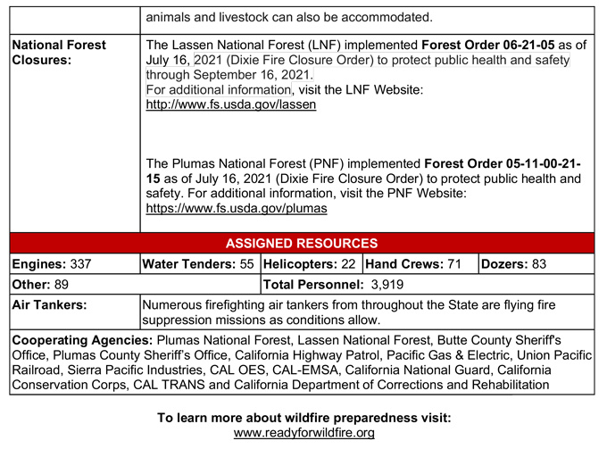
- If you need assistance with animals contact Plumas County Animal Services at 283-3673 or after hours 283-6300.
- Large animals/livestock can also be accommodated.
Source: InciWeb
July 21, 2021 - CAL FIRE reports the Dixie Fire in Butte and Plumas Counties is at 85,479 Acres with 15% Containment.