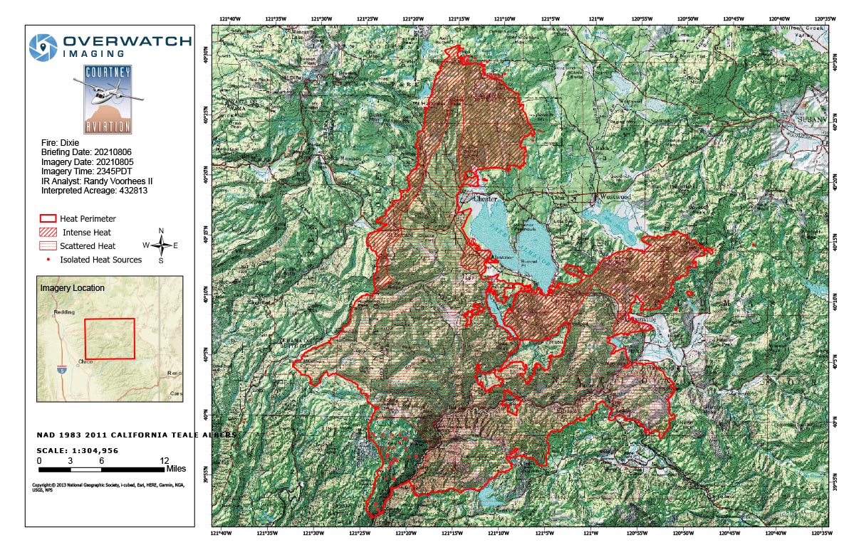
Flight Notes: Interpreted Acreage: 432,813 a Growth of 110,331 from last period
Largest column to north west remained throughout our flight or was not visible due to smoke and night. Only scanned upper half of the fire area. Utilized existing southern isolated and scattered heat polygons. Some significant growth occurred on the bottom edge of our scan area. Growth south east of Greenville is estimated along with the growth east of Butt Valley Reservoir. IR imagery map will show imagery cut off where the swags occurred.
Note: Both maps are 1,200 pixels wide
Friday, August 6, 2021 - Above Map is the Dixie Fire Infrared Map for Today with Flight Notes.
Click Here for: Dixie Fire in Butte and Plumas Counties Friday, August 6, 2021 Updates
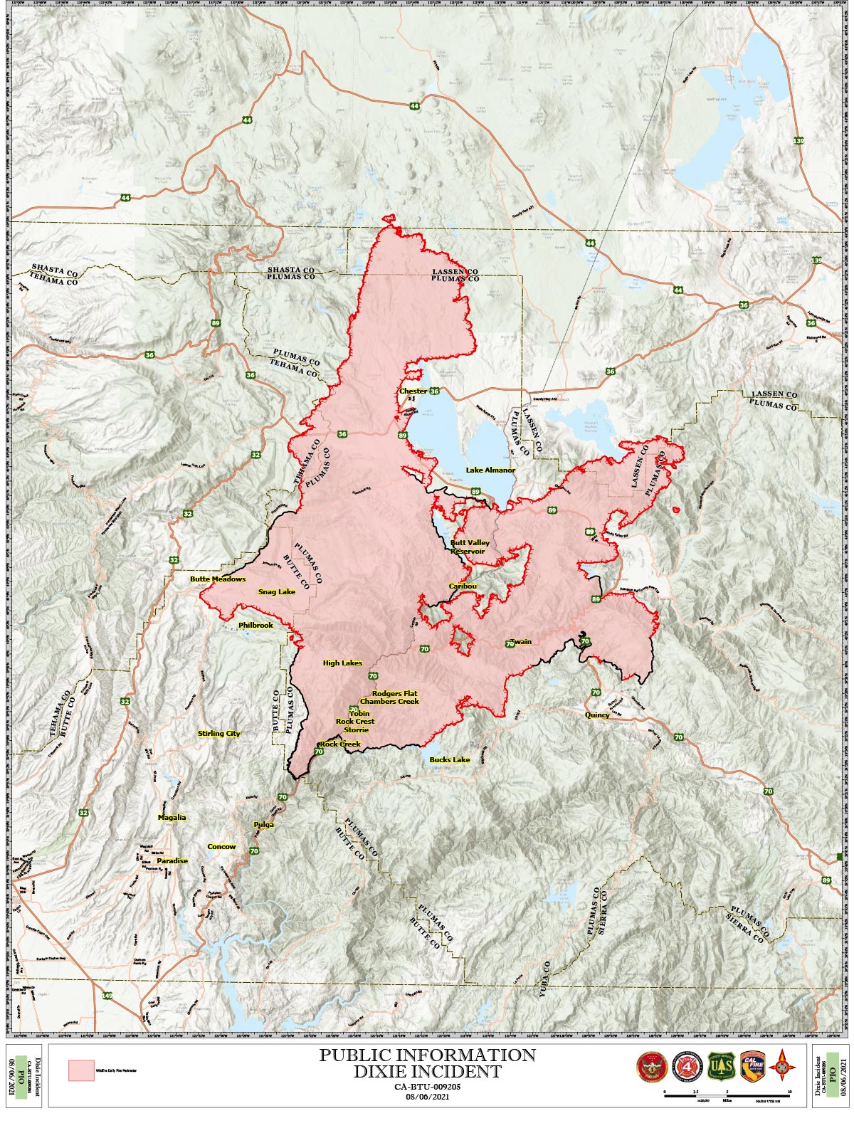
The Bottom Map is the Public Information Map of the Dixie Fire for Today.