


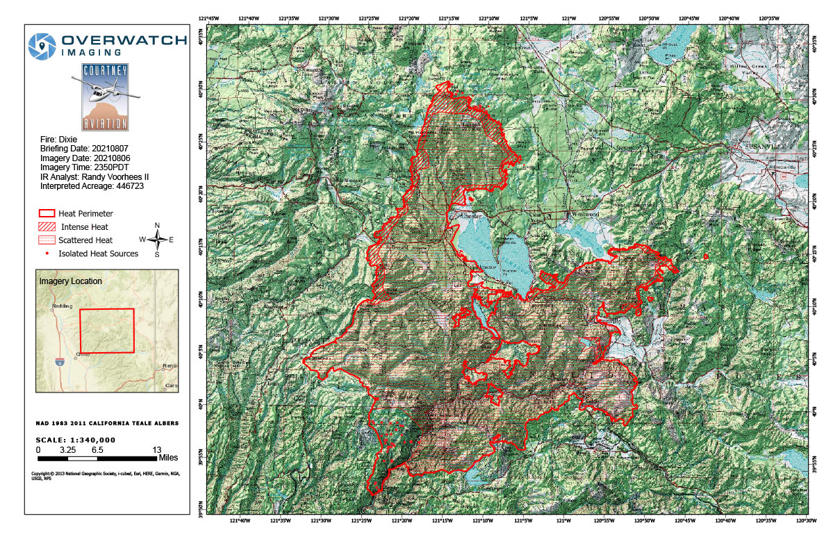
Flight Notes: Interpreted Acreage: 446,723 a Growth of 13,910 from last period
Utilized existing southern isolated and scattered heat polygons. Due to large size of incident scan box we were not able to spend additional flight time scanning the incident’s priorities, relatively minimal growth compared to the last few days. Large islands throughout the incident continue to burn and shrink.
Note: Both maps are 1,200 pixels wide
Saturday, August 7, 2021 - Above Map is the Dixie Fire Infrared Map for Today with Flight Notes.
Click Here for: California Dixie Fire Saturday, August 7, 2021 Updates
The Bottom Map is the Public Information Map of the Dixie Fire for Today.
