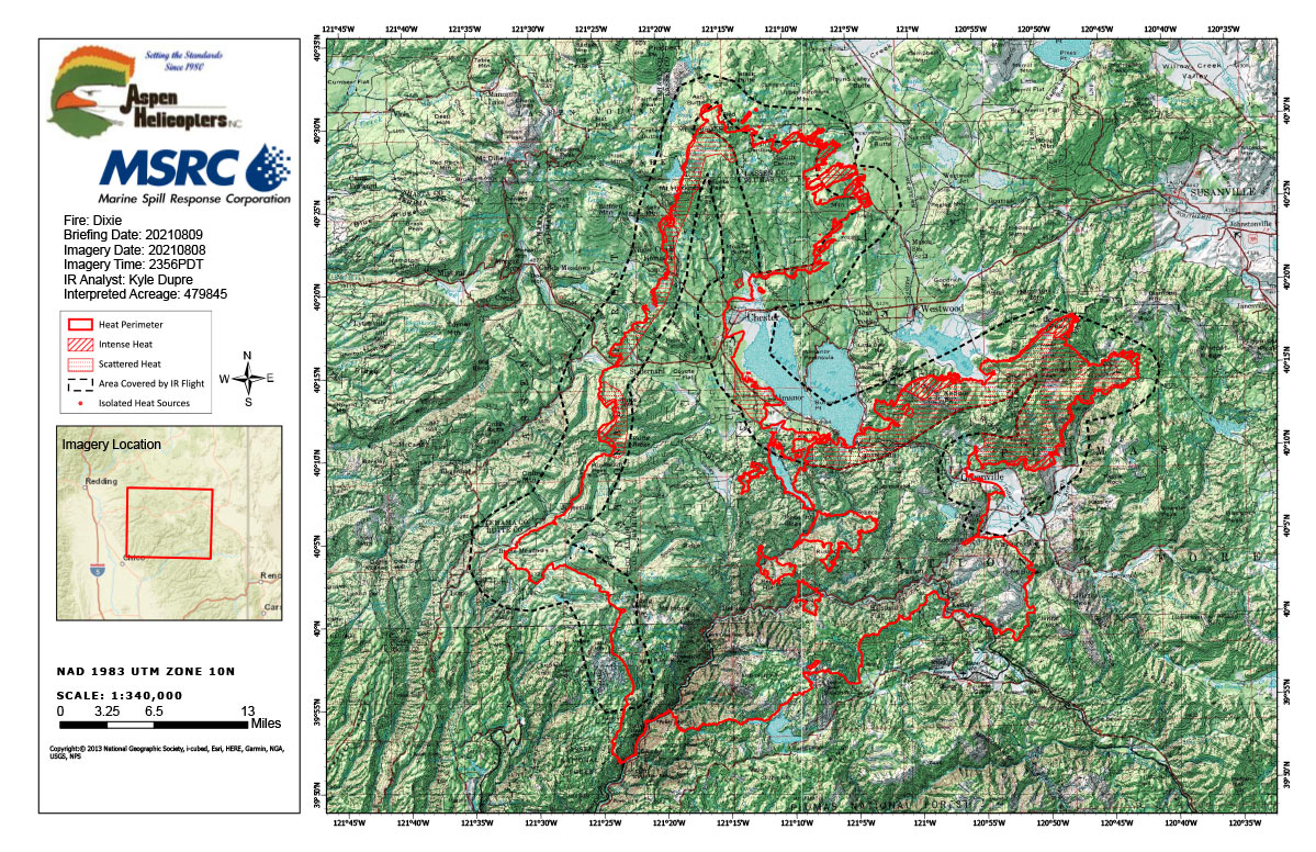
Flight Notes: Interpreted Acreage: 479,845 a Growth of 16,368 from last period
Insufficient imagery to provide a thorough interpretation of the northern peninsula heat perimeter due to aircraft avoidance of smoke plumes. Only interpreted what was available and created islands in this sector; though assumed these islands do tie back the main perimeter. More aggressive fire growth in the northeast finger, continuing to head eastward, with multiple intense heat sources detected and hot spots 1 mile outside perimeter. Note that the full perimeter was not mapped.
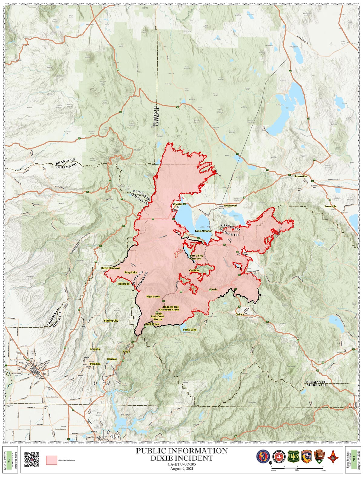
Note: both maps are 1,200 pixels wide
Monday, August 9, 2021 - Above Map is the Dixie Fire Infrared Map for Today with Flight Notes.
Click Here for: California Dixie Fire Monday, August 9, 2021 Updates
The Bottom Map is the Public Information Map of the Dixie Fire for Today.