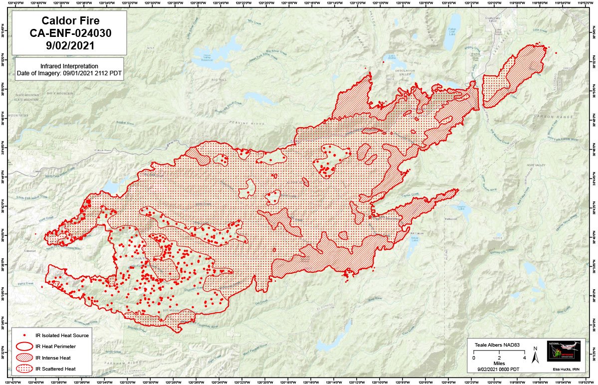
Flight Notes: Interpreted Acreage: -- a Growth of -- acres from last period.
Tonight’s interpretation began using the most recent perimeter downloaded from NIFS at 2100 on 9/01/21.
Interpretation identified lots of intense heat along the northeastern and southeastern edge with northern spotting. Scattered heat is present across the fire area with small pockets of isolated heat. The southwestern edge of the fire shows considerable cooling and is dominated by isolated heat.
The fire is now approximately 8 miles from the current Tamarack perimeter.
Note: Click here for Friday's Infrared Map
Note: Map is 1,200 pixels wide
Thursday, September 2, 2021 - Above Map is the Caldor Fire Infrared Map for Today with Flight Notes.Click Here for: California Caldor Fire Thursday, September 2, 2021 Updates


