Click here for: California Caldor Fire Thursday, September 2, 2021 Updates
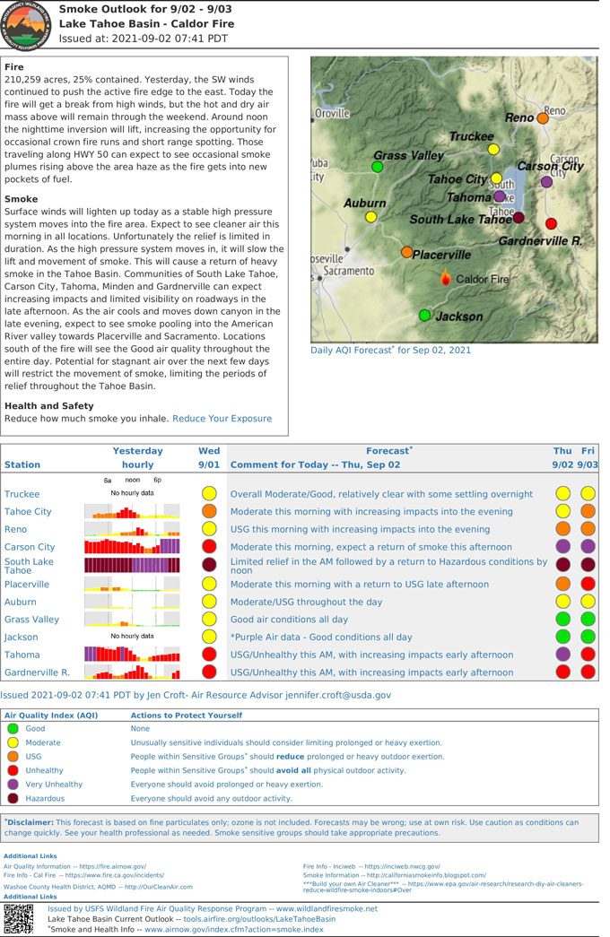
September 2, 2021 - The US Interagency Wildland Fire Air Quality Response Program Smoke Outlook for the Caldor Fire for Thursday.
Fire: The fire is 210,259 acres and 25% contained. Yesterday, the SW winds continued to push the active fire edge to the east. Today the fire will get a break from high winds, but the hot and dry air mass above will remain through the weekend. Around noon the nighttime inversion will lift, increasing the opportunity for occasional crown fire runs and short range spotting. Those traveling along HWY 50 can expect to see occasional smoke plumes rising above the area haze as the fire gets into new pockets of fuel.
Smoke: Surface winds will lighten up today as a stable high pressure system moves into the fire area. Expect to see cleaner air this morning in all locations. Unfortunately the relief is limited in duration. As the high pressure system moves in, it will slow the lift and movement of smoke. This will cause a return of heavy smoke in the Tahoe Basin. Communities of South Lake Tahoe, Carson City, Tahoma, Minden and Gardnerville can expect increasing impacts and limited visibility on roadways in the late afternoon. As the air cools and moves down canyon in the late evening, expect to see smoke pooling into the American River valley towards Placerville and Sacramento. Locations south of the fire will see the Good air quality throughout the entire day. Potential for stagnant air over the next few days will restrict the movement of smoke, limiting the periods of relief throughout the Tahoe Basin.
Health and Safety: Take it easier during smoky times to reduce how much smoke you inhale. If it looks or smells smoky outside, avoid strenuous activities such as mowing the lawn or going for a run. Reduce Your Exposure

Source: Issued by the US Interagency Wildland Fire Air Quality Response Program


