


Note: Click here for Wednesday's Dixie Fire Updates
Dixie Fire East Zone Community Meeting Video
Evening Update Per CAL FIRE: California Dixie Fire is at 960,470 Acres, with 75% Containment, and 2,413 personnel assigned for Tuesday evening.
Basic Information
| Current as of | 9/14/2021, 6:40:51 PM |
| Incident Type | Wildfire |
| Cause | Under Investigation |
| Date of Origin | Tuesday July 13th, 2021 approx. 05:15 PM |
| Location | Feather River Canyon near Cresta Powerhouse and Lake Almanor. |
| Incident Commander | Jerry McGowan, CAIMT1; Steve Watkins, CAIMT14; Jay Kurth, NIMO 1 |
| Incident Description | Wildfire |
| Coordinates | 39.819 latitude, -121.419 longitude |
Current Situation
| Total Personnel | 2,413 |
| Size | 960,470 Acres |
| Percent of Perimeter Contained | 75% |
| Estimated Containment Date | Thursday September 30th, 2021 approx. 12:00 AM |
| Fuels Involved |
The primary carrier of fire at lower elevations is grass and shrub mix with areas of timber litter. In the mid to upper elevation the fuels are heavy forest litter with shrubs and small trees. There are pockets of heavy dead and down. |
| Significant Events |
Minimal Creeping Smoldering Flanking Minimal fire activity today across the Dixie East fire area. Majority of fire activity is smoking stump holes, some cat-faces in standing trees and a few logs holding heat. Little duff creep and smolder as things have dried out since wetting rain. Very low probability of surface fire spread in needle cast that shed in burned areas; not enough continuity and density. The most active portions of fire are likely to remain in unburned interior islands/peninsulas northwest of Cluster Lakes and between North Prospect Peak, Little Bunchgrass, Rim Spur, and Baker Roads. Watch for isolated heat along Suicide Tie and between Jelly Cap and Pole Line Roads and across Highway 44 which could flare up and rapidly spread north and east into continuous vegetation and checkerboard timber plantations. |
Outlook
| Planned Actions |
Priority areas include: the Lassen & Shasta Sectors, Old Station and surrounding communities, the Highway 395 escarpment area including Janesville, Milford and Herlong Junction as well as Lake Davis and the Grizzly Creek area west of the escarpment. The Community of Old Station was repopulated 9/14 @ 0700 and Highway 89 was opened to the intersection of Hwy 44. Continue to establish direct and indirect containment lines south of Old Station. Resources continue to establish containment lines north of Highway 44 in the vicinity of Hat Creek Rim and Plateau as well as protecting critical fiber optic infrastructure. Provide for service calls within communities impacted by the fire: Chester, Hwy 36 corridor, Hwy 89 corridor, Hwy 395 corridor, Paxton, Greenville, Jonesville, Crescent Mills, Taylorsville, Prattville, Butte Meadows, Bucks Lake, Meadows Valley, Rush Creek, Warner Valley, Pecks Valley, Williams Valley, Hunt Canyon, Susanville, Janesville, and the Greater Almanor area. Continued mop up of and patrol of 1,000-hr fuels will require a significant amount of resources due to the volume of fuels and the steep and rugged terrain. Continued holding actions and point protection of communities and critical infrastructure will require a significant resource presence for the next several operational periods. East Zone priorities: (1) Patrol direct line in the Devil's Punchbowl area. (2) Resources will continue to mop up dozer and handline from Lake Davis to Clover Valley and mop up dozer and handline further south into Dixie Valley, as well as south towards Clover Valley and Portola. (3) East of Milford, patrol and mop up containment lines on the NW flanks of the fire (4) Maintain containment, mop-up, and backhaul of equipment on western and central divisions in the Zone. (5) Initiate suppression repair in high priority areas identified by the Resource Advisors and where equipment is already present. Structure protection is in place within Genesee, Dixie Valley, Lake Davis area, Milford, and Taylorsville. |
| Projected Incident Activity |
12 hours: (Tuesday night) Light downslope wind and cool temperatures in the low 40s to low 50s are expected. Humidity recovery is expected to remain in the 40 to 60 percent range. Minimal fire activity as fuels dry out and consume since the precipitation on September 9-10. Primarily stump holes with some surface activity possible as the day warms and dries along with the gusty winds. Needle cast fuel beds will support surface fire in interior islands and patches, but zero to low probability in areas that underburned or greater. Potential for some torching trees will increase the chances of short-range spotting. Low to moderate fire behavior expected; mostly smoldering in forest litter and duff, due to increased fire containment. Low to moderate RH recovery will also likely limit behavior. A recent flare-up on the steep flanks of Lassen Peak will continue to flank and spread north and east and will likely cause control issues due to inaccessibility. 24 hours: (Wednesday) Temperatures begin a gradual cooling trend, though humidity remains low, dropping into the teens in the afternoon. The warming and drying trend continues for one more day. High temperatures are forecast to rise into the upper 70s to upper 80s. Winds will shift to the southwest, gusting around 25 mph on ridges in the afternoon. Peak winds up to 18 mph in the afternoon could cause unburned interior islands to flare up with a very slight possibility of isolated torching. Flare-up on Lassen Peak and torching trees could loft embers outside existing firelines with subsequent moderate flame lengths and rate of spread. 48 hours: (Wednesday night and Thursday) Southwest ridge winds continue gusting to 25 mph throughout the evening, with gusts to 14 after midnight. Overnight temperatures a few degrees cooler. Humidity recovery should remain moderate. Highs will trend cooler, remaining in the low 70s to low 80s. Southwest winds increase and become gusty, up to 20-26 mph over ridges in the late afternoon and early evening. Afternoon humidity levels remain dry, generally dropping into the teens. Afternoon southwest wind gusts up to 15 mph create a slight chance for isolated flare-ups and spotfires outside of containment lines. Anything that escapes should remain on the surface and be attackable by crews/engines/dozers. 72 hours: (Thursday night and Friday) Gusty southwest winds continue overnight, with overnight temperatures a few degrees cooler. The cooling trend continues, with Friday highs dropping about 3 degrees from Thursday. Humidity levels will increase a little but will still remain quite dry, bringing increased fire weather concerns. Southwest winds increase further, gusting to 24 to 28 mph. These winds are likely to test existing containment lines and increase the potential for flare-ups in unburned interior islands and spotfires across firelines. Unlined portions of the fire have significant moderate duration crownfire potential. |
| Remarks |
Transfer of command from CAL FIRE IMT1 to California Interagency Incident Management Team 14 (CAIIMT 14) and NIMO (Kurth) Team occurred this morning at 0700 hours. |
Current Weather
| Weather Concerns |
East Zone: High pressure continued with mostly sunny skies with a few high clouds and some haze. Humidity recovery trended lower but was good to moderate this morning, with 40 to 60 percent on the ridges and over 75 percent in the valleys. Afternoon humidity was very low, dropping to around 9 to 14 percent. Wind from the west-northwest gusted to around 12 to 17 mph. Temperatures trended a few degrees warmer, in the upper 80s to around 90. West Zone: Calm weather again today with another increase in temperatures. Today was the hottest day this week. Highs were in the mid 70s to upper 80s depending on elevation. Skies were mostly clear; some smoke and haze was present as well. Relative humidity continued to drop, decreasing to 10-15%. Winds were mostly terrain-driven, with a light northwesterly general wind of 5-10 mph. Some gusts to 15 mph were recorded. Overall, fair weather. |
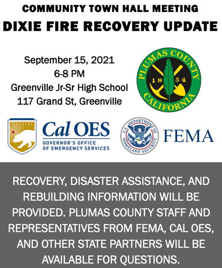
Update: A Community Town Hall Meeting is scheduled in Greenville for September 15, 2021. Recovery, disaster assistance, and rebuilding information will be provided. See the flyer for the date and location.
Dixie Fire Morning Operations East Zone Update Video
Update: As of 11:00 A.M., The Shasta County Sheriff’s Office is lifting the Evacuation WARNING for Shasta County Zone 12 (SCU-E012 on the Zonehaven map). This area extends from just west of Huckleberry Mountain on the west side, to Highway 44 on the east side, north of Red Lake Mountain on the south side, and south of Fredonyer Peak on the north side. A map of this area can be found on zonehaven: community.zonehaven.com.
All other evacuation orders and warnings for Shasta County remain in effect including:
Shasta County Zones 2, 3, 8, 9A, 9B, and 10. These are mainly forested areas.
Traffic control points:
- Highway 44 from the west is open until the Highway 89/44 junction north of Old Station.
- SR 89 from the 89/44 junction is open to the SR 299 junction to the north.
- Eastbound Highway 44 toward Susanville is closed at the 89/44 junction on the Shasta County side and at Road A21 on the Lassen County side.
September 14, 2021 - Dixie Fire is 960,470 acres and 75% contained for Tuesday morning.
Basic Information
| Current as of | 9/14/2021, 1:39:16 AM |
| Incident Type | Wildfire |
| Cause | Under Investigation |
| Date of Origin | Tuesday July 13th, 2021 approx. 05:15 PM |
| Location | Feather River Canyon near Cresta Powerhouse and Lake Almanor. |
| Incident Commander | Jerry McGowan, CAIMT1; Steve Watkins, CAIMT14; Jay Kurth, NIMO 1 |
| Incident Description | Wildfire |
| Coordinates | 39.819 latitude, -121.419 longitude |
Current Situation
| Total Personnel | 2,403 |
| Size | 960,470 Acres |
| Percent of Perimeter Contained | 75% |
| Estimated Containment Date | Thursday September 30th, 2021 approx. 12:00 AM |
| Fuels Involved |
The primary carrier of fire at lower elevations is grass and shrub mix with areas of timber litter. |
| Significant Events |
Minimal Creeping Smoldering Minimal fire activity today across the Dixie East fire area. Some increase in smoking stump holes, some cat-faces in standing trees holding heat and a few logs, with very little duff creep and smolder as things dry out after few days since wetting rain. Very low probability of surface fire in needle cast shed in areas burned as the days warm and winds increase. Smoldering, creeping, flaming and isolated torching are continuing and can be expected as conditions continue to warm up and dry out following the ¼ - ½ inches of precipitation a couple of days ago. Unburned interior islands of fuel near the line continue to flare up and present control issues due to limited firefighting resources. |
Outlook
| Planned Actions |
Priority areas include: the Lassen & Shasta Sectors, Old Station and surrounding communities, the highway 395 escarpment area including Janesville, Milford and Herlong Junction as well as Lake Davis and the Grizzly Creek area west of the escarpment. The Community of Old Station will be repopulated 9/14 @ 0700. Hwy 89 will be open to the intersection of Hwy 44. Continue to establish direct and indirect containment lines south of Old Station. Resources continue to establish containment lines north of Hwy 44 in the vicinity of Hat Creek Rim and Plateau as well as protecting critical fiber optic infrastructure. Provide for service calls within communities impacted by the fire: Chester, Hwy 36 corridor, Hwy 89 Corridor, Hwy 395 corridor, Paxton, Greenville, Jonesville, Crescent Mills, Taylorsville, Prattville, Butte Meadows, Bucks Lake, Meadows Valley, Rush Creek, Warner Valley, Pecks Valley, Williams Valley, Hunt Canyon, Susanville, Janesville, and the Greater Almanor area. Continued mop up of and patrol of 1,000-hr fuels will require a significant amount of resources due to the volume of fuels and the steep and rugged terrain. Continued holding actions and point protection of communities and critical infrastructure will require a significant resource presence for the next several operational periods. East Zone priorities: (1) Patrol direct line in the Devil's Punchbowl area. (2) Resources will continue to mop up dozer and handline from Lake Davis to Clover Valley and mop up dozer and handline further south into Dixie Valley, as well as south towards Clover Valley and Portola. (3) East of Milford, patrol and mop up containment lines on the NW flanks of the fire (4) Maintain containment, mop-up, and backhaul of equipment on western and central divisions in the Zone. (5) Initiate suppression repair in high priority areas identified by the Resource Advisors and where equipment is already present. |
| Projected Incident Activity |
12 hours: Weather was calm with clear skies. Temperatures dropped overnight to mid 30s to mid 40s at higher elevations and in the low 50s in valleys. RH recovery was moderate to 40- 50%, but drier than last night. Light downslope/downvalley winds occurred overnight. Minimal fire activity due to since precipitation on September 9 and 10. Primarily stump holes with some surface activity possible as the day warms and dries along with the gusty winds. 24 hours: (Mon night) Mostly clear skies. Northwest wind will change to light drainage wind. Humidity recovery moderate to good. Minimal fire activity as fuels dry out and consume since the recent precipitation. Needle cast fuel beds will support surface fire, but zero to low probability in areas that underburned. As conditions become warmer and drier, critical burning conditions will become more likely. Winds transitioning from westerly to northeasterly could comprise the west flank of the fire and escapes across incomplete firelines could threaten Old Station and surrounding infrastructure. Expect smoldering, creeping, flaming, and isolated/group tree torching. Sustained surface and crown fire runs are possible under peak wind gusts of 13+ mph during the heat of the burn period. Short range spot fires with a high probability of ignition are possible. 48 hours: (Tue night and Wed) A clear night and mostly sunny day is expected. Wind will be the lightest of the week, with gusts staying at 15 mph or below. Warming and drying out continues for both overnight and afternoon. Winds shift to southwest, with gusts up to 22 mph. Winds transition back to southwest which should ease concerns for slopovers and threat to the community of Old Station and along Highway 89 and Hat Creek. Expect flame length 2-4 feet with moderate rates of spread in unlined/unburned portions within the fire perimeter. Minimal fire activity as fuels continue to dry out from the recent precipitation. Needle cast fuel beds will support surface fire, but zero to low probability in areas that underburned. Potential for some torching trees will increase the chances of short range spotting. 72 hours: (Wed night and Thu) Temperatures remain very warm, with some temperatures in the upper 80s. Humidity remains low, with many locations getting below 15 percent for the afternoon. Winds southwest, with gusts to around 25 mph. A gradual cooling trend could help moderate fire behavior, however, peak southwesterly wind gusts up to 17 mph could cause control and containment issues to the north and east of the main finger of activity next to Old Station. Needle cast fuel beds will support surface fire, but zero to low probability in areas that underburned. Potential for some torching trees will increase the chances of short range spotting. |
| Remarks |
Transfer of command from CAL FIRE IMT1 to California Interagency Incident Management Team 14 (CAIIMT 14) and NIMO (Kurth) Team occurred this morning at 0700. hours |
Current Weather
| Weather Concerns |
High pressure continued with mostly sunny skies with a few high clouds and some haze. Humidity recovery trended lower but was good to moderate this morning, with 45 to 65 percent on the ridges and over 75 percent in the valleys, Afternoon humidity was low, dropping to around 11 to 18 percent. Wind from the west northwest gusted to around 10 to 15 mph. Temperatur |
Click here for: California Dixie Fire Monday, September 13, 2021 Updates
