


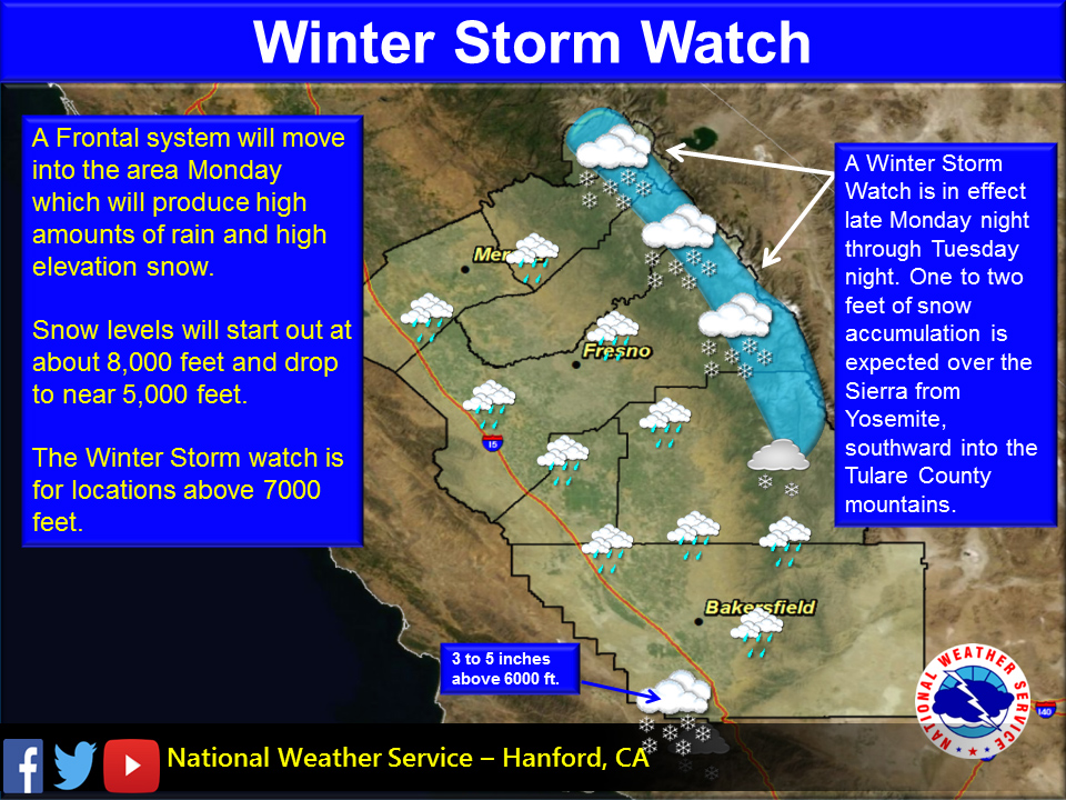
January 7, 2018 - A Winter Storm Watch is in effect for the higher elevation of the Sierra Nevada from Monday evening through Tuesday evening above 7000 feet as a frontal system moves through the area.
12 to 24 inches of snow with isolated areas getting up to 3 feet of snow is expected, which will make driving conditions very difficult if not impossible.
Prepare for possible road closures.
The mountain communities over the grapevine may also get several inches of snow.
The foothills and mountains below the snow level will see 2 to 3 inches of rain.
The north San Joaquin could see up to an inch of rain, less amounts over the south valley, Kern County mountains and desert.
Also, Flash flooding is possible, especially near the burn scars of the recent fires.
Winter Storm Watch in effect from January 8, 07:00 PM PST until January 9, 07:00 PM PST
Winter Storm Watch
URGENT - WINTER WEATHER MESSAGE
National Weather Service Reno NV
221 AM PST Sun Jan 7 2018


Including the city of Mammoth Lakes
221 AM PST Sun Jan 7 2018

...WINTER STORM WATCH NOW IN EFFECT FROM MONDAY EVENING THROUGH
TUESDAY EVENING ABOVE 7000 FEET...

* WHAT...Heavy snow possible. Plan on difficult travel conditions,
  including during the morning and evening commutes on Tuesday.
  Total snow accumulations of 1-2 feet above 7500 feet, are
  possible, with localized amounts of 3+ feet along the Sierra
  crest. 4-12 inches are possible between 7000-7500 feet with up
  to 2 inches down to 6500 feet.

* WHERE...Mono County.

* WHEN...From Monday evening through Tuesday evening.

* ADDITIONAL DETAILS...Significant reductions in visibility are
  possible.

PRECAUTIONARY/PREPAREDNESS ACTIONS...

Now is the time to prepare an emergency kit for your home and
car. If traveling consider alternate plans, remember to carry
tire chains, extra food, water and clothing. Once the storm
arrives, travel may be difficult or impossible for an extended
period of time.
Source: NWS

