


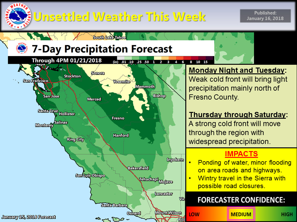
January 16, 2018 - The National Weather Service (NWS) Hanford office reports a cold front will bring some showers mainly north of Fresno county continuing through Tuesday.
Light amounts of rain are expected in the San Joaquin Valley. Up to one quarter of an inch of rain is expected below the snow line of around 7,500 feet. 1-3 inches of snow is possible above 7,500 feet from Yosemite to Kings Canyon.
A stronger storm system will impact the region Thursday and continue through Saturday with substantially more precipitation, especially over the higher terrain.
The storm could bring up to 1 foot of snow over the highest elevations of the Sierra by Friday evening with potentially hazardous winter driving conditions and travel delays.
Monday Mornings NWS comments on the upcoming storm:
The main focus will remain on the storm expected to hit Central California by the end of the week. GFS mod-trend continues to show little noise in the solution of a deeper trough timed for the end of the week. While minimal uncertainty begins to appear Friday night, this time frame is toward the end of the storm passage.
Therefore, with little uncertainty in the timing and strength of the disturbance, will carry high probability of measurable of rain and snow for the late Thursday night through early Friday morning time frame as snow could reach almost reach the 3000 foot line toward the end the storm later on Friday into early Saturday morning.
During the bulk of the storm on Friday will see liquid values of an inch over the mountains and up to a quarter an inch for the lower valley locations.
The inch of liquid over the mountains will translate into a possible foot of new snow over the Sierra from Yosemite to Kings Canyon. Afterward, a northwesterly flow aloft will keep the area unsettled with spotty showers Friday night into early Saturday morning.
Ridging during the latter half of the weekend will terminate the precipitation as yet another storm moves into the region toward the beginning of next week. Will introduce a slight chance of possible precipitation as uncertainty is still too high to determine the strength of the storm.
Source: NWS

