


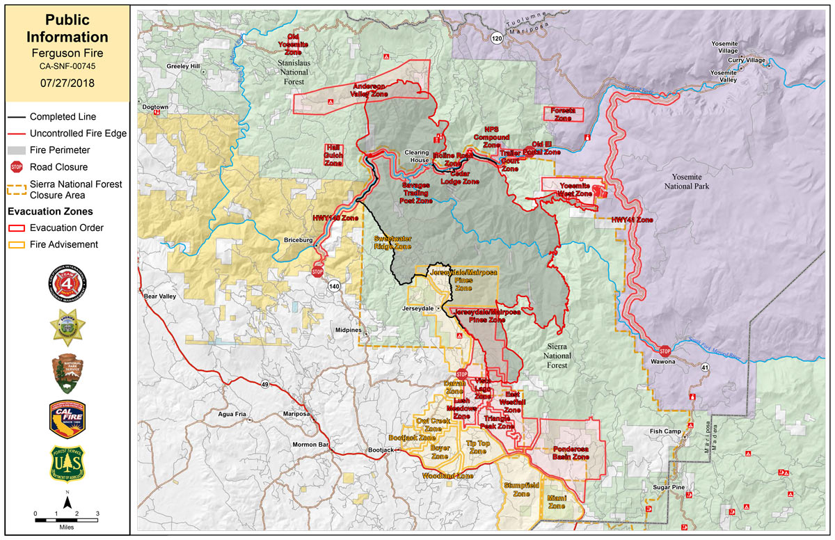
Friday Public Information Map
CLICK HERE FOR A LARGE MAP (3,000 Pixels Wide and 2.0MB)

Click here for the Sierra Sun Times Scanner
Reminder: Scanner Information is NOT Official
Click here for Thursday's Information on the Ferguson Fire
Update: 8:48 P.M. Ferguson Fire Evacuation Order Lifted for Portions of Lushmeadows in Mariposa on Friday, July 27, 2018
Update: 7:26 P.M. Ferguson Fire Near Yosemite National Park in Mariposa County Friday Evening, July 27, 2018 Update: 46,675 Acres with 29% Containment
Update: 7:07 P.M. Video from Ferguson Fire Community Meeting in Groveland on Friday, July 27, 2018
Update: 6:16 P.M. Yosemite National Park Announces Yosemite Valley to Reopen After Ferguson Fire on Friday, August 3, 2018
Update: 4:52 P.M. Mariposa County Residents Advised to Avoid Hazards in Re-Populated Areas Due to Ferguson Fire Near Yosemite National Park
Update: 1:48 P.M. Important Things to Know About Re-population During the Ferguson Fire in Mariposa County
Update: 10:44 A.M. Amphibious Firefighters Tackle Ferguson Blaze in Mariposa County Near Yosemite National Park
Update: (Spanish added 12:30 P.M.) 10:11 A.M. Sierra National Forest Morning Operational Update Video for the Ferguson Fire on July 27, 2018
Update: 9:13 A.M. Ferguson Fire Near Yosemite National Park in Mariposa County, Friday, July 27th Progression Map
Update: 7:52 A.M. Forest Service Wildland Fire Smoke/Air Quality Outlook of the Yosemite Area for Friday, July 27 - Includes Mariposa, Oakhurst and Yosemite
Update: 7:30 A.M. Ferguson Fire Near Yosemite National Park in Mariposa County Friday Morning, July 27, 2018 Update: 45,911 Acres with 29% Containment
Update: 5:57 A.M. Friday Morning, July 27 Infrared Map of the Ferguson Fire in Mariposa County Near Yosemite National Park - Estimated Acreage: 45,911 29% Contained
Update: 5:00 A.M. Ferguson Fire Near Yosemite National Park in Mariposa County Friday, July 27 Operations Map
Update: 4:43 A.M. Estimated Acreage: 45,911
July 27, 2018 - The Ferguson Fire is burning on the Sierra National Forest near Yosemite National Park in Mariposa County.
Today: Ferguson Fire Community Meeting in Groveland on Friday, July 27, 2018
Thursday Evening Information
Video from Ferguson Fire Community Meeting in Mariposa on Thursday, July 26, 2018
Jerseydale Road in Mariposa is Now Open with No Restrictions on Thursday, July 26, 2018
California Governor Jerry Brown Declares State of Emergency in Mariposa County Due to Ferguson Fire
Ferguson Fire Near Yosemite National Park in Mariposa County Thursday Evening, July 26, 2018 Update: 44,223 Acres with 27% Containment
