


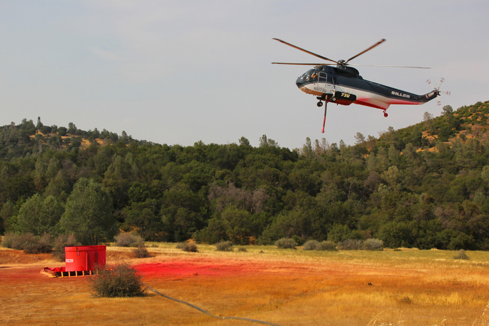
Credit: Team Rubicon
Engines: 244 Water Tenders: 47 Helicopters: 14 Crews: 92 Dozers: 77 Total Personnel: 3,766
Update: 7:10 A.M. 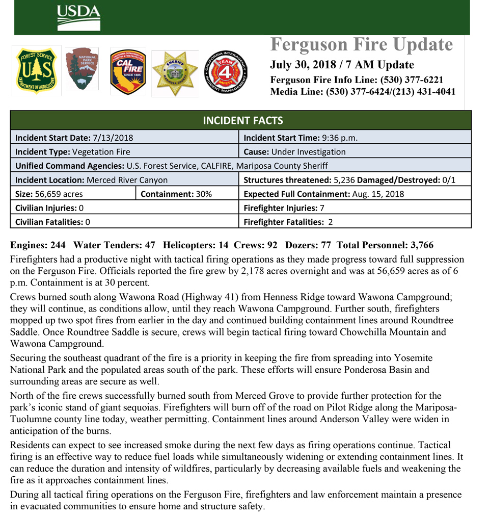
July 30, 2018 - Firefighters had a productive night with tactical firing operations as they made progress toward full suppression on the Ferguson Fire. Officials reported the fire grew by 2,178 acres overnight and was at 56,659 acres as of 6 p.m. Containment is at 30 percent.
Crews burned south along Wawona Road (Highway 41) from Henness Ridge toward Wawona Campground; they will continue, as conditions allow, until they reach Wawona Campground. Further south, firefighters mopped up two spot fires from earlier in the day and continued building containment lines around Roundtree Saddle. Once Roundtree Saddle is secure, crews will begin tactical firing toward Chowchilla Mountain and Wawona Campground.
Securing the southeast quadrant of the fire is a priority in keeping the fire from spreading into Yosemite National Park and the populated areas south of the park. These efforts will ensure Ponderosa Basin and surrounding areas are secure as well.
North of the fire crews successfully burned south from Merced Grove to provide further protection for the park’s iconic stand of giant sequoias. Firefighters will burn off of the road on Pilot Ridge along the Mariposa-Tuolumne county line today, weather permitting. Containment lines around Anderson Valley were widen in anticipation of the burns.
Residents can expect to see increased smoke during the next few days as firing operations continue. Tactical firing is an effective way to reduce fuel loads while simultaneously widening or extending containment lines. It can reduce the duration and intensity of wildfires, particularly by decreasing available fuels and weakening the fire as it approaches containment lines.
During all tactical firing operations on the Ferguson Fire, firefighters and law enforcement maintain a presence in evacuated communities to ensure home and structure safety.
Air quality is likely to decrease as a result of increased smoke from the firing operations. Residents can monitor the latest air quality and health advisories at:
· https://wildlandfiresmoke.net/outlooks/YosemiteArea
· https://wildlandfiresmoke.net/outlooks/SouthernSierra
Natural resource specialists will begin surveying the western side of the fire today to assess areas requiring repair and mitigation. Burned Area Emergency Response teams play an important role in rehabilitating the land after damaged from the constructing of containment lines and other suppression tactics.
Yosemite National Park closure: Yosemite National Park officials enacted closures July 25 for the Yosemite Valley and Wawona areas, as well as the Mariposa Grove of Giant Sequoias. The park is expected to reopen Aug. 3, conditions permitting. For more information, go to: nps.gov/yose or call 209-372-0200.
Mandatory Evacuations: Areas that are currently under a mandatory evacuation include:
· Anderson Valley
· Cedar Lodge/Indian Flat Campground
· East Westfall Road and all side roads
· El Portal Trailer Court
· Foresta
· Incline Road from Foresta Bridge to the last BLM campground
· Old El Portal
· Old Yosemite Road
· Ponderosa Basin Community
· Rancheria Flat – Government Housing
· Savage’s Trading Post
· Yosemite View Lodge
· Yosemite West
Advisory Evacuations: This is NOT an Evacuation Order. This is an advisement only of a potential Evacuation Order should conditions change.
· Monte Vista
· Vista Lago
· Triangle Road from East Westfall to Highway 49 South and all side roads
Road Closures:Highway 140 is closed from the entrance of Yosemite National Park to 1.5 miles east of Midpines. Incline Road, River Road from Briceburg to the gate at Railroad Flat and all campground areas along Highway 140, Foresta Road, Anderson Valley Road, Summit Road and Old Yosemite Road are closed.
Triangle Road from East Westfall Road to Highway 49 South.
Chowchilla Mountain Road at Highway 49 South, Harris Road at Highway 49 South, and all roads inside the Ponderosa Basin subdivision.
Wawona Road (Highway 41) between Chilnualna Falls Road in Wawona and Bridalveil Falls Road in Yosemite Valley.
Red Cross Shelters:
· Mariposa Elementary School, 5044 Jones St., Mariposa, CA 95338
Animal Shelters:
· Small animals: Mariposa Elementary School, 5044 Jones St., Mariposa, CA 95338
· Large animals: 5007 Fairgrounds Road, Mariposa, CA 95338

