


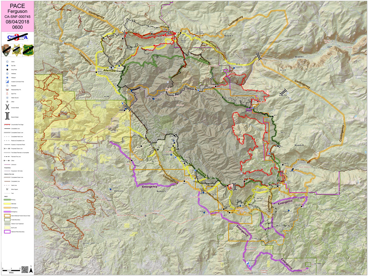
Saturday PACE Map
Primary, Alternate, Contingency, Emergency
CLICK HERE FOR A LARGE MAP (3,000 Pixels Wide and 3.0MB)

Click here for the Sierra Sun Times Scanner
Reminder: Scanner Information is NOT Official
Click here for Friday's Information on the Ferguson Fire
Update: 6:55 P.M. Ferguson Fire Near Yosemite National Park in Mariposa County Saturday Evening, August 4, 2018 Update: 81,699 Acres with 35% Containment
Spanish Video Added 3:00 P.M.
Update: 12:45 P.M. Sierra National Forest Operational Update Video for the Ferguson Fire on August 4, 2018
Update: 8:23 A.M. Forest Service Wildland Fire Smoke/Air Quality Outlook of the Yosemite Area for Saturday, August 4 - Includes Mariposa, Oakhurst and Yosemite
Update: 7:05 A.M. Ferguson Fire Near Yosemite National Park in Mariposa County Saturday Morning, August 4, 2018 Update: 80,755 Acres with Containment Dropping to 36%
Update: 6:30 A.M. On Saturday, August 4th Mariposa County Air Pollution Control District Reports Ferguson Fire is Affecting Air Quality in the Area - Currently Some Locations are in the Hazardous Range
Update: 6:03 A.M. Saturday Morning, August 4 Infrared Map of the Ferguson Fire in Mariposa County Near Yosemite National Park - Estimated Acreage: 80,755 With 36% Containment
Update: 5:55 A.M. Turtleback Dome Camera in Yosemite National Park Looking Southwest at Flames from the Ferguson Fire on Saturday Morning
Update: 5:30 A.M. Ferguson Fire Near Yosemite National Park in Mariposa County Saturday, August 4 Operations Map
August 4, 2018 - The Ferguson Fire is burning on the Sierra National Forest near Yosemite National Park in Mariposa County.
Friday Evening Information
Update: 7:35 P.M. Ferguson Fire Near Yosemite National Park in Mariposa County Friday Evening, August 3, 2018 Update: 77,207 Acres with 41% Containment
Update: 6:10 P.M. Video from Ferguson Fire Community Meeting in Oakhurst on Friday, August 3, 2018
Update: 5:57 P.M. Mariposa County Sheriff’s Office Issues a Mandatory Evacuation for El Portal Community Due to the Ferguson Fire
