


Above normal temperatures expected to continue into the fall.
Few, if any, additional monsoonal storms.
Above normal large fire potential most areas, slowly decreasing from north to south in the fall.
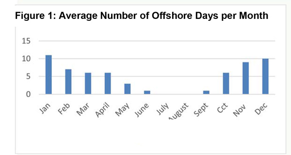
Near normal number of offshore wind events expected through November.
Weather Discussion
September 2, 2018 - Residents of California finally received a well-earned break from the heat during the second half of August. The strong ridge which was present throughout July weakened and moved east of the area, allowing onshore flow to become reestablished. Daytime temperatures cooled to within a few degrees of normal by August 15th, but conditions overnight remained sultry with warm
 temperatures and high humidity. Very warm ocean temperatures were the culprit, but upwelling caused most water temperatures to fall back into the upper 60s and lower 70s at the beaches.
The monsoon remained very active over the Southwest and 4-Corners Region but the bulk of the heavier precipitation stayed east of the Colorado River. There were some spotty wetting rains over the Sierras and the eastern sides of the San Bernardino and Cleveland National Forests. A few areas of northern San Diego County experienced over 2 inches of precipitation from strong thunderstorms, but the rainfall came too quickly to change subsoil moisture over most areas in the long term.
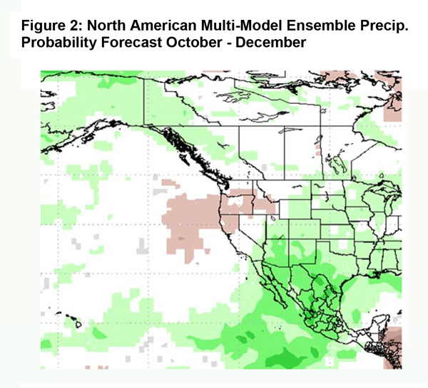
At the time of this writing, several weak troughs are poised to move into the Pacific Northwest. Long term models indicate this pattern may continue during the first few weeks of September which could keep temperatures from climbing to the extreme readings which often occur in September. A high pressure ridge has been acting as a storm conveyor, delivering a new trough into Washington and Oregon every 2-3 days. This ridge may continue to move northward into the northern Pacific and the Aleutians which may keep the storm track active across the Pacific Northwest and Western Canada. Across our area, southwesterly flow aloft may result which would keep the monsoon east of the district for the rest of the season. Therefore, additional summer thunderstorm activity is expected to be minimal in September outside the desert. Most models, as well as the official outlook from the Climate Prediction Center maintain a wet pattern just to our east in Arizona and the rest of the Southwest (Figure 2 below). But we feel there will be a very tight gradient between the wet weather over the Southwest and the dry weather across Southern California the next 3 months.
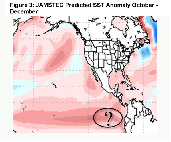
If the beginning of fall turns out to be as dry as expected, one may be left to ponder as to when significant rains may actually arrive across the district. Winter “rainy season” rainfall typically arrives in October for Northern California and tends to spread southward into Central California during the month of November. Sea surface temperatures are currently quite warm across a large area of the Pacific. This pattern of warm water is expected to continue into the fall. Some of the stronger temperature anomalies may lie along the equator which is consistent with the expectation of a strengthening El Niño which may peak around 1°C above normal in November and December (Figure 4, below).
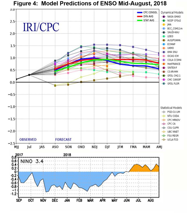
There is a weak correlation between the onset of a moderate or stronger El Niño and a later than average arrival of significant winter rainfall. Once the rain begins – often several weeks late – conditions tend to be wetter than normal in this scenario. Rainfall output for the December – January time period fit the typical pattern of wet in Southern California/dry in the Pacific Northwest in the long range models. It remains to be seen as to whether this ENSO event will be a typical El Niño or a Modoki El Niño as was suggested by some models earlier this summer. The temperature of the Niño 1+2 region off the South American coast may play an integral role in determining the amount of rainfall this year (Figure 3 below). But recent model trends point toward a wetter rather than a drier winter (dissipation of the Modoki ENSO SST profile).
Concerning the number of offshore wind events, local guidance indicates near normal wind episodes are expected through November. Last year at this time, a well above normal number of days were forecast, which unfortunately came to fruition. A repeat of the extremely strong and long duration wind events of 2017 is not expected this year.
Fuels and Drought Outlook
After a spike in wildfire activity in July and early August, resource demand has entered a lull that sometimes occurs between the end of monsoon season and the beginning of offshore winds. While the weather has been benign the past few weeks, the lack of intense resource demand as of late belies the extremely dead fuel conditions which still cover most of the area.
In general, dead fuels are at, or are near, record low fuel moisture readings with the greatest departure from normal being along the central coast and portions of Southern California. Live fuels aren’t faring much better. Much of Central California as well as most of Southern California currently is experiencing critically dry live fuels. Reports from the field indicate live fuels are at dryness levels usually seen in late September or early October.
Therefore, due to the expected delay in winter rains along with the extremely dry fuels, large fire potential is expected to remain above normal over most areas in September and early October. Large fire potential and associated resource demand will gradually drop to near normal from north to south in late October into November. Several offshore wind events will therefore be likely before significant wetting rains occur in Southern California. The peak in resource demand across the southern part of the state may occur in late October and early November when the overlap between the driest fuels and the strongest winds occur. But look for all areas to see little demand by the first week of December.
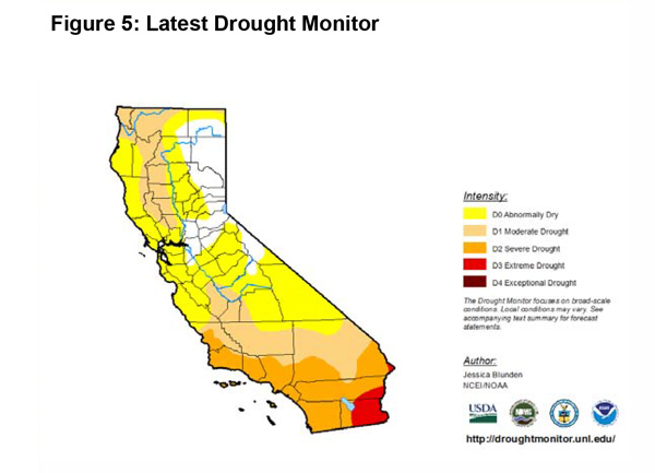
Most of the district is in a D1 drought or worse (Figure 5, below). The drought may intensify slightly during the fall, but with a favorable SST profile, there is a good chance for some areas to emerge from drought conditions early next year. Near normal, or perhaps slightly above normal, snowpack in the Sierras will keep area reservoirs in good shape heading into spring 2019.
Source: Predictive Services

