


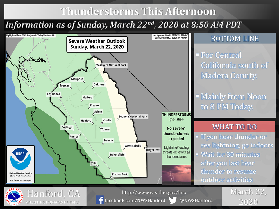
A chance of thunderstorms this afternoon for Mariposa, Oakhurst and Yosemite Valley
March 22, 2020 - The National Weather Service Hanford Office reports a few strong thunderstorms are possible in the Central California interior through the evening.
Funnel clouds, small hail, and wind gusts near 40 miles per hour are some of the hazards associated with strong thunderstorms.
In addition to dangerous cloud to ground lightning strikes, any thunderstorm can produce intense rainfall rates, leading to localized flooding.
  Area Forecast Discussion
  National Weather Service Hanford CA
  323 AM PDT Sun Mar 22 2020


  .SYNOPSIS...A Pacific storm system will bring widespread rain and
  mountain snow to the region this afternoon through Monday. Another
  system will bring more rain and mountain snow from Tuesday through
  Thursday.

  &&

  .DISCUSSION...
  The remnants of a weak upper trough over the region has sparked
  a few light showers in the last couple hours. Showers are mainly
  across northern Kings and Tulare Counties with an isolated shower
  near Squaw Valley in the Sierra Foothills as well. The high-res
  models are not picking up on this. But don`t expect these showers
  to last too long with only a trace to a few hundredths of an inch
  of rain likely.

  Satellite water vapor imagery shows an upper low spinning about
  500 miles off the coast of southern California. This system will
  track east northeast today and begin to spread precipitation over
  the district by this afternoon. Model consensus shows the center
  of the low crossing over the coast just north of Point Conception
  late Sunday night. It`s then expected to accelerate eastward as
  an open wave over northern Arizona by Monday afternoon. The bulk
  of the precipitation will fall Sunday night into Monday morning.
  QPF gives from a quarter to half an inch rain for the San Joaquin
  Valley and Kern County Mountains, with one to two tenths possible
  in the Kern County Desert. The Sierra Nevada looks to receive a
  half to one inch liquid. A Winter Weather Advisory is in effect
  for the Sierra above 6000 feet from 3 PM this afternoon through
  8 AM Monday. Snow amounts should generally range from 4-7 inches
  with local amounts up to 10 inches. A few inches could fall down
  to 5000 feet Monday morning as well. Scattered light showers are
  possible through the rest of Monday, but amounts should be light.
  Winds will increase in the wake of this system and could approach
  advisory criteria through the Kern County Mountain passes into
  the desert Monday afternoon into Tuesday morning.

  The wet pattern continues as a colder storm system drops south
  along the Pacific Northwest coast Monday night and over northern
  California on Tuesday. Models slowly shift it southward to over
  SoCal by Thursday. Precip looks fairly light Monday night into
  Tuesday morning, mainly from Yosemite to Kings Canyon NP. Most
  of the precip is expected in the Sierra Tuesday night through
  Wednesday with snow levels falling to near 3000 feet Wednesday
  morning. Snow levels are also expected to lower to the major pass
  levels in the Kern County Mountains by Thursday morning. Expect
  showers to taper off Thursday night with dry weather returning
  Friday into next weekend.
Source: NWS

