


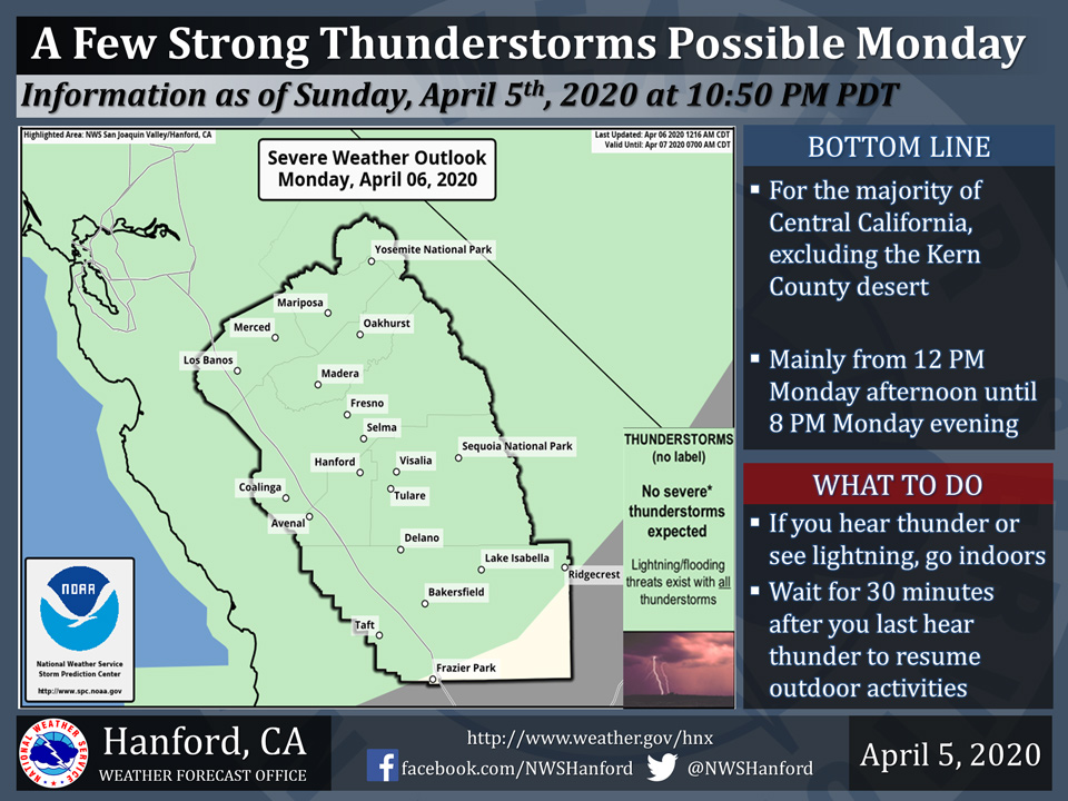
Possible Thunderstorms Today for Mariposa County, Madera County Including Oakhurst and Yosemite National Park
April 6, 2020 - The National Weather Service reports a few strong thunderstorms are possible Monday in the majority of Central California, excluding the Kern County desert.
Small hail, funnel clouds, and wind gusts near 40 miles per hour are some of the hazards associated with strong thunderstorms.
In addition to dangerous cloud to ground lightning strikes, any thunderstorm can produce intense rainfall rates, leading to localized flooding.
  Area Forecast Discussion
  National Weather Service Hanford CA
  343 AM PDT Mon Apr 6 2020


  .SYNOPSIS...
  Heavy rain and mountain snowfall will decrease later today as a
  strong winterlike storm slips further south along the California
  coast. Unsettled weather continues into midweek as the system
  swings inland across southern California. Conditions will then
  dry out and warm up by the end of the week into early next week.

  &&


  .DISCUSSION...
  A potent low pressure system dropping south along the California
  coast has produced copius rainfall and heavy snow over much of
  central California Sunday into early this morning. The main area
  of moderate to heavy precipitation has been sagging south and is
  currently affecting mainly Fresno County southward. Rainfall
  totals so far of 3/4" to around an inch are common across the
  northern half of our area, with many locations in the higher
  terrain receiving a couple of inches. Down south, amounts range
  from under 1/10" to around 1/4", with a little bit more measured
  in the higher terrain. As much as 2-3 feet of snow has been
  accumulating in the higher Sierra elevations, even higher amounts
  in some locations.

  Models prog the low pressure system to continue sliding south
  today and Tuesday, then swinging inland near southern California
  by Wednesday. This will shift the threat of heaviest precipitation
  southward today, although increasing convective activity should
  develop across our area as instability increases by this
  afternoon. Significant snowfall should continue to accumulate in
  the Sierra where the Winter Storm Watch remains until 5 PM. Kern
  County mountains will see continued accumulating snow above 6000
  ft into the evening hours and the Winter Storm Warning there
  remains through 11 PM tonight.

  Precipitation accumulation for Tuesday and Wednesday will be more
  modest and will occur mainly over the mountains and the southern
  portions of our area as the system moves by to our south. After
  the possibility of some lingering mountain and desert showers
  Thursday on the backside of the low, Friday should then begin a
  dry and warming period, with temperatures reaching around 10
  degrees above climo by the start of next week.
Source: NWS

