


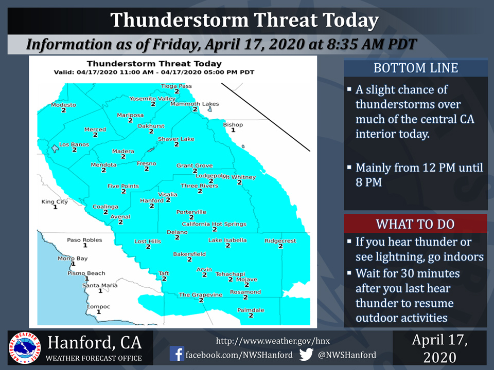
April 17, 2020 - The National Weather Service Hanford Office reports isolated thunderstorms are possible within the blue highlighted area today, primarily this afternoon into early this evening.
In addition to dangerous lightning, thunderstorms can bring briefly heavy rain and locally strong, gusty winds. When thunder roars, seek shelter indoors!
  Area Forecast Discussion
  National Weather Service Hanford CA
  258 AM PDT Fri Apr 17 2020

  .SYNOPSIS...
  A storm system will be responsible for an elevated chance of
  precipitation today and tonight. A few strong thunderstorms are
  possible this afternoon. Outside of any thunderstorm,
  precipitation amounts will be relatively scant. Cooler than normal
  weather is expected this weekend into early next week, prior to
  the start of a warming trend.

  &&

  .DISCUSSION...
  A storm system off the coast of Central California will move
  southeastward this morning. This low pressure system will make
  landfall over Southern California this afternoon. The storm
  system will weaken as it moves eastward into the Desert Southwest
  tonight. A few strong thunderstorms are possible throughout
  Central California this afternoon into this evening. Outside of
  areas impacted by thunderstorms, precipitation amounts will be
  relatively light today and tonight. Less than one tenth of an inch
  of rainfall is likely in the San Joaquin Valley and Kern County
  desert today and tonight. One tenth to one quarter of an inch of
  rainfall is possible in the Southern Sierra Nevada foothills and
  Kern County mountains today and tonight. The snow level should be
  around 8,000 feet today and tonight. Three to six inches of snow
  is possible above 8,000 feet today and tonight.

  A secondary storm system may impact Central California Sunday
  afternoon or Monday afternoon. Once again, precipitation amounts
  associated with this secondary storm system will be scant. A ridge
  of high pressure will build across the Golden State Monday night
  through Thursday, resulting in dry weather with a warming trend.
Source: NWS

