


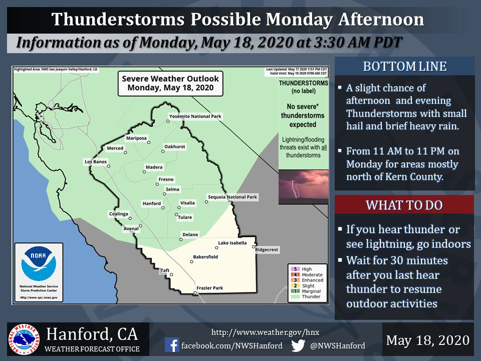
Possible Thunderstorms Today for Mariposa, Oakhurst and Yosemite National Park
May 18, 2020 - The National Weather Service Hanford Office reports a few strong thunderstorms are possible across Central California this afternoon & evening.
Hail, brief heavy rain & gusty wind are some of the hazards expected.
In addition to dangerous cloud to ground lightning strikes, any thunderstorm can produce localized flooding.
  Area Forecast Discussion
  National Weather Service Hanford CA
  335 AM PDT Mon May 18 2020


  .SYNOPSIS...
  A Pacific storm system will spread precipitation throughout
  Central California. High elevation mountain snow and valley rain
  will persist into Tuesday. A few strong thunderstorms are possible
  this afternoon and evening north of Kern County. Dry weather is
  expected Wednesday through Monday.

  &&

  .DISCUSSION...
  Strong Pacific storm system is making its way into the CENCAL
  interior this morning as showers are breaking out over the region.
  Showers are increasing in the Sierra attm. Regional radar and
  satellite are indicating a line of heavy showers making its way
  onshore across Monterey Bay. The front is pushing through the CWA
  and embedded troughs will bring enhanced showers and possibly
  thunderstorms through the day as the main center of low pressure
  will sit off the NORCAL coast before moving inland later today.
  Significantly cooler temperatures are expected today with periods
  of showers and thunderstorms. Winds will be strong along the west
  side of the SJV through this morning.

  Convection will decrease after sunset this evening. We will see
  additional precip across the Sierra with continued onshore flow
  and orographic lift. However the bulk of the moisture will be over
  and only spotty showers are expected overnight. Unsettled weather
  is expected across the region again on Tuesday as onshore flow
  will continue with embedded shortwaves that will trigger showers.
  Afternoon convection is possible once again in the Sierra on
  Tuesday, mainly north of Kings Canyon. The main upper level trough
  will move through on Tuesday morning with the coldest day
  expected.

  NW flow aloft will keep the region dry and seasonable Wednesday
  through Saturday. Weak embedded shortwaves will progress through
  the NW flow through Friday. Weak ridging will bump temps up on
  Sunday and Monday with a rex block pattern setting up in the EPAC
  for early next week.
Source: NWS

