


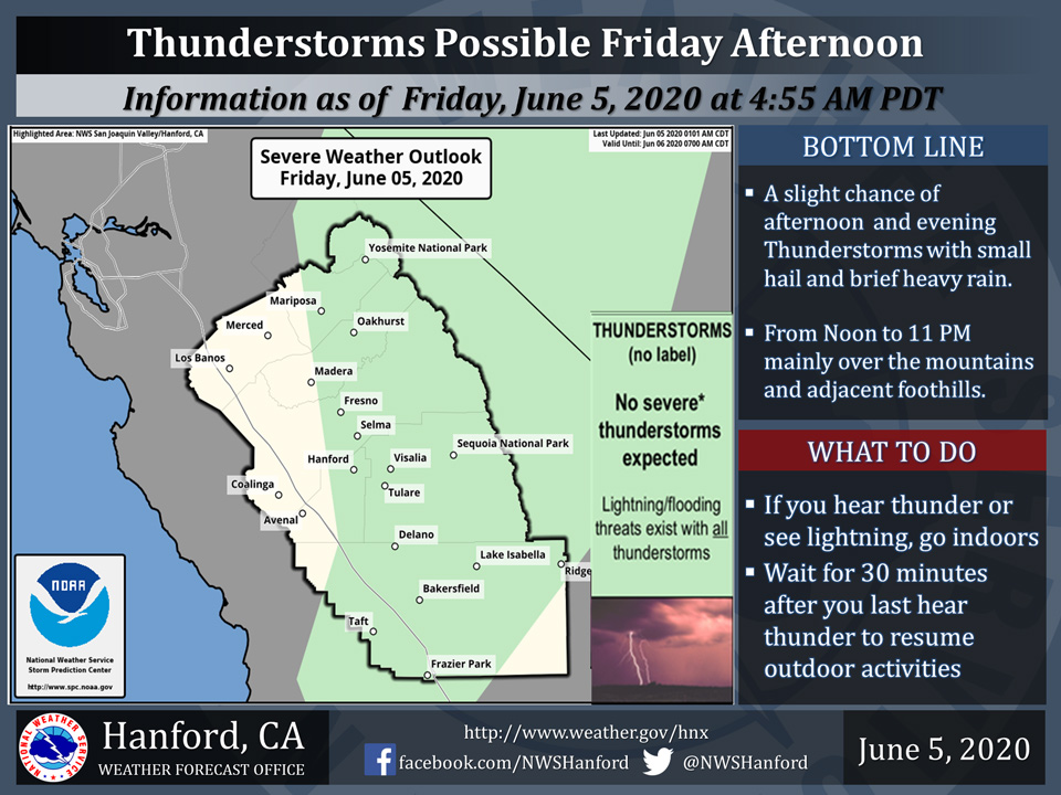
A chance of Thunderstorms today for Eastern Mariposa County including Yosemite National Park and Eastern Madera County including Oakhurst
June 5, 2020 - The National Weather Service Hanford Office reports a few strong thunderstorms are possible across the Sierra Nevada Friday afternoon and evening.
Small hail, brief heavy rain and wind gusts near 45 miles per hour are some of the hazards associated with strong thunderstorms.
In addition to dangerous cloud to ground lightning strikes, any thunderstorm can produce localized flooding.
  Area Forecast Discussion
  National Weather Service Hanford CA
  327 AM PDT Fri Jun 5 2020


  .SYNOPSIS...
  Chance of thunderstorms will occur today over the higher
  elevations of the Sierra and down into the Kern County Mountains.
  A cooling trend starting today will bring temperatures back to
  well below normal by Sunday. Breezy to windy conditions are likely
  through the weekend especially in wind prone areas. Temperatures
  begin trending back to slightly above normal levels by the middle
  of next week.

  &&

  .DISCUSSION...
  Ridging that has brought us the short lived hot weather the last
  couple of days is beginning to move back eastward as troughing
  over the eastern Pacific pushes eastward into the western third
  of the CONUS. This troughing will bring breezy to gusty winds but
  the most noticeable change will be the cooling. This troughing
  moving into the region will also bring an increase in mid to
  upper level moisture from the south. This influx of moisture will
  increase cloud cover but also increase chances of convection over
  the higher elevations of the Sierra and the Kern County Mountains
  later today. Main impacts expected with any storm development will
  be brief heavy downpours, small hail, and gusty winds. Of course,
  any thunderstorms will have dangerous lightning. So if out hiking
  or camping in the mountains today in this cooler weather, keep an
  eye to the sky.

  By Sunday, we will see high temperatures in the San Joaquin Valley
  and Kern desert areas in the mid 70 degree zone. This will be a
  nice change for most. A more quasi-zonal on shore pattern aloft
  will put the hottest weather behind us for at least the next
  several days. Weak ridging will move into the region on Wednesday
  and Thursday which will temporarily raise temperatures back to
  above normal, but at this time it looks like most valley and
  desert areas will see high temperatures stay below the century
  mark.
Source: NWS

