


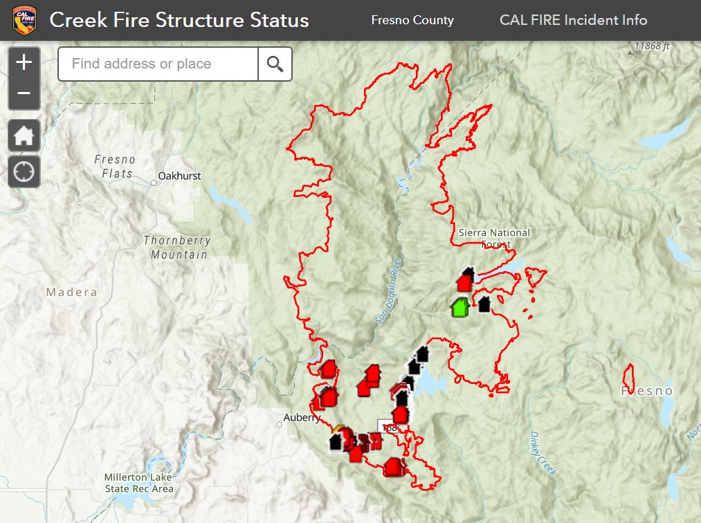
September 12, 2020 - CAL FIRE, in collaboration with the County of Fresno, has released a preliminary interactive map of the Creek Fire. The interactive map displays preliminary information about damaged and destroyed property. Not all properties have been inspected. It is anticipated it will take two weeks for completion. The public may access the map online and enter an address(es) to see limited information on the condition of property based on initial reports from damage assessment teams.
Due to the changing nature of the Creek Fire and the priority of protecting life and safety, the map will continually be updated as personnel are allowed to safely enter areas and record data. For this reason, not all properties will be reflected at this time so the public is asked for patience as data is collected and entered on a regular basis by CAL FIRE.
What this map provides:
- A resource for general information regarding the status of properties observed in areas affected by the Creek Fire
- Awareness of conditions that may aid residents with initial planning for returning to their property.
- A snapshot in time of a property. Information is subject to change depending on fire conditions and available data.
What this map does NOT provide:
- Official confirmation of property status. Any information provided on this map is considered preliminary. Conditions will only be verified upon formal inspection by disaster assessment officials upon safe reentry into the area.
- Comprehensive data for all homes in affected areas. Data and information will be updated as it is safely identified, collected and uploaded. Addresses that cannot be located on the map is NOT an indication of property status.
- Map is NOT proof of a home’s condition to be used for insurance, permitting, rebuilding or other purposes.
Damage inspection teams are made up of CAL FIRE personnel, the area remains hazardous and off limits to the public. Map will be updated regularly, with all data subject to change based on available information. Please find link to map at https://arcg.is/1vaCOP
Learning the status of a property during a disaster can evoke a strong emotional response. Support is available. 24/7 Disaster Distress Helpline 1-800-985-5990 or text TalkWithUs to 66746. In-person counseling is also available at the Temporary Evacuation Point at Clovis North / Granite Ridge campus.
Within the next week, the County of Fresno will establish a multi-agency Local Assistance Center to serve as a one-stop-shop to provide disaster assistance for those impacted by the Creek Fire. More details will be provided as they are available.
For more information and resources, please visit the County of Fresno’s Creek Fire resource website at https://www.co.fresno.ca.us/departments/public-health/fresno-county-emergency.
Source: Fresno County
