


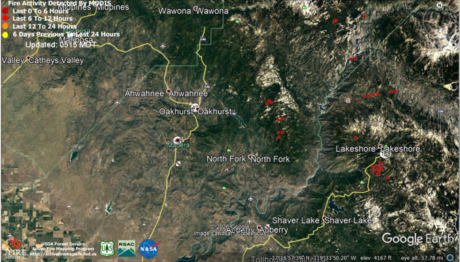
 MODIS map of the Creek Fire on Saturday at 4:15 A.M. PST
Note: 1,500 Wide and older yellow detections removed
MODIS Active Fire Mapping Program Frequently Asked Questions
Update 6:55 P.M. CAL FIRE Evening Update: 271,938 acres and 25% containment, with 8,063 structures threatened.
'Click' here to view 14 page PDF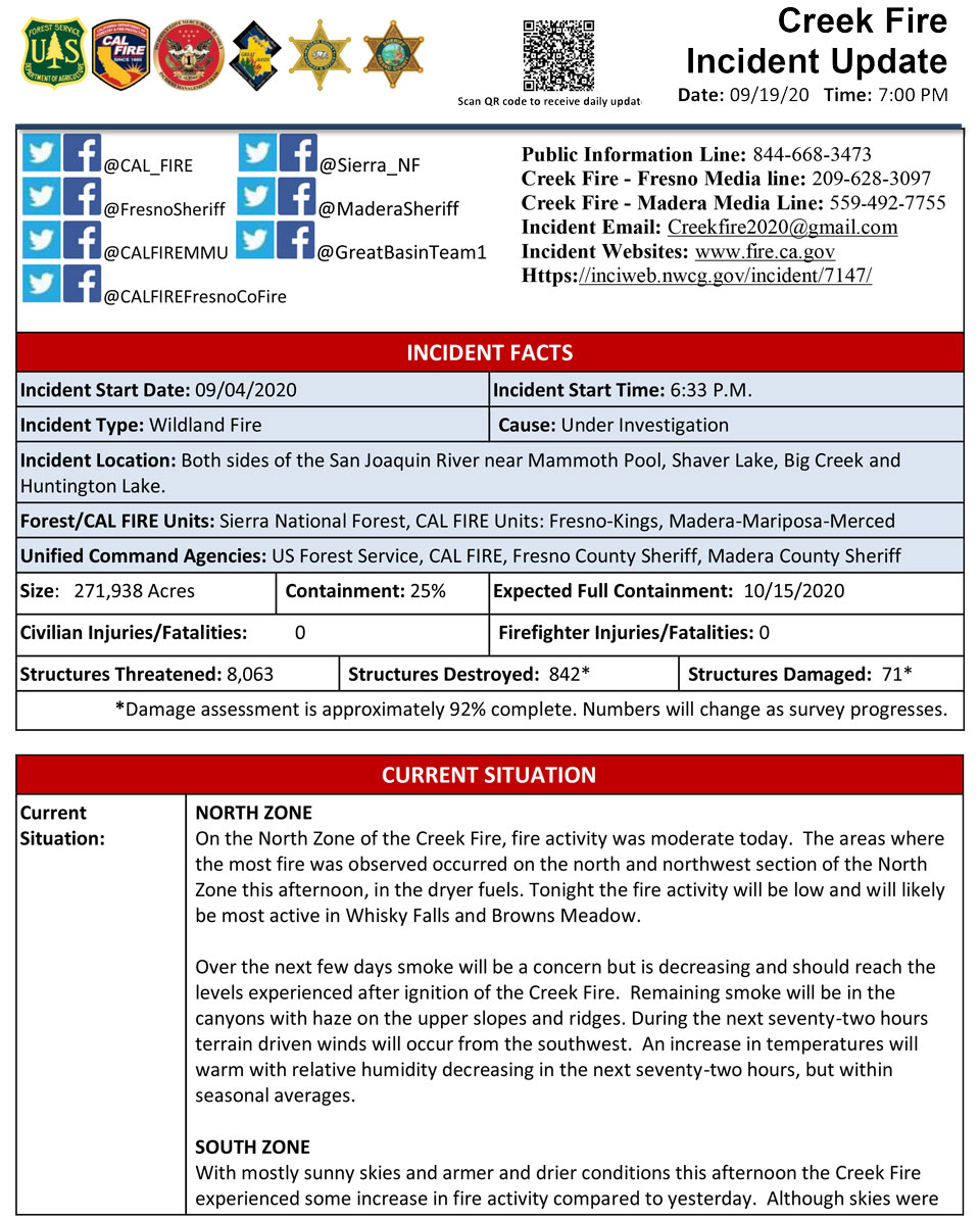
Update 6:25 P.M. U.S. Sailors & Marines Have Arrived in Madera County to Assist with the Creek Fire
Update 5:55 P.M. Fresno County Reports Shaver Lake Wastewater Treatment Plant was Damaged by the Creek Fire
Update 4:00 P.M. Per Madera County Sheriff's Office: Evacuation Order Lifted M8, M9, M10, M21, and M22
Evacuation Orders for M8, M9, M10, M21, and M22 have been reduced to Evacuation Warnings. Residents in the area need to be aware that there is still a potential for evacuations and need to be prepared to evacuate at a moments notice.
Citizens need to monitor the situation and be prepared to take action immediately. These areas are being opened to residents only.
Douglas Ranger Station Road between Mill Site and the dead end including spur roads such as Wild Rose Lane, Elderberry Lane, and Trails End Road. (Evacuation Zone M8) Road 274 between Road 225 and Central Camp Road. including all spur roads such as Gentle Way, Road 229A, Poison Oak Place, Mono Wind Way, Willow Canyon Drive, Gentle Way, Thunder Way, Gilpin Lane, Sierra Dawn Drive, Sunrise Ridge Road, Los Robels, Parcels of Paradise, Putney Place, and Shinn Cabin Lane. (Evacuation Zones M9, M10, M21, and M22)
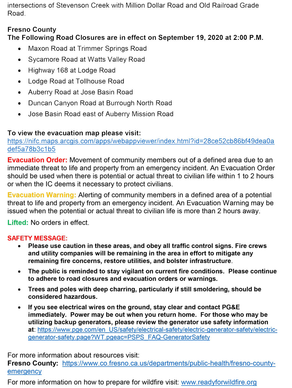
Update 2:00 P.M. Per CAL FIRE: EVACUTATION ORDERS Reduced to WARNINGS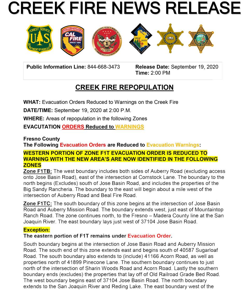
Update 10:20 A.M.: Sierra National Forest Creek Fire Operations South Zone Briefing Video for Saturday, September 19, 2020
Update 9:40 A.M.: Sierra National Forest Creek Fire North Zone Operations Briefing Video For Saturday, September 19, 2020
Update 9:13 A.M.: Forest Service Wildland Fire Smoke/Air Quality Outlook Due to the Creek Fire in the Yosemite Area for September 19 & 20, 2020
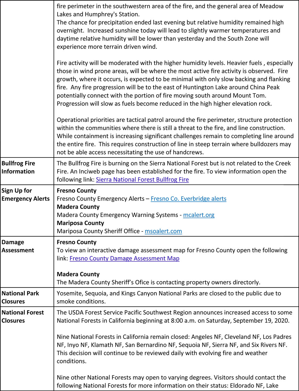
Update 8:15 A.M.: CAL FIRE morning update: 248,256 acres and 22% containment, with 8,603 structures threatened.
'Click' here to view 14 page PDF With Evacuations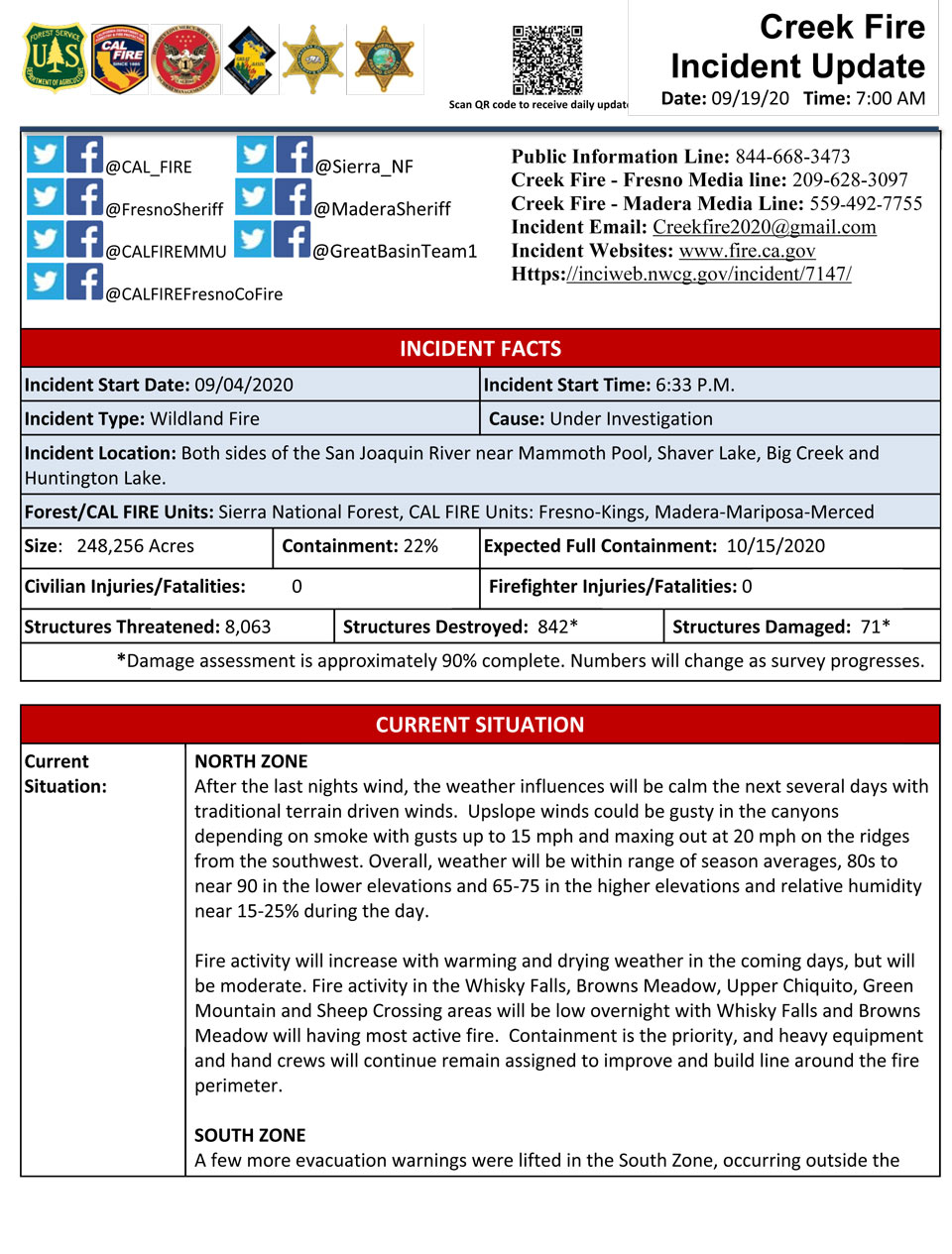
Update 5:45 A.M. Sierra National Forest Creek Fire Operations Map for Saturday, September 19, 2020 - Shows Divisions, Uncontrolled Fire Edge, Completed Dozer Lines, Proposed Dozer Lines
September 19, 2020 - No overnight infrared mapping of the Creek Fire.
Friday Evening Update: 248,256 acres and 22% containment.
Sierra National Forest Creek Fire Updates for Friday, September 18, 2020
