


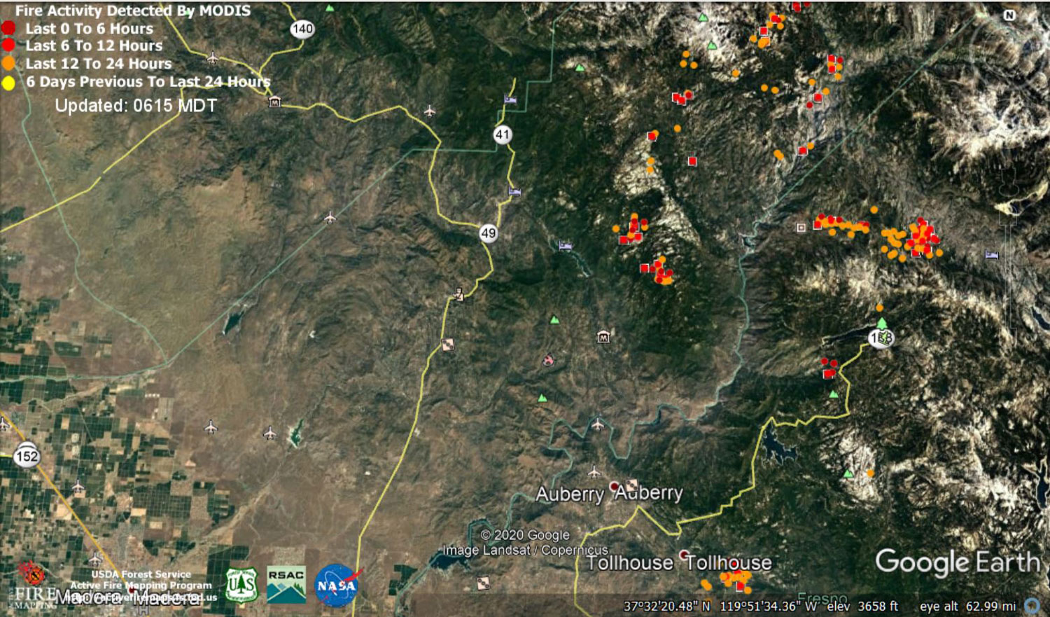
 MODIS map of the Creek Fire on Wednesday at 5:15 A.M. PST
Note: 1,500 Wide and older yellow detections removed
MODIS Active Fire Mapping Program Frequently Asked Questions
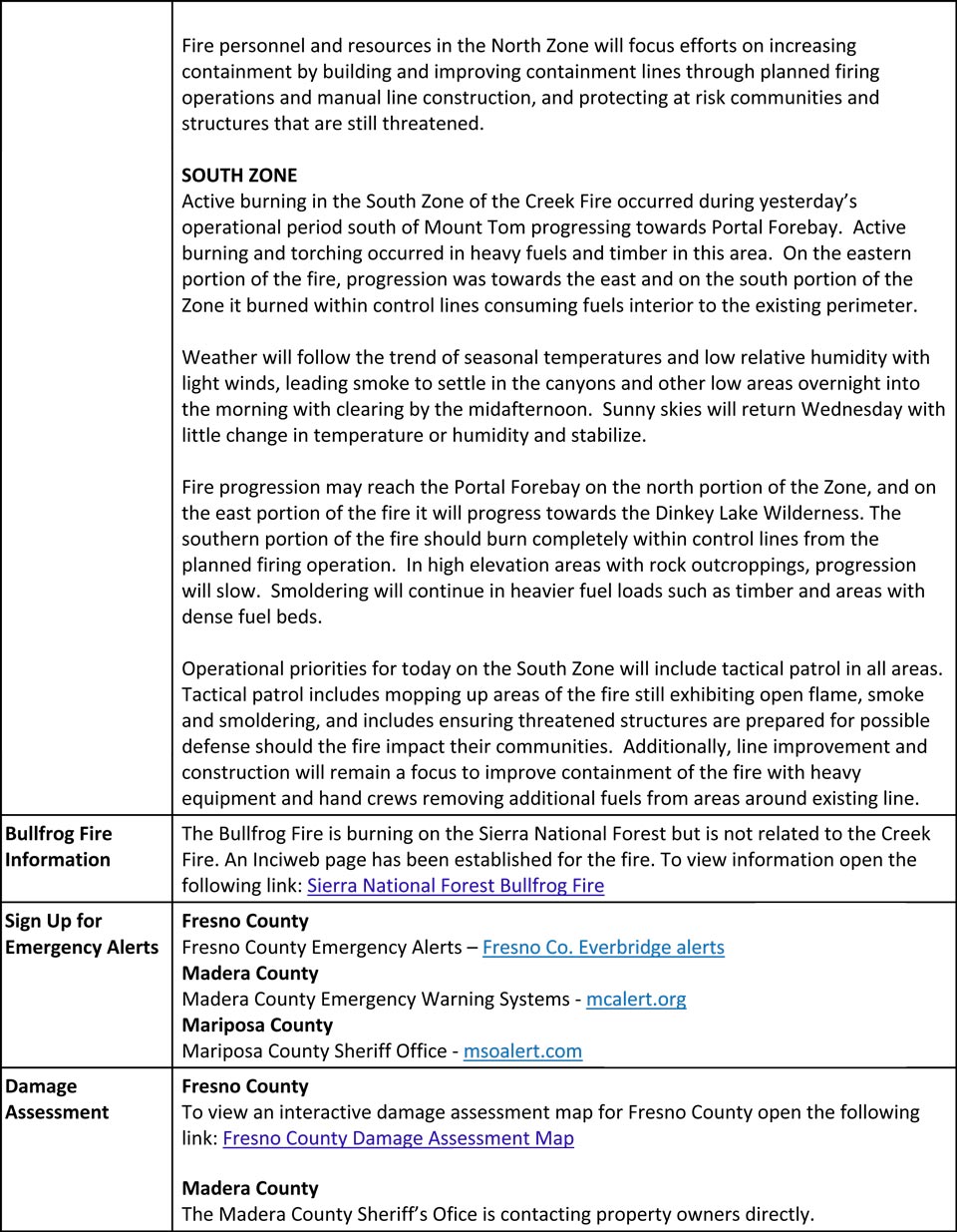
Update for 7:00 P.M. CAL FIRE Evening Update for the Creek Fire: 289,695 acres and 34% containment, with 5,283 structures threatened.
'Click' here to view 12 page PDF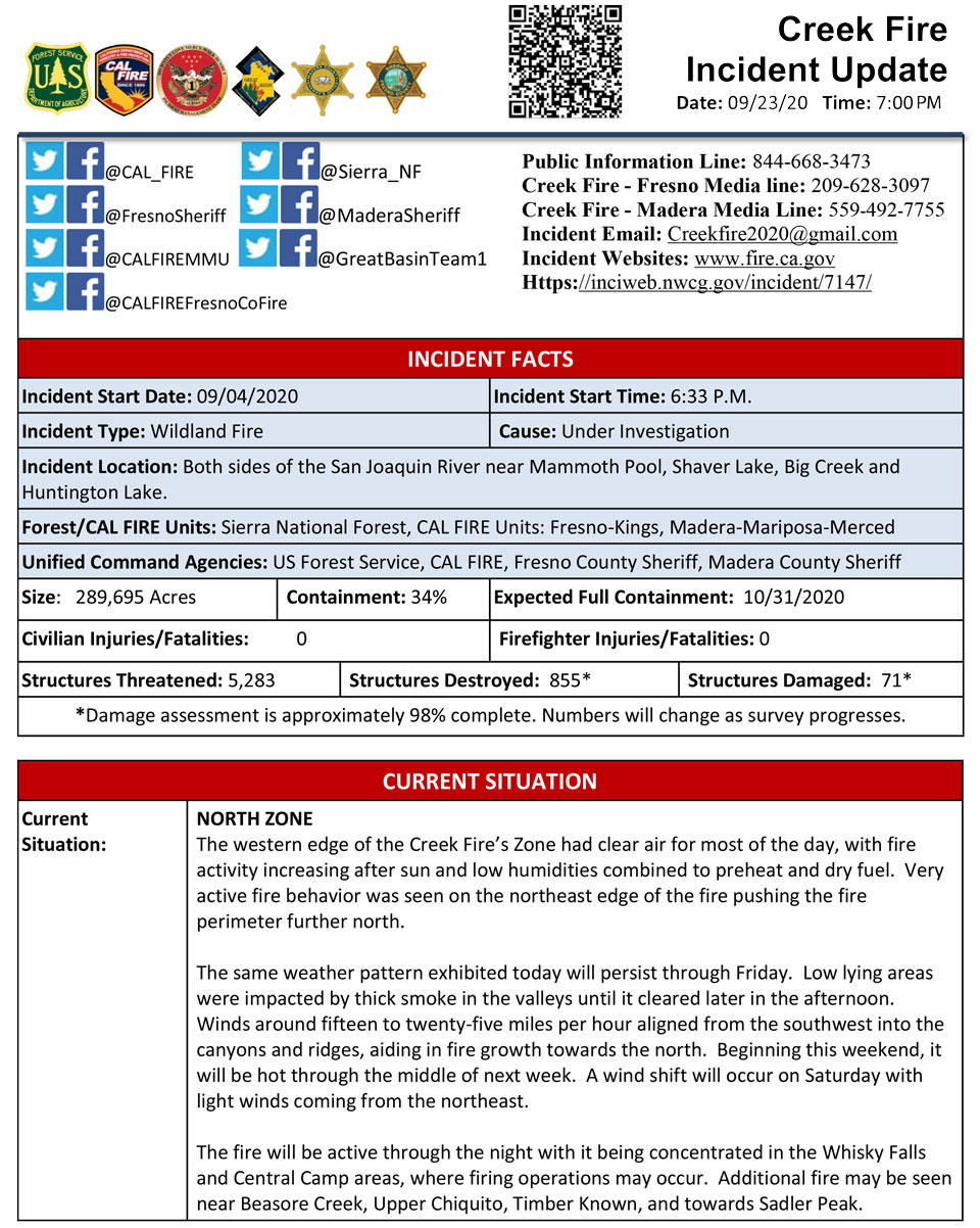
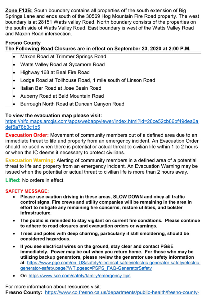
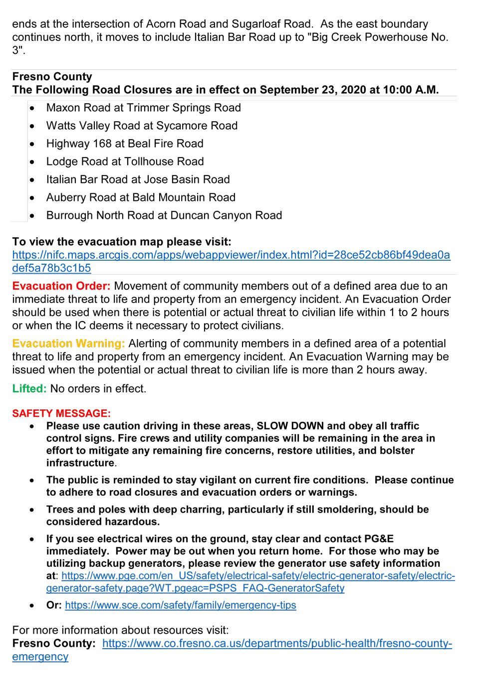
Update 2:00 P.M.: CAL FIRE - Fresno County Creek Fire Repopulation 2:00 P.M. Update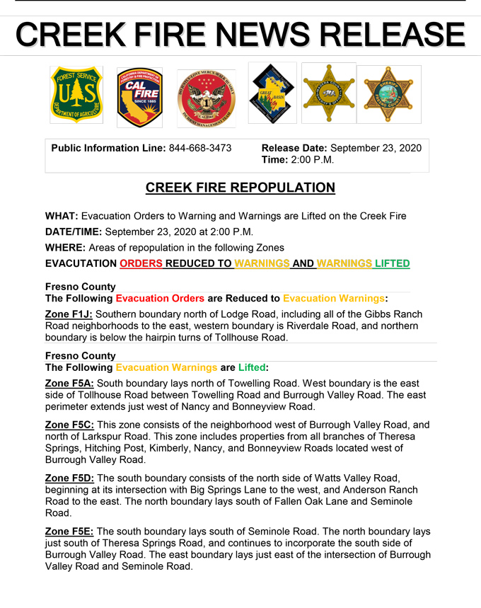
Update 11:20 A.M.: Sierra National Forest Creek Fire Operations South Zone Briefing Video for Wednesday, September 23, 2020
Update 11:05 A.M.: Sierra National Forest Creek Fire North Zone Operations Briefing Video For Wednesday, September 23, 2020
Update 10:35 A.M.: Mariposa County Sheriff's Office; The Fire Advisement / Evacuation Warning for the Fish Camp area has been lifted.
The Creek Fire continues to burn, however there is no longer a threat to the Fish Camp community. Firefighting equipment may still be in and around the area so please continue to drive cautiously. To view a map of the current Creek Fire Evacuations and Warnings please visit https://arcg.is/1jv4LG
Update 10:15 A.M.: CAL FIRE - Fresno County Creek Fire Repopulation
Update 10:05 A.M.: Madera County Sheriff's Office; Evacuation Warnings Lifted for M21, M23, M24, M25, M55, and M56
The Madera County Sheriff's Office is pleased to announce the evacuation warnings for the following Evacuation Zones have been lifted. M21: Parcels of Paradise M23: Manzanita Lake Area M24: Bass Lake Annex M25: South Shore of Bass Lake M55: Crass Drive M56: Dorstan Drive Please go to the Madera County Web Page and click on the fire map to see more information.
Update 9:30 A.M.: Forest Service Wildland Fire Smoke/Air Quality Outlook Due to the Creek Fire in the Yosemite Area for September 23 & 24, 2020
Update 8:25 A.M.: CAL FIRE morning update: 289,695 acres and 32% containment, with 6,723 structures threatened.
'Click' here to view 14 page PDF With Evacuations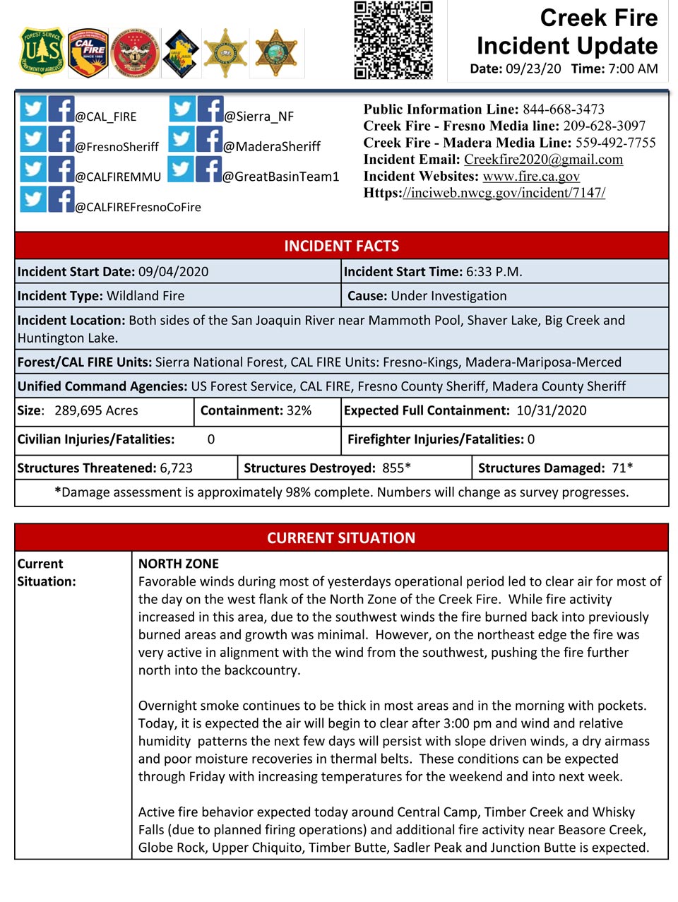
Update 6:00 A.M.: Sierra National Forest Creek Fire Operations Map for Wednesday, September 23, 2020 - Shows Divisions, Uncontrolled Fire Edge, Completed Dozer Lines, Proposed Dozer Lines
Update 5:50 A.M.: Sierra National Forest Creek Fire Public Information Map for Wednesday, September 23, 2020 - Shows Fire Perimeter and Containment
September 23, 2020 - Overnight infrared mapping has the Creek Fire at 289,695 Interpreted Acres.
Comments and notes on flight:
No data was received for the eastern center of the Creek fire. The perimeter in that area is indicated as estimated.
Large areas of creeping growth were noted along the northern and southwestern portion of the perimeter.
Large areas of intense fire were detected along the northern perimeter of the fire.
Large areas of scattered fire were detected along the western area of the fire.
Isolated fires were most numerous near the northern and south western edge of the fire.
Tuesday Evening Update: 286,519 acres and 32% containment.
Sierra National Forest Creek Fire Updates for Tuesday, September 22, 2020
