


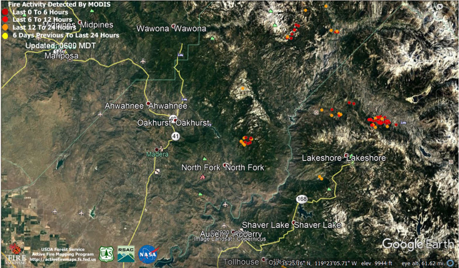
MODIS map of the Creek Fire on Friday at 5:00 A.M. PST
Note: 1,500 Wide and older yellow detections removed
MODIS Active Fire Mapping Program Frequently Asked Questions
Update 7:15 A.M. Saturday, September 26: Update 11:45 A.M.: Sierra National Forest Creek Fire North Zone Operations Briefing Video For Friday, September 25, 2020
Update for 7:20 P.M. CAL FIRE Evening Update: 291,426 acres and 39% containment, with 4,576 structures threatened.
'Click' here to view 11 page PDF With Evacuations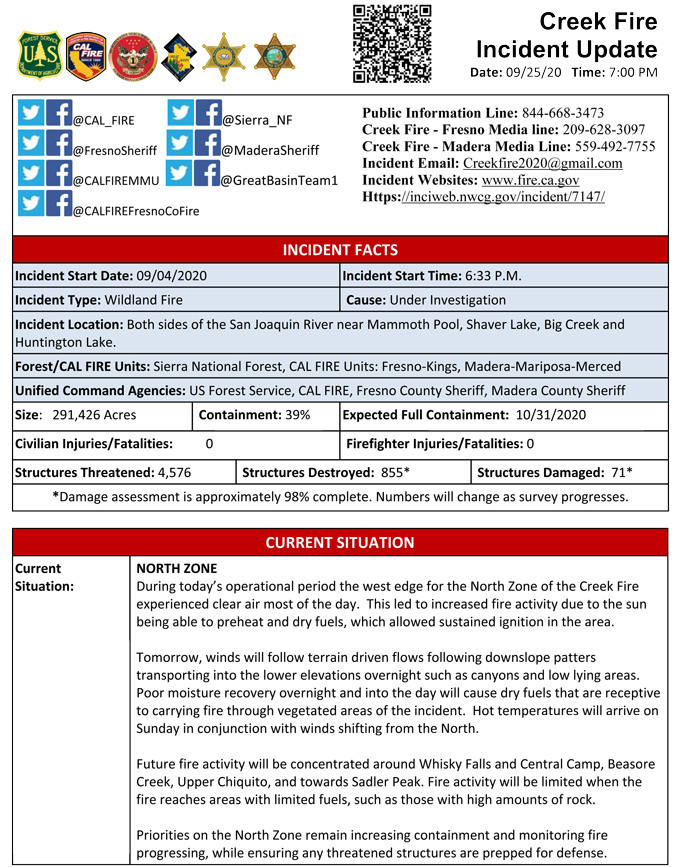
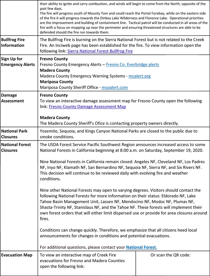
Update for 7:00 P.M. Sierra National Forest to Hold a Creek Fire Livestream Incident Briefing with CAL FIRE on Tuesday, September 25, 2020
Update 10:20 A.M.: Sierra National Forest Creek Fire Operations South Zone Briefing Video for Friday, September 25, 2020
Update 8:35 A.M.: Forest Service Wildland Fire Smoke/Air Quality Outlook Due to the Creek Fire in the Yosemite Area for September 25 & 26, 2020
Update 8:20 A.M.: CAL FIRE morning update: 291,426 acres and 36% containment, with 4,576 structures threatened.
'Click' here to view 11 page PDF With Evacuations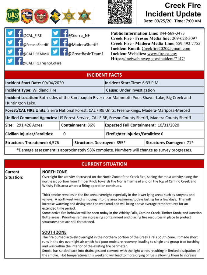
Update 6:10 A.M.: Sierra National Forest Creek Fire Operations Map for Friday, September 25, 2020 - Shows Divisions, Uncontrolled Fire Edge, Completed Dozer Lines, Proposed Dozer Lines
September 25, 2020 - No data was produced in overnight infrared mapping.
Comments and notes on flight:
Thursday Evening Update: 291,426 acres and 36% containment.
Sierra National Forest Creek Fire Updates for Thursday, September 24, 2020

