


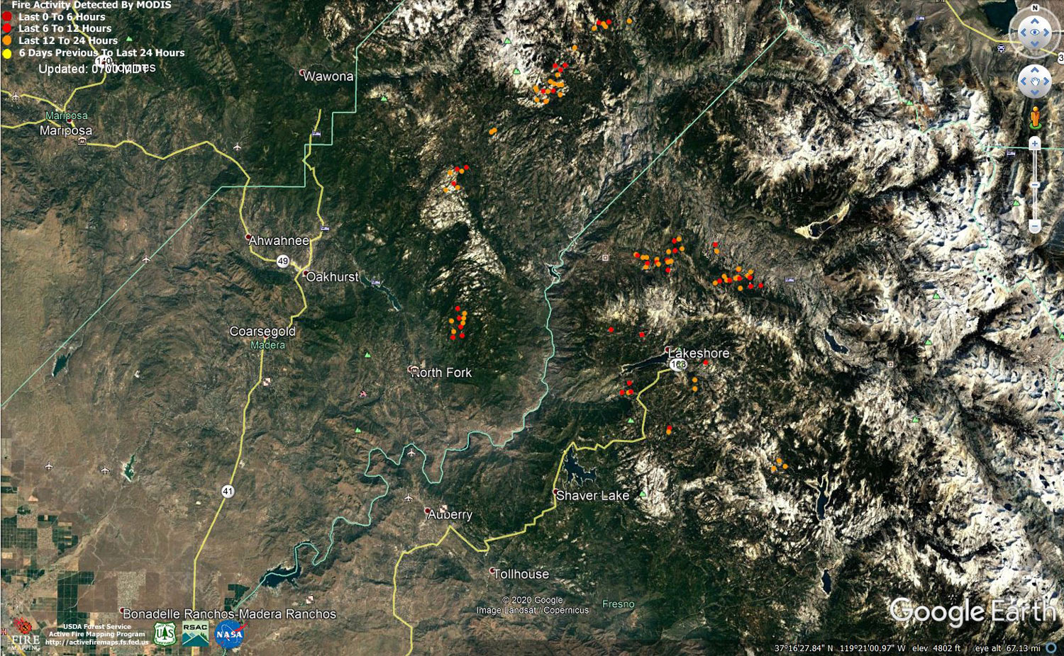
MODIS map of the Creek Fire on Saturday at 6:00 A.M. PST
Note: 1,500 Wide and older yellow detections removed
MODIS Active Fire Mapping Program Frequently Asked Questions
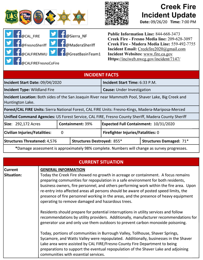
Update for 7:00 P.M. Per CAL FIRE Creek Fire is now 292,172 acres and 39% contained.
'Click' here to view 10 page PDF With Evacuations
Update 6:40 P.M. Fresno County Sheriff’s Office Announced Sunday Re-Entry Zones for Specific Residents to Survey Creek Fire Damage
Update for 4:00 P.M. Per CAL FIRE - Evacuation Orders are Lifted on the Creek Fire: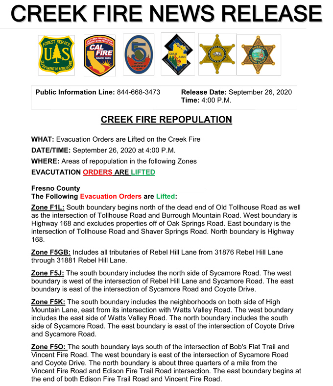
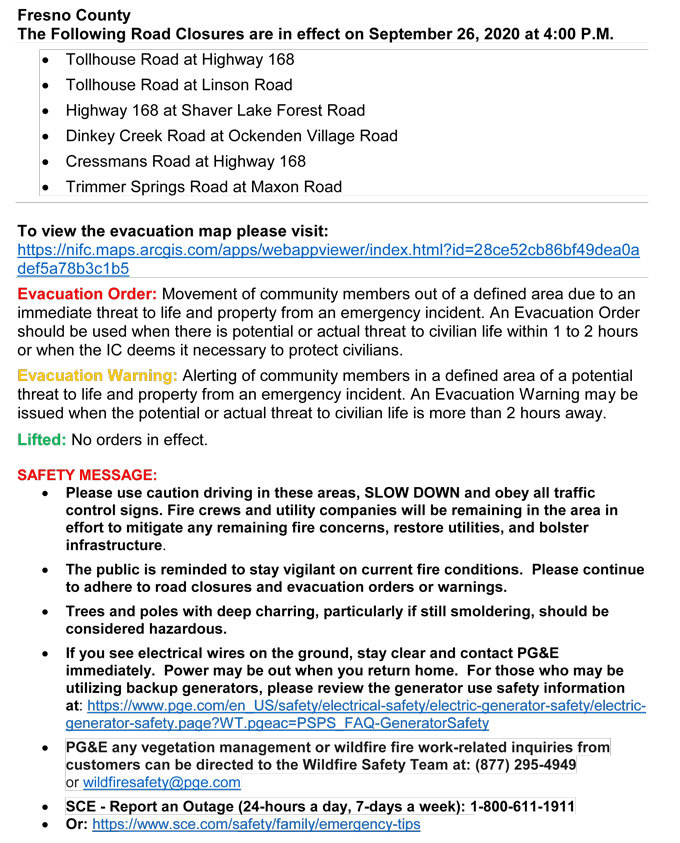
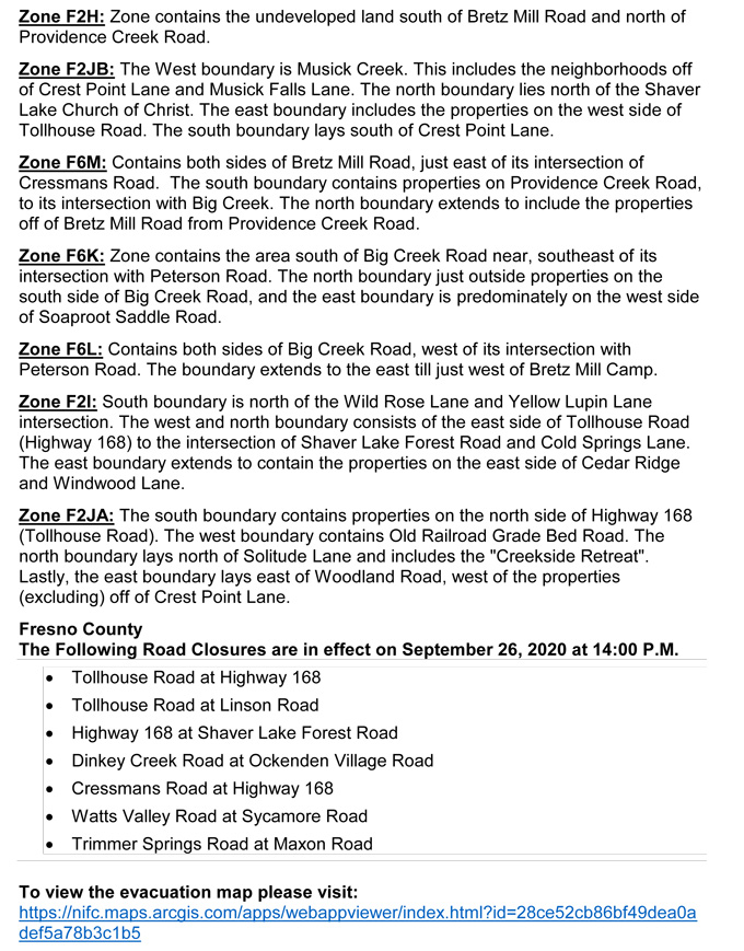
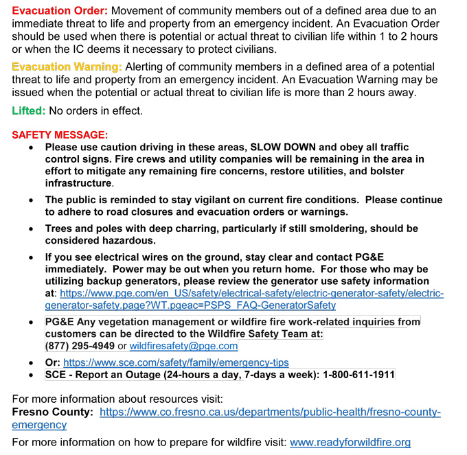
Update for 2:00 P.M. Per CAL FIRE - Evacuation Orders are Lifted on the Creek Fire:
Update for 1:50 P.M. Madera County Sheriff’s Office: Evacuation Warnings Lifted for M12, M52, M53, and M142
The Madera County Sheriff's Office is pleased to announce the evacuation warnings for the following Evacuation Zones have been lifted. M12: Pines M52: Saddleback Estates M53: Chepo Saddle Area M142: Sugar Pine Please go to the Madera County Web Page and click on the fire map to see more information.
Update 11:30 A.M.: Sierra National Forest Creek Fire North Zone Operations Briefing Video For Saturday, September 26, 2020
Update 9:50 A.M.: Sierra National Forest Creek Fire Operations South Zone Briefing Video for Saturday, September 26, 2020
Update 8:20 A.M.: Forest Service Wildland Fire Smoke/Air Quality Outlook Due to the Creek Fire in the Yosemite Area for September 26 & 27, 2020
Update 7:50 A.M.: CAL FIRE morning update: 292,172 acres and 39% containment, with 4,576 structures threatened.
'Click' here to view 11 page PDF With Evacuations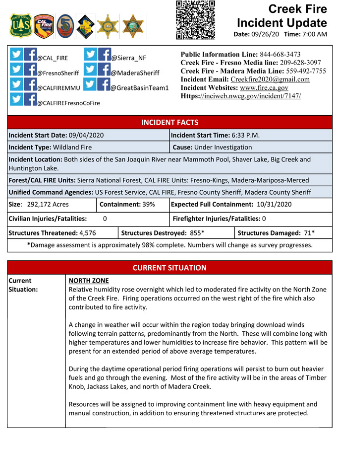
Update 6:30 A.M.: Sierra National Forest Creek Fire Operations Map for Saturday, September 26, 2020 - Shows Divisions, Uncontrolled Fire Edge, Completed Dozer Lines, Proposed Dozer Lines
September 26, 2020 - Overnight infrared mapping has the Creek Fire at 292,172 Interpreted Acres.
Comments and notes on flight:
No data was received for the northern end and southern 60% of the fire. The perimeter in those areas is indicated as estimated.
A small area of growth with intense fire was detected along the northwestern perimeter of the fire.
Small areas of creeping growth were noted along other portions of the northern perimeter.
Small areas of intense fire were detected within the northern perimeter of the fire.
Large areas of scattered fire were detected within the northern perimeter of the fire.
Isolated fires were generally within fairly close proximity to the main perimeters.
Friday Evening Update: 291,426 acres and 39% containment.
Sierra National Forest Creek Fire Updates for Friday, September 25, 2020

