


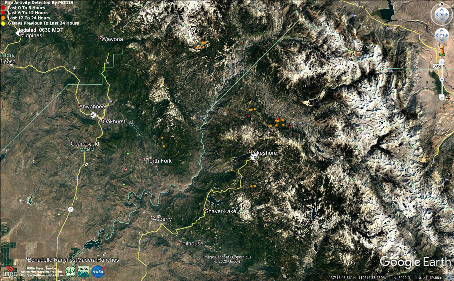
MODIS map of the Creek Fire on Sunday at 5:30 A.M. PST
Note: 1,500 Wide and older yellow detections removed
MODIS Active Fire Mapping Program Frequently Asked Questions
Update for 7:00 P.M.: CAL FIRE evening update: 302,870 acres and 39% containment, with 4,576 structures threatened.
'Click' here to view 8 page PDF With Evacuations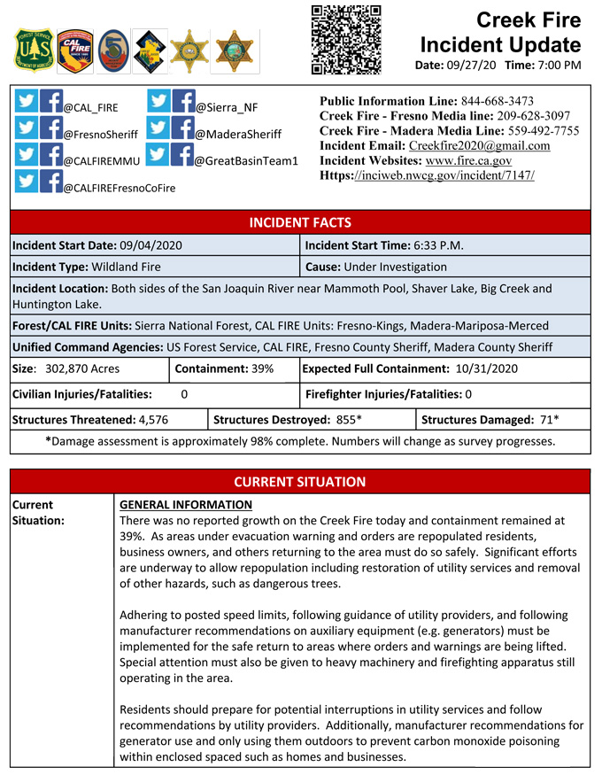
Update for 6:00 P.M. Per Madera County Sheriff’s Office: Evacuation Warnings Lifted for M8, M9, M10, M11, and M22
The Madera County Sheriff's Office is pleased to announce the evacuation warnings for the following Evacuation Zones have been lifted.
M8 – Douglas Ranger Station Road
M9 – Willow Canyon Drive
M10 – Road 274
M11 – Marina View
M22 – Gilpin Way
Please go to the Madera County Web Page and click on the fire map to see more information.
Road 274 between Beasore Road and Road 225 is open to thru traffic. Please use caution while driving in the area due increased fire equipment being in the area.
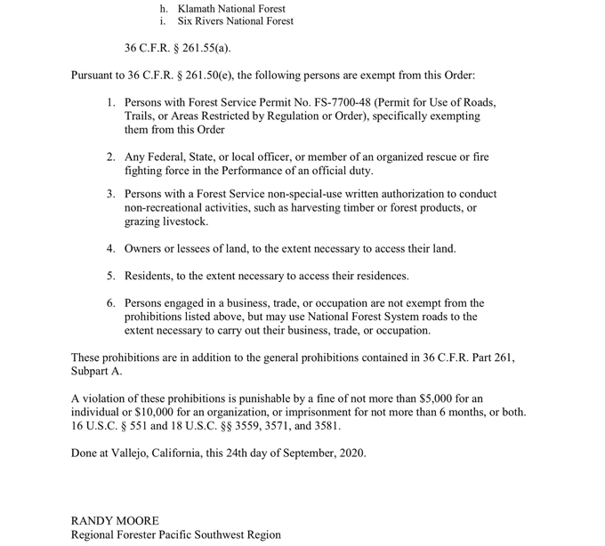
Update 12:10 P.M. Per USDA Emergency Forest Closure for the Creek Fire, Sept. 25 - Sept. 30: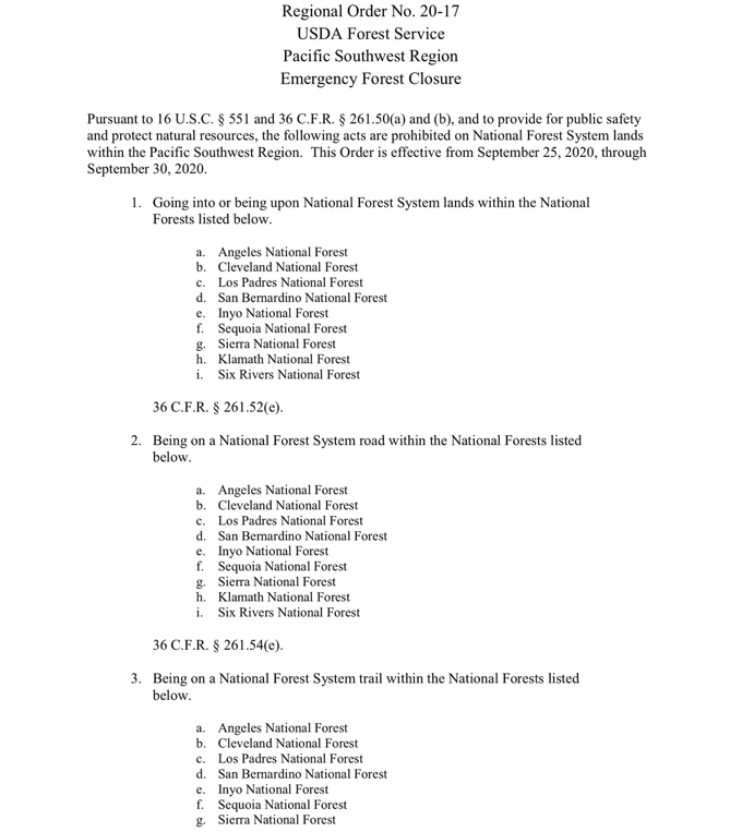
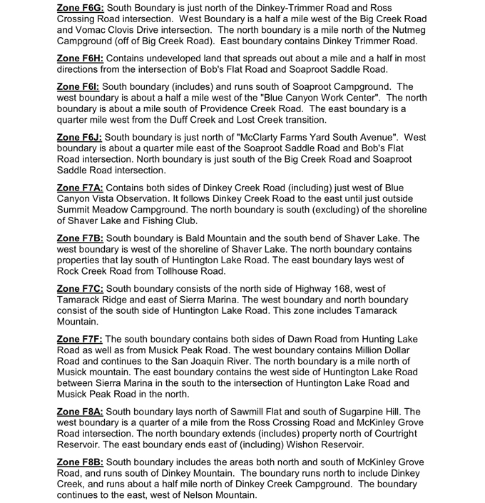
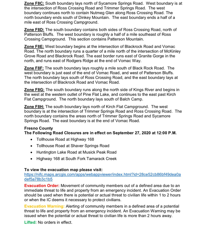
Update 12:00 P.M. Per CAL FIRE Evacuation Orders are Lifted on the Creek Fire:
Update 10:55 A.M.: Sierra National Forest Creek Fire North Zone Operations Briefing Video For Sunday, September 27, 2020
Update 10:00 A.M. Per CAL FIRE Evacuation Orders are Lifted on the Creek Fire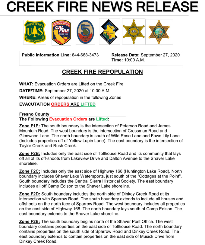
Update 9:00 A.M.: CAL FIRE morning update: 302,870 acres and 39% containment, with 4,576 structures threatened.
'Click' here to view 8 page PDF With Evacuations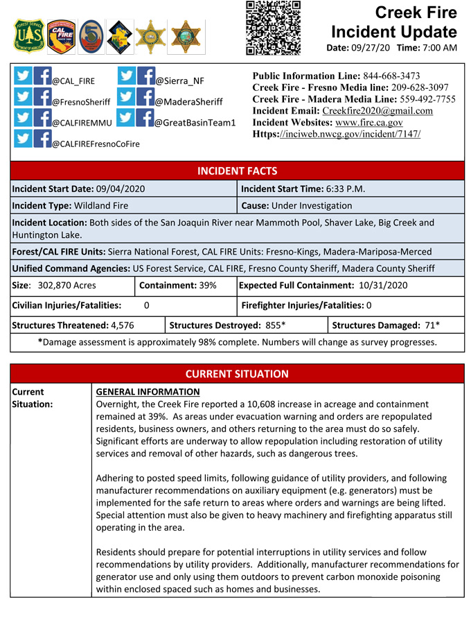
Update 8:40 A.M.: Forest Service Wildland Fire Smoke/Air Quality Outlook Due to the Creek Fire in the Yosemite Area for September 27 & 28, 2020
Update 6:10 A.M.: Sierra National Forest Creek Fire Operations Map for Sunday, September 27, 2020 - Shows Divisions, Uncontrolled Fire Edge, Completed Dozer Lines, Proposed Dozer Lines
September 27, 2020 - Overnight infrared mapping has the Creek Fire at 299,762 Interpreted Acres.
Comments and notes on flight:
No data was received for the northern and eastern portions of the fire. The perimeter in those areas is indicated as estimated.
Heavy clouds and haze were present over the southwestern third of the fire. The perimeter in that area is indicated as estimated.
An area of growth with scattered fire was detected along the west-central perimeter of the fire.
Small areas of intense fire were detected within the southwestern portion of the perimeter.
Moderate-sized areas of scattered fire were detected within the west-central portion of the perimeter.
Isolated fires were generally within fairly close proximity to the main perimeters.
Saturday Evening Update: 292,172 acres and 39% containment.
Sierra National Forest Creek Fire Updates for Saturday, September 26, 2020

