


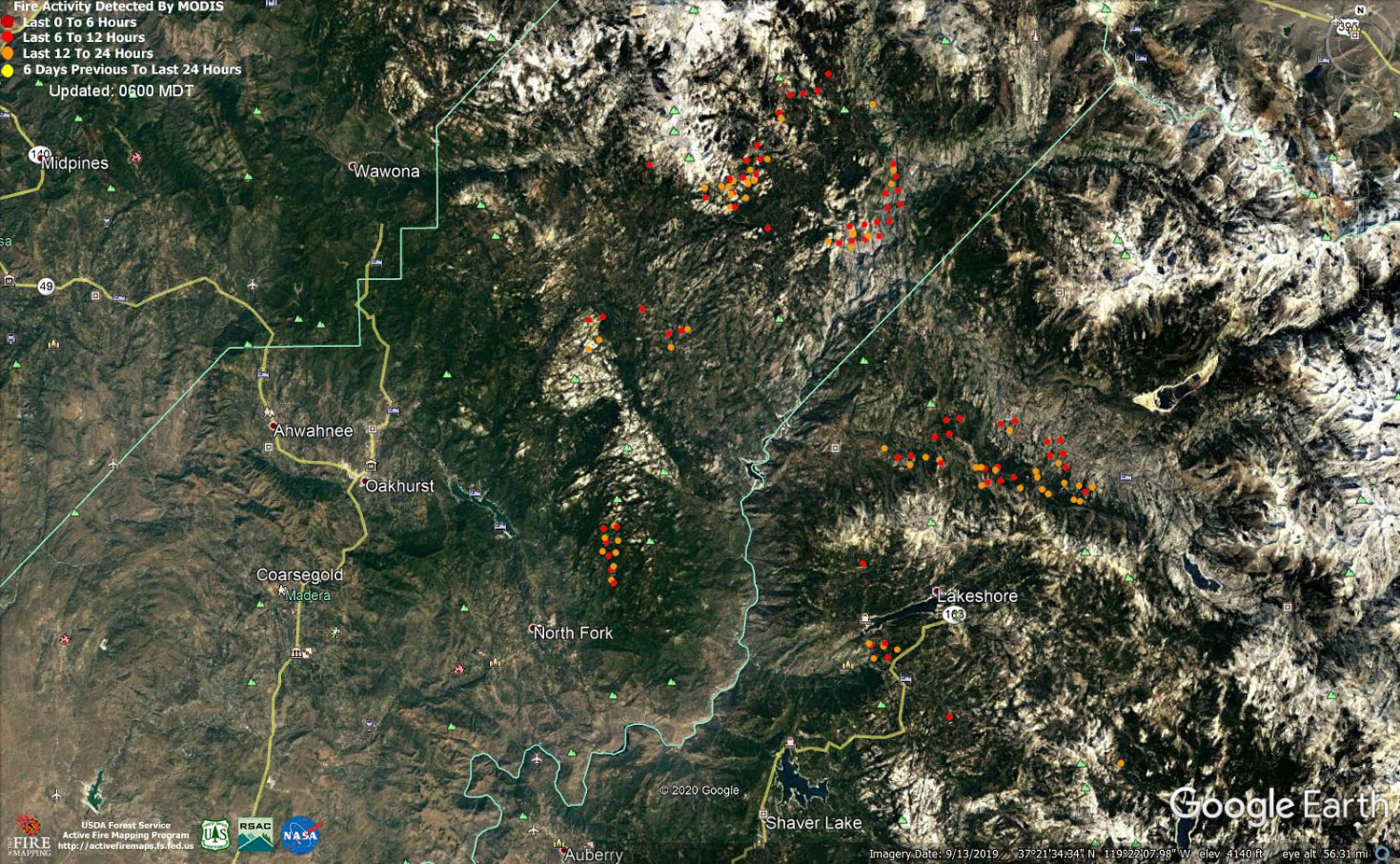
MODIS map of the Creek Fire on Monday at 5:00 A.M. PST
Note: 1,500 Wide and older yellow detections removed
MODIS Active Fire Mapping Program Frequently Asked Questions
Update 7:15 P.M. Per CAL FIRE evening update: 304,640 acres and 39% containment, with 3,172 personnel on the fire.
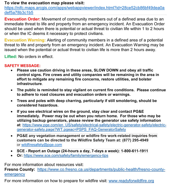
'Click' here to view 8 page PDF With Evacuations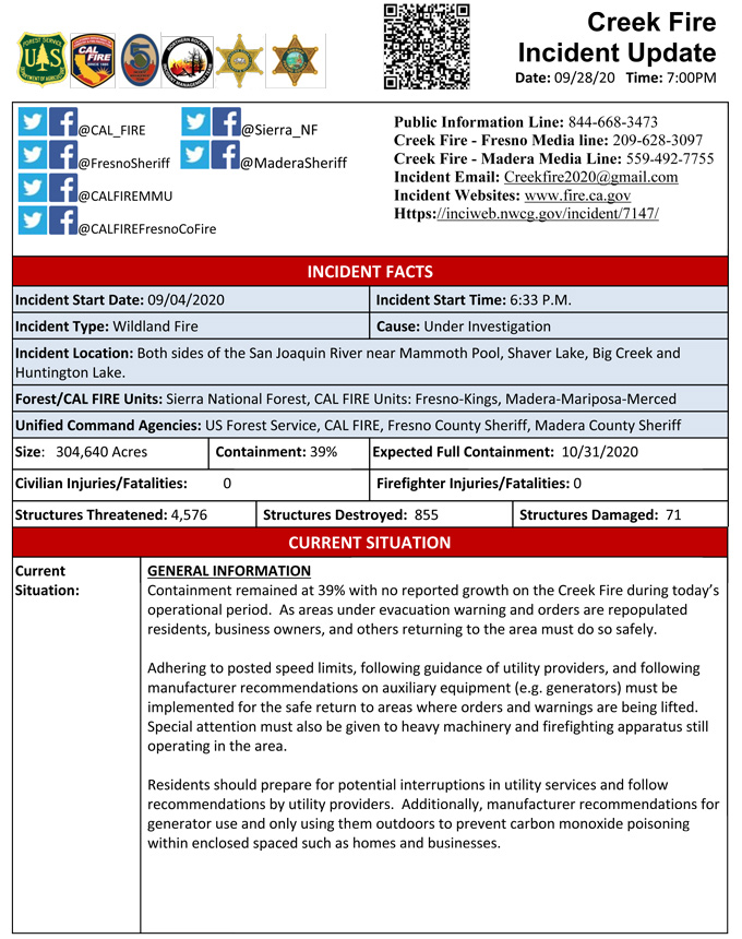
Update LIVE 7:00 P.M. (2:55 P.M.): Sierra National Forest to Hold a Creek Fire Livestream Incident Briefing with CAL FIRE on Monday, September 28, 2020
Update 2:30 P.M. Sierra National Forest Creek Fire North Zone Operations Briefing Video For Monday, September 28, 2020
Update 2:10 P.M. Per CAL FIRE Evacuation Order Lifted for Creek Fire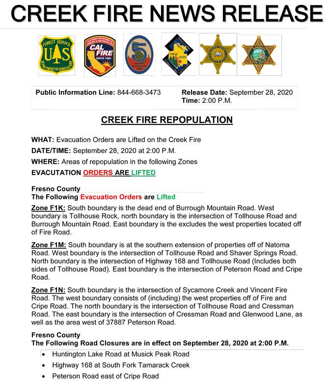
Update 2:05 P.M. Per Madera County Sheriff's Office: Evacuation Order Lifted for M4B and M17A
Evacuation Orders for M4B and M17A have been reduced to Evacuation Warnings. Residents in the area need to be aware that there is still a potential for evacuations and need to be prepared to evacuate at a moments notice. Citizens need to monitor the situation and be prepared to take action immediately. These areas are being opened to residents only. M4B: Kingsman Flat M17A: Hogue Ranch
Update 1:20 P.M.: CAL FIRE Statewide Fire Update Video for Monday, September 28, 2020
Update 9:30 A.M.: Sierra National Forest Creek Fire Operations South Zone Briefing Video for Monday, September 28, 2020
Update 8:40 A.M.: Forest Service Wildland Fire Smoke/Air Quality Outlook Due to the Creek Fire in the Yosemite Area for September 28 & 29, 2020
Update 7:45 A.M.: CAL FIRE morning update: 304,604 acres and 39% containment, with 4,576 structures threatened.
'Click' here to view 8 page PDF With Evacuations
Update 6:45 A.M.: Sierra National Forest Creek Fire Progression Map for Monday, September 28, 2020
September 28, 2020 - Tech issues prevented overnight infrared mapping of the Creek Fire.
Comments and notes on flight:
Sunday Evening Update: 302,870 acres and 39% containment.
Sierra National Forest Creek Fire Updates for Sunday, September 27, 2020

