


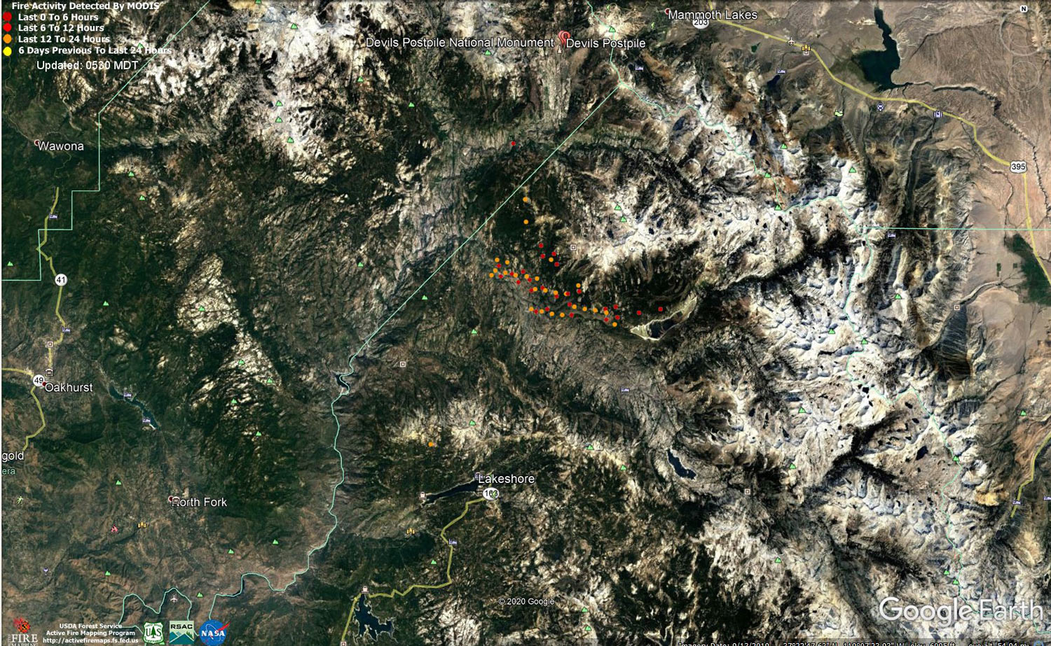
MODIS map of the Creek Fire on Friday at 4:30 A.M. PST
Note: 1,500 Wide and older yellow detections removed
MODIS Active Fire Mapping Program Frequently Asked Questions
Update 10:00 P.M. CAL FIRE Evening Update for the Creek Fire: the fire is currently 358,967 acres and 61% containment
Update for 7:00 P.M.: Livestream Incident Briefing with CAL FIRE on Friday, October 23, 2020
Update 2:20 P.M.: Central Sierra Resiliency Fund to Host Two Clinics for Creek Fire Victims to be Held in Shaver Lake on Saturday, October 24, 2020
Update 11:50 A.M.: Sierra National Forest Creek Fire Operations Briefing Video for Friday, October 23, 2020
Update 9:15 A.M.: Forest Service Wildland Fire Smoke/Air Quality Outlook Due to the Creek Fire in the Yosemite Area for October 23 & 24, 2020
Update 8:20 A.M. CAL FIRE Morning Update for the Creek Fire: 357,656 acres and 61% containment.
Note: No PDF File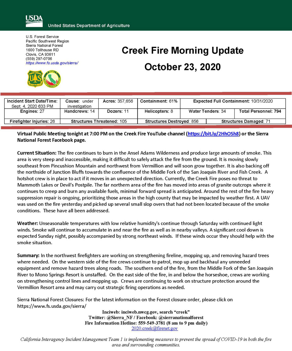
Update 5:50 A.M.: Sierra National Forest Creek Fire Public Information Map for Friday, October 23, 2020 - Shows Contained Line and Uncontrolled Fire Edge
October 23, 2020 - No reported overnight infrared mapping for the Creek Fire.
Comments and notes on flight:
Thursday Evening Update: 357,656 acres and 61% containment.
Sierra National Forest Creek Fire Updates for Thursday, October 22, 2020

