


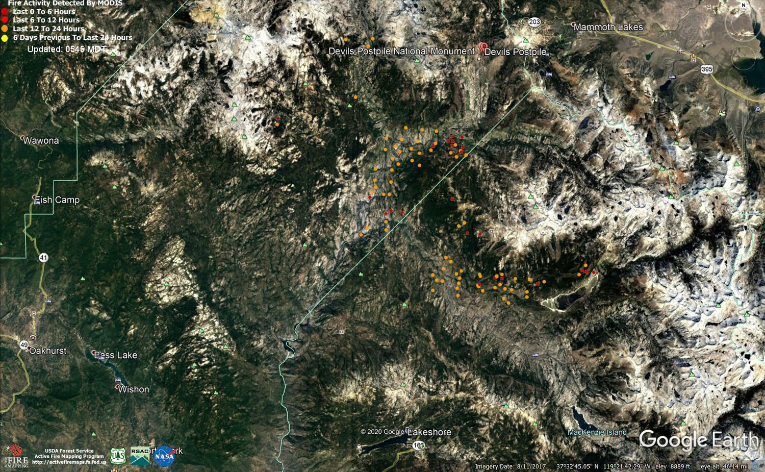
MODIS map of the Creek Fire on Tuesday at 4:45 A.M. PST
Note: 1,500 Wide and older yellow detections removed
MODIS Active Fire Mapping Program Frequently Asked Questions
Update 8:30 P.M.: Sierra National Forest to Hold a Creek Fire Livestream Incident Briefing with CAL FIRE on Wednesday, October 28, 2020
Update 7:50 P.M.: Sierra National Forest Creek Fire Evening Operations Briefing Video for Tuesday, October 27, 2020
Update 11:30 A.M.: Sierra National Forest Has Extended the Closure Area Around the Creek Fire
Update 10:20 A.M.: Sierra National Forest Creek Fire Operations Briefing Video for Tuesday Morning, October 27, 2020
Update 9:15 A.M.: Forest Service Wildland Fire Smoke/Air Quality Outlook Due to the Creek Fire in the Yosemite Area for October 27 & 28, 2020
Update 8:10 A.M.: CAL FIRE Morning Update for the Creek Fire: 374,466 acres and 63% containment.
Note: No PDF File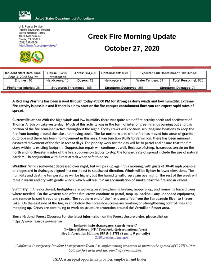
Update 5:45 A.M.: Sierra National Forest Creek Fire Public Information Map for Tuesday, October 27, 2020 - Shows Contained Line and Uncontrolled Fire Edge
October 27, 2020 - Overnight infrared mapping has the Creek Fire at 374,466 Interpreted Acres.
Comments and notes on flight:
A lot of intense heat observed along the eastern perimeter north and northwest of Thomas A. Edison Reservoir.
Monday Evening Update: 369,362 acres and 63% containment.
Sierra National Forest Creek Fire Updates for Monday, October 26, 2020

