


Includes Eastern Mariposa County, Eastern Madera County and Yosemite National Park
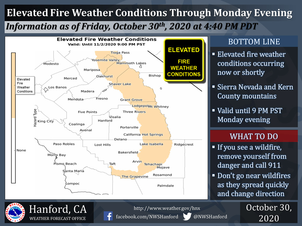
October 31 , 2020 - The National Weather Service Hanford Office reports Elevated Fire Weather Conditions for the Sierra Nevada and Kern County mountains.
The combination of dry fuels and low relative humidity values can contribute to erratic fire behavior this afternoon through Monday evening in the Sierra Nevada and Kern County mountains.
Any fires that develop will likely spread quickly.
  Area Forecast Discussion
  National Weather Service Hanford CA
  215 AM PDT Sat Oct 31 2020

  .SYNOPSIS...Well above average temperatures will continue through
  the middle of next week. Temperatures will cool by the end of the
  week as a cooler airmass moves in.

  &&

  .DISCUSSION...A rex block off the western CONUS coast continues to
  maintain a warm and dry airmass over our area. The rex block is
  progged to shift eastward into CA today and Sunday which will only
  result in a more pronounced offshore flow and additional warming
  across our area by Sunday. Afternoon highs across our area will be
  8-10 Deg F above seasonal normals on Sunday and Monday as the rex
  block remains over CA.

  The medium range models are showing an upper trough approaching
  the western CONUS coast on tuesday, but this system is progged to
  split and have little impact for our area. As the ridge from the
  rex block shifts further eastward, height falls will allow for a
  slight synoptic cooling to take place by mid-week, but daytime
  temperatures will remain above normal.

  The models are still having trouble handling a strong upper low
  pressure system which will impact the western CONUS late in the
  week. The GFS drops this system out of the Gulf of AK into the
  PAC NW on Friday then drops it into the Great Basin taking an
  inside slider trajectory which would result in the deeper
  moisture and dynamics with this system remaining to the north of
  our area. The ECMWF on the other hand brings the system through
  central CA on Saturday which would result in a significant
  precipitation event for our area. Ensemble means and the NBM are
  more in line with the GFS idea so our forecast will trend that way
  for now. Temperatures will lower to slightly below normal values
  by next weekend and some light showers will be possible in the
  Sierra Nevada north of Fresno County. The main concern by next
  weekend might actually be the potential for increased winds and
  their impact on the large wildfires still ongoing in the Sierra
  Nevada.
Source: NWS

