


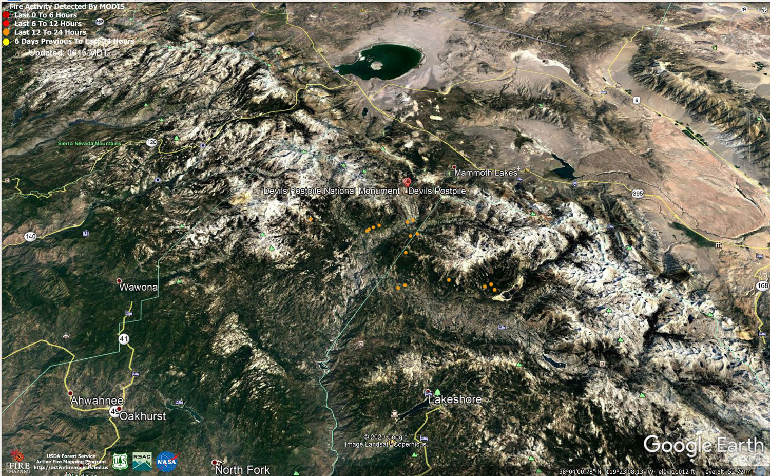
MODIS map of the Creek Fire on Saturday at 5:15 A.M. PST
Note: 1,500 Wide and older yellow detections removed
MODIS Active Fire Mapping Program Frequently Asked Questions
Update 6:00 P.M.: Sierra National Forest Creek Fire Evening Operations Briefing Video for Saturday, October 31, 2020
Update 11:05 A.M.: Sierra National Forest Creek Fire Operations Briefing Video for Saturday Morning, October 31, 2020
Update 11:00 A.M.: Forest Service Wildland Fire Smoke/Air Quality Outlook Due to the Creek Fire in the Yosemite Area for October 31 & November 1, 2020
Update 9:35 A.M.: CAL FIRE Morning Update for the Creek Fire: 380,002 acres and 70% containment.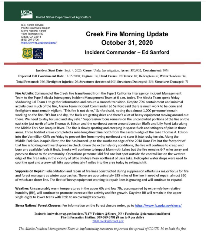
Update 6:05 A.M.: Sierra National Forest Creek Fire Public Information Map for Saturday, October 31, 2020 - Shows Contained Line and Uncontrolled Fire Edge
October 31, 2020 - Overnight infrared mapping has the Creek Fire at 380,002 Interpreted Acres.
Comments and notes on flight:
Tonight, we flew the full Northern half of the fire. The Southern half was flown following the southern half of the perimeter.
In the South several small isolated heat spots were identified, but no major heat. One spot on the center/southeastern penninsula, inside western edge, looked like a tiny heat across the line: 37° 6.488'N -119° 12.811'W
In the North half all sides are active to varying degrees. The most active heat and perimeter growth is in the northeast. The northern edge going to the West is also active and growing but not as much.
Today we used the heat perimeter from last nights data products. For heat detection and perimeter updating we used 16-bit LWIR imagery only .
Friday Evening Update: 379,571 acres and 70% containment.
Sierra National Forest Creek Fire Updates for Friday, October 30, 2020

