


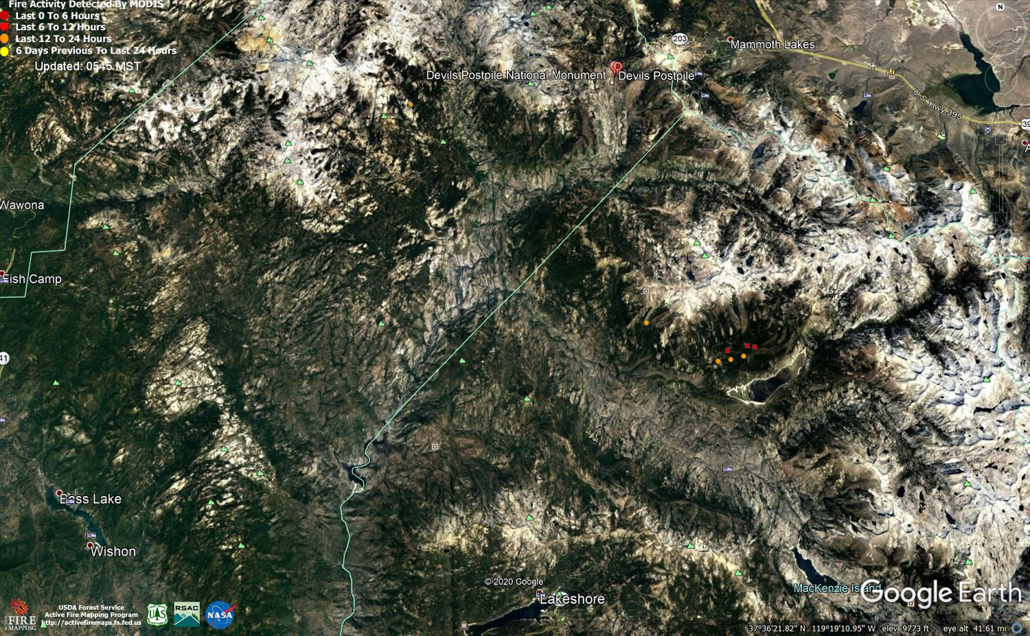
MODIS map of the Creek Fire on Monday at 4:45 A.M. PST
Note: 1,500 Wide and older yellow detections removed
MODIS Active Fire Mapping Program Frequently Asked Questions
Update 12:05 P.M.: Sierra National Forest Creek Fire Operations Briefing Video for Monday Morning, November 2, 2020
Update 9:25 A.M.: Sierra National Forest Morning Update for the Creek Fire: 380,663 acres and 70% containment.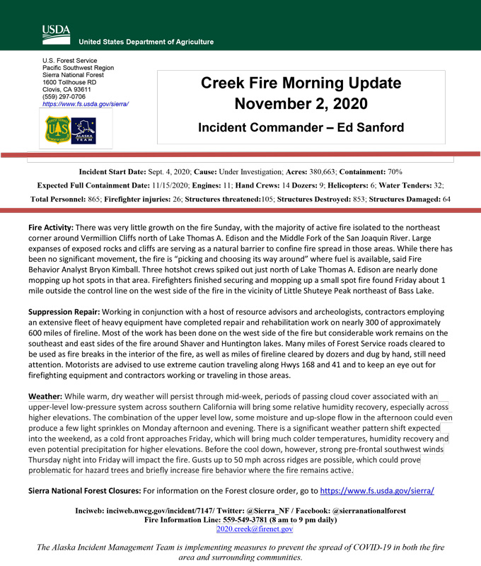
Update 9:00 A.M.: Forest Service Wildland Fire Smoke/Air Quality Outlook Due to the Creek Fire in the Yosemite Area for November 2 & 3, 2020
Update 5:45 A.M.: Sierra National Forest Creek Fire Public Information Map for Monday, November 2, 2020 - Shows Contained Line and Uncontrolled Fire Edge
November 2, 2020 - Overnight infrared mapping has the Creek Fire at 380,663 Interpreted Acres.
Comments and notes on flight:
Tonight, we flew only the Northern half of the Creek fire perimeter and collected LWIR and RGB imagery. Raw Imagery is being made accessible over a share drive. Heat Perimeter from 20201101 NIROPS products was used to generate tonight’s NIROPS products. For heat detection and perimeter updating we used 16 bit LWIR imagery only .
The most active heat and perimeter growth is in the East and Northeast. The northern edge going to the west is also active and growing but not as much. I closed 3 coves, all on the North East side. Today’s perimeter growth value is smaller than yesterday
Sunday Evening Update: 380,345 acres and 70% containment.
Sierra National Forest Creek Fire Updates for Sunday, November 1, 2020
