


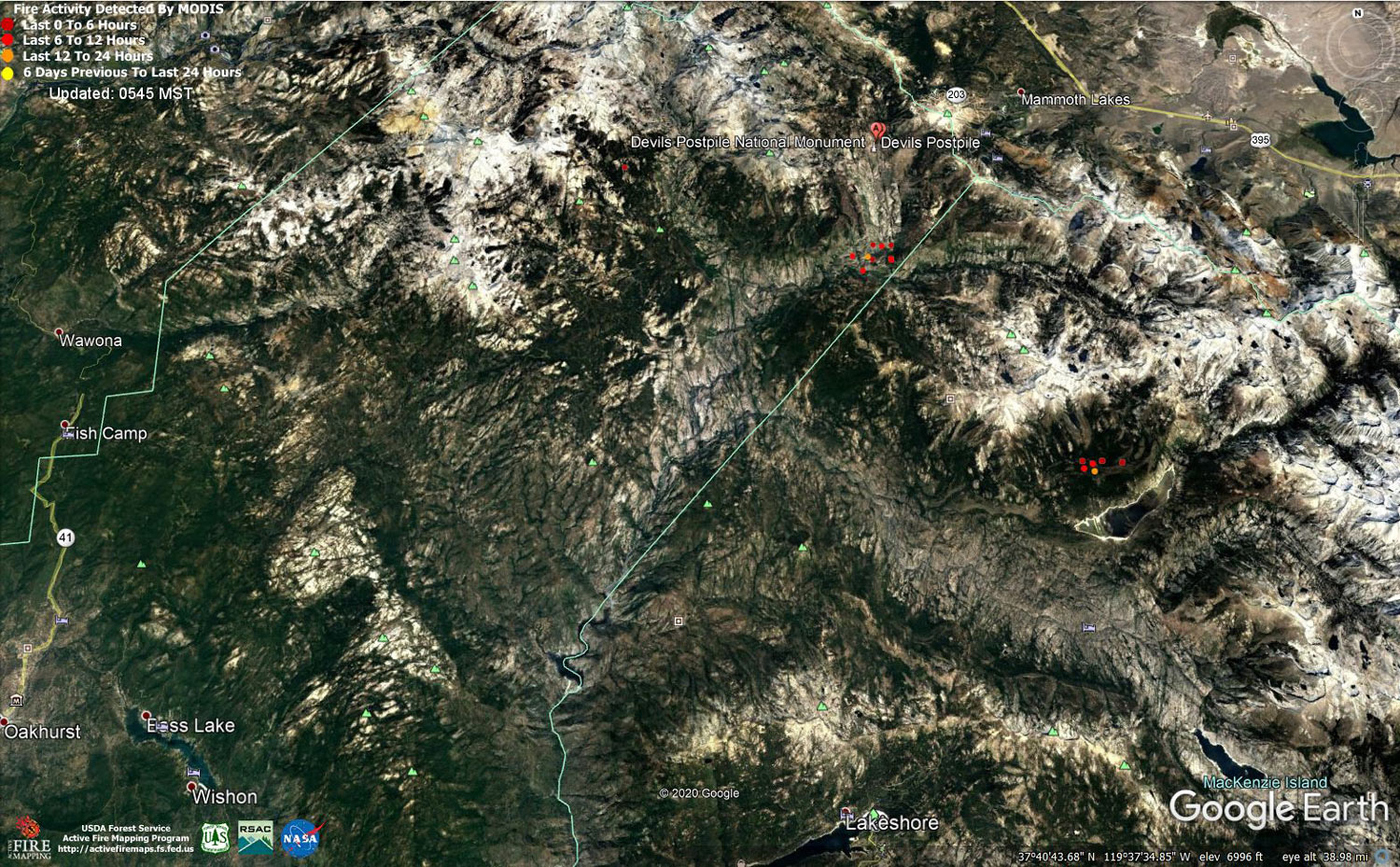
MODIS map of the Creek Fire on Tuesday at 4:45 A.M. PST
Note: 1,500 Wide and older yellow detections removed
MODIS Active Fire Mapping Program Frequently Asked Questions
Update 7:35 P.M.: Sierra National Forest to Hold a Creek Fire Livestream Incident Briefing with CAL FIRE on Wednesday, November 4, 2020
Update 12:30 P.M.: Sierra National Forest Creek Fire Operations Briefing Video for Tuesday Morning, November 3, 2020
Update 9:30 A.M.: Sierra National Forest Morning Update for the Creek Fire: 378,201 acres and 70% containment.
Note: There was an approximately 2,500 acre decrease in acreage due to better mapping.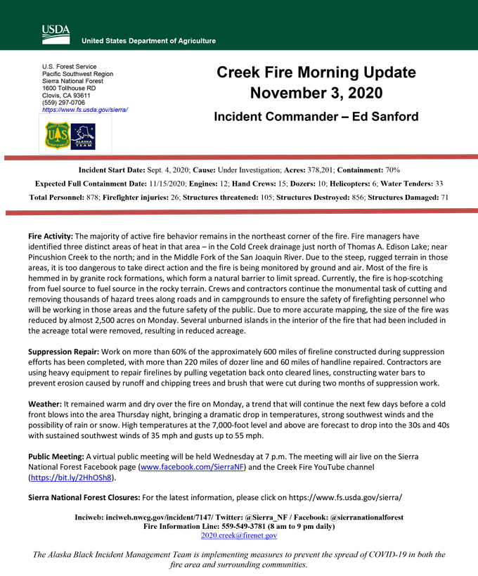
Update 9:10 A.M.: Forest Service Wildland Fire Smoke/Air Quality Outlook Due to the Creek Fire in the Yosemite Area for November 3 & 4, 2020
Update 5:50 A.M.: Sierra National Forest Creek Fire Public Information Map for Tuesday, November 3, 2020 - Shows Contained Line and Uncontrolled Fire Edge
November 3, 2020 - Overnight infrared mapping has the Creek Fire at 381,172 Interpreted Acres.
Comments and notes on flight:
Tonight, we flew only the Northern half of the Creek fire perimeter. Heat Perimeter from 20201102 NIROPS products was used to generate tonight’s NIROPS products. For heat detection and perimeter updating we used 16 bit LWIR imagery only.
Slight increase in overall heat tonight, which is reflected by a little more growth compared to yesterday.
Monday Evening Update: 377,693 acres and 70% containment.
Sierra National Forest Creek Fire Updates for Monday, November 2, 2020
