


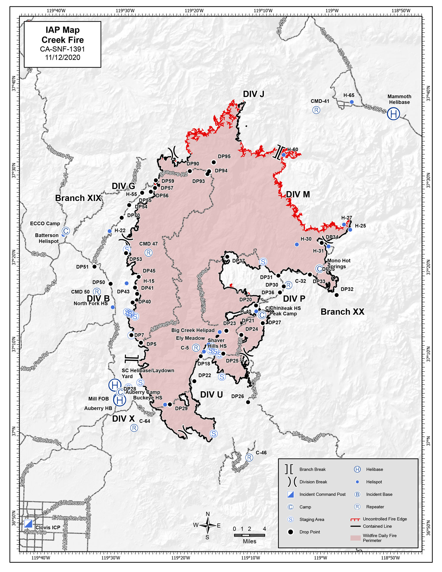
Incident Action Plan Map of the Creek Fire for Thursday
Note: 1500 wide
Click Here for Large Map (1.6M)
Update 10:00 A.M.: Sierra National Forest Creek Fire Operations Briefing Video for Thursday, November 12, 2020
Update 8:40 A.M.: Forest Service Wildland Fire Smoke/Air Quality Outlook Due to the Creek Fire in the Yosemite Area for November 12 & 13, 2020
Update 8:40 A.M.: Sierra National Forest Morning Update for the Creek Fire: 379,802 acres and 70% containment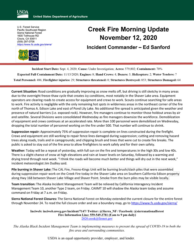
Update 5:50 A.M.: Sierra National Forest Creek Fire Public Information Map for Thursday, November 12, 2020 - Shows Contained Line and Uncontrolled Fire Edge
MODIS map of the Creek Fire on Thursday at 4:30 A.M. PST shows no detected footprints
MODIS Active Fire Mapping Program Frequently Asked Questions
November 12, 2020 - No reported overnight infrared mapping for the Creek Fire.
Comments and notes on flight:
Aircraft flew two IR flight strips (imagery displayed mostly cloud cover).
Aircraft determined remaining areas to the south to have significant cloud cover and aborted mission.
No imagery.
Wednesday Evening Update: 379,802 acres and 70% containment.
Sierra National Forest Creek Fire Updates for Wednesday, November 11, 2020

